Area Overview for NW1 9RZ
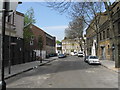
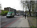
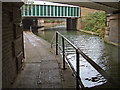
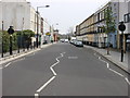
Photos of NW1 9RZ


Area Information
Living in NW1 9RZ means residing within a specific postcode cluster defined by a total area size of 1,359 square metres. This compact residential zone hosts a population of 2,451 residents, creating a tightly knit environment where daily interactions are frequent. The density here is exceptionally high, registering approximately 1.8 million people per square kilometre when calculated against the total land area provided. Such figures indicate a built-up urban setting rather than a sprawling suburban sprawl. Daily life revolves around immediate proximity to major transport links and commercial hubs common to the Camden borough. You will find yourself surrounded by the infrastructure of a major metropolitan centre, where space is a premium commodity. The area functions as a distinct residential unit within the wider London landscape, offering convenience over quiet seclusion. Residents navigate a landscape defined by its administrative boundaries and the concentration of private dwellings within these specific coordinates. The location commands attention as a focal point for local housing activity, distinct from the surrounding postcodes yet intrinsically linked to the broader Camden neighbourhood dynamic. Understanding the physical scale of NW1 9RZ helps buyers grasp the intensity of urban living they can expect within these borders.
- Area Type
- Postcode
- Area Size
- 1359 m²
- Population
- 2451
- Population Density
- 11881 people/km²
The property market in NW1 9RZ is characterised by a significant rental sector, with home ownership standing at only 37%. This figure confirms that the majority of the 2,451 residents are private or social tenants rather than mortgage-holders. Accommodation type is listed as flats, indicating that the housing stock consists primarily of multi-unit developments rather than standalone houses or semi-detached properties. This typology suits the high population density of the postcode, where 1,803,223 people per square kilometre is recorded against an area size of 1,359 square metres. For buyers looking at homes in this specific postcode cluster, the market will favour purchase-to-rent strategies or those seeking entry-level flats. The concentration of flats suggests reduced garden space and potentially higher noise levels due to shared walls and proximity to other units. Investment potential exists in a zone where demand typically outstrips supply, yet the low ownership rate implies a less stable long-term community structure compared to owner-occupied estates. Prospective buyers should anticipate competition among tenants looking to invest. The nature of the dwellings means maintenance responsibilities often fall to managing agents rather than individual owners, which can affect property values and renovation possibilities. Understanding this split between owner-occupiers and renters provides crucial context for navigating the local real estate landscape in NW1 9RZ.
House Prices in NW1 9RZ
Showing 11 properties
| Address | Type | Beds | Baths | Last Sale Price | Last Sale Date | |
|---|---|---|---|---|---|---|
| 29 Rochester Square, London, NW1 9RZ | Terraced | 3 | 2 | £1,625,000 | Dec 2018 | |
| 30 Rochester Square, London, NW1 9RZ | house | 4 | - | £960,000 | Dec 2010 | |
| 34 Rochester Square, London, NW1 9RZ | house | - | - | £650,000 | Oct 2002 | |
| 31 Rochester Square, London, NW1 9RZ | Flat | - | - | £169,000 | Sep 2001 | |
| 36 Rochester Square, London, NW1 9RZ | Detached | 3 | 2 | £285,000 | Mar 1996 | |
| Flat A, 32 Rochester Square, London, NW1 9RZ | Flat | 4 | 1 | - | - | |
| 35 Rochester Square, London, NW1 9RZ | Flat | - | - | - | - | |
| Flat B, 32 Rochester Square, London, NW1 9RZ | Maisonette | - | - | - | - | |
| Flat 1ST And 2ND Floor, 33 Rochester Square, London, NW1 9RZ | Flat | - | - | - | - | |
| Flat A, 33 Rochester Square, London, NW1 9RZ | Maisonette | 2 | 1 | - | - |
Energy Efficiency in NW1 9RZ
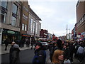
Your daily lifestyle in NW1 9RZ is defined by extremely close access to diverse amenities within practical reach. Retail options include Tesco Camden, Sainsburys Camden, and Tesco Kentish, providing ample choice for grocery shopping. Transport connectivity is extensive, with five rail stations nearby including Camden Road Station, Kentish Town West Station, and Caledonian Road and Barnsbury Station. You are also close to five major Underground stations such as Camden Town Station, Mornington Crescent, and Chalk Farm Station. Water travel options include the Camden Lock Waterbus, London Zoo Waterbus Stop, and Savoy Pier. Bus connections link to London Victoria Coach Station Arrivals, Green Line Coach Station, and Victoria Coach Station, suggesting proximity to major coach terminals. This density of services means you do not need to venture far for essentials or leisure. The presence of major high streets and transport hubs indicates a vibrant commercial environment surrounds this residential postcode. Living in NW1 9RZ places you at the intersection of retail and transport networks that serve the wider city.
Amenities
Schools
Families living in NW1 9RZ have access to The Camden School for Girls, which is recorded as a nearby school in the data. This institution is designated as a primary school and holds a Good Ofsted rating. The presence of a primary-rated school indicates a level of educational oversight appropriate for early childhood development. No secondary schools are listed in the provided data for this specific postcode area, meaning resident families must look beyond NW1 9RZ for older children's education. The mix of school types available locally is limited to primary education only. While The Camden School for Girls provides a solid foundation for younger students, its designation as a primary school suggests a need to commute further for secondary options. The 'Good' rating offers assurance of reasonable educational standards, though it does not reflect a top-tier performance record. Buyers considering schools near NW1 9RZ should factor in travel time to other educational institutions not listed here. The reliance on a single nearby primary establishment shapes the local school-run dynamics and may influence the decision-making process for parents with multiple children of different ages. The data confirms the existence of this one school within reasonable reach of the property postcode.
| Rank | School | Type | Entry gender | Ages |
|---|
Explore more schools in this area
Go to Schools tabDemographics
The community within NW1 9RZ exhibits a mature demographic profile, with a median age of 47 years. The most common age range consists of adults aged between 30 and 64 years, suggesting a population that has likely established long-term roots in the vicinity. Home ownership accounts for 37% of households, meaning the majority of residents are tenants. This rental-heavy structure points to a dynamic market where property turnover may be more frequent than in owner-occupied zones. Accommodation type is predominantly flats, aligning with the high-density nature of the postcode and the urban fabric of Camden. The predominant ethnic group listed is White, though the area remains part of London's diverse mosaic. Deprivation metrics are not included in the current data set, so no specific commentary on socio-economic stressors is possible based on the available figures. Instead, the age distribution and housing tenure provide a clearer picture of the daily rhythm of life. A large proportion of working-age adults suggests the area supports a steady workforce, while the preponderance of flats indicates a design suited for smaller households or singles. Buyers should note that 63% of homes are likely tenured properties, which may influence local community cohesion and financial planning strategies for prospective purchasers.
Household Size
Accommodation Type
Tenure
Ethnic Group
Religion
Household Composition
Age
Household Deprivation
NS-SEC
Explore more demographic insights in this area
Go to Demographics tabPlanning
Planning Constraints
- Flood RiskPremium
- Ramsar Wetland SitesPremium
- Area of Outstanding Natural BeautyPremium
- Protected Nature ReservePremium
- Protected WoodlandPremium