Area Overview for NW1 9NA
Photos of NW1 9NA


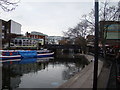


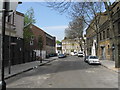
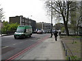
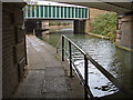

100 photos from this area
Area Information
Key information about the NW1 9NA including its size, population, and administrative classification.
- Area Type
- Postcode
- Area Size
- 2630 m²
- Population
- 1950
- Population Density
- 13402 people/km²
House Prices in NW1 9NA
16
Properties
£688,250
Average Sold Price
£140,000
Lowest Price
£1,450,000
Highest Price
Showing 16 properties
| Address | Type | Beds | Baths | Last Sale Price | Last Sale Date | |
|---|---|---|---|---|---|---|
| 11 Reeds Place, London, NW1 9NA | house | 3 | 1 | £1,450,000 | Jan 2024 | |
| 1 Reeds Place, London, NW1 9NA | Detached | 2 | 1 | £1,118,500 | Sep 2022 | |
| 6 Reeds Place, London, NW1 9NA | Terraced | 3 | 2 | £1,400,000 | Oct 2017 | |
| 5 Reeds Place, London, NW1 9NA | Flat | - | - | £795,000 | Mar 2010 | |
| 8 Reeds Place, London, NW1 9NA | Flat | - | - | £597,000 | Sep 2004 | |
| 14 Reeds Place, London, NW1 9NA | Flat | - | - | £535,000 | Dec 2001 | |
| 12 Reeds Place, London, NW1 9NA | Flat | - | - | £292,000 | Dec 2000 | |
| 3 Reeds Place, London, NW1 9NA | Terraced | 3 | 1 | £365,000 | Aug 2000 | |
| 2 Reeds Place, London, NW1 9NA | Flat | - | - | £190,000 | Aug 1998 | |
| 7 Reeds Place, London, NW1 9NA | Flat | - | - | £140,000 | Nov 1995 |
Page 1 of 2
Energy Efficiency in NW1 9NA
Amenities
Schools
| Rank | School | Type | Entry gender | Ages |
|---|
Explore more schools in this area
Go to Schools tabDemographics
Household Size
One person
most common
Accommodation Type
Flats
most common
Tenure
29
majority
Ethnic Group
White
most common
Religion
N/A
most common
Household Composition
N/A
most common
Age
47
median
Adults (30-64 years)
most common
Household Deprivation
N/A
with no deprivation
NS-SEC
46
in Lower managerial occupations
Explore more demographic insights in this area
Go to Demographics tabPlanning
Planning Constraints
- Flood RiskPremium
- Ramsar Wetland SitesPremium
- Area of Outstanding Natural BeautyPremium
- Protected Nature ReservePremium
- Protected WoodlandPremium