Area Overview for NW1 9DU
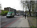
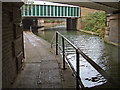
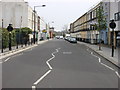
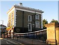
Photos of NW1 9DU


Area Information
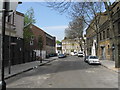
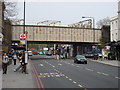
Living in NW1 9DU means residing in a specific residential cluster within the St Pancras and Somers Town ward of the London Borough of Camden. This small area covers just 1774 square metres yet houses 1591 residents, creating a population density of 896,603 people per square kilometre. The location sits amidst three major railway termini: Euston, King's Cross, and St Pancras International, which define the immediate surroundings. While the surrounding ward characterised as one of the 10% most deprived areas in the country, this specific postcode represents a dense, council-owned residential block typical of the historic district. The area has deep historical roots, evolving from Georgian developments and French Revolution refugee settlements into a working-class community shaped by railway expansion in the nineteenth century. Father Basil Jellicoe's social housing initiatives transformed the landscape in the early twentieth century, leaving blocks named after saints that remain visible today. You are located in a zone where Georgian houses towards Bloomsbury and Holborn have gained value, but the immediate neighbourhood retains its authentic, high-density working-class identity. Daily life revolves around the rhythmic movement of trains and the practical convenience of London's central transport network. The area offers a direct connection to international travel via Eurostar services from the adjacent St Pancras station while maintaining a distinct, non-gentrified local atmosphere.
- Area Type
- Postcode
- Area Size
- 1774 m²
- Population
- 1591
- Population Density
- 13404 people/km²
The housing market in NW1 9DU is defined almost entirely by the prevalence of flats, with ownership standing at just 22 percent of all homes. This statistic indicates that the area functions primarily as a rental market rather than an owner-occupier haven. You are looking at a stock dominated by council-owned residential blocks, a legacy of the Sidney Street estate developments completed in the 1930s. These blocks are named after saints and represent significant milestones in social housing design, including the first all-electric apartment block in the United Kingdom. The low ownership rate means that if you are buying, you are likely targeting one of the surviving Georgian houses that have increased in value towards Bloomsbury and Holborn, rather than the typical terrace or flat within the immediate cluster. Most prospective buyers will need to navigate the private and social rent sectors. The high density of 1774 square metres containing 1591 people dictates that space is at a premium. While the surrounding ward faces deprivation indices placing it in the 10% most deprived nationally, the property stock itself offers a unique place within London's housing history. Investors might find opportunity in this dense, flat-heavy environment, but first-time buyers must weigh the low ownership threshold against the convenience of the transport links.
House Prices in NW1 9DU
Showing 10 properties
| Address | Type | Beds | Baths | Last Sale Price | Last Sale Date | |
|---|---|---|---|---|---|---|
| 78 Camden Road, London, NW1 9DU | Flat | 2 | - | - | - | |
| Flat A, 80 Camden Road, London, NW1 9DU | Flat | - | - | - | - | |
| Flat D, 80 Camden Road, London, NW1 9DU | Flat | - | - | - | - | |
| Flat Basement And Ground Floor, 74 Camden Road, London, NW1 9DU | Flat | - | - | - | - | |
| Flat C, 80 Camden Road, London, NW1 9DU | Flat | - | - | - | - | |
| Flat A, 82 Camden Road, London, NW1 9DU | Flat | - | - | - | - | |
| Flat B, 82 Camden Road, London, NW1 9DU | Flat | - | - | - | - | |
| Flat E, 80 Camden Road, London, NW1 9DU | Flat | - | - | - | - | |
| Flat B, 80 Camden Road, London, NW1 9DU | Flat | - | - | - | - | |
| 76 Camden Road, London, NW1 9DU | Maisonette | 2 | 2 | - | - |
Energy Efficiency in NW1 9DU
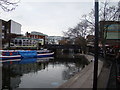
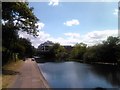
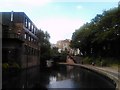
Daily life in NW1 9DU is shaped by immediate access to a diverse array of amenities within practical reach. Retail options include five specific locations, notably Sainsburys Camden, M&S Camden Town SF, and Aldi Camden, ensuring you have high-quality grocery shopping without leaving the district. Transport hubs themselves function as lifestyle destinations, with five rail, five metro, and five ferry stops offering not just travel but also social and leisure opportunities. Residents can utilise the Camden Lock and London Zoo Waterbus stops for recreational canal excursions. Travel connections include five rail stations and five metro stations, providing direct access to London St Pancras International for international travel. You also have access to extensive bus networks linking to London Victoria Coach Station and Green Line services for regional travel. The character of the area is defined by these transport nodes and the surrounding historic architecture. Surviving Georgian houses and the iconic Sidney Street estate blocks named after saints contribute to the visual landscape. The proximity to major roads like Euston Road, Eversholt Street, and Pancras Road ensures easy vehicular access despite the density. This blend of historic significance and modern transport convenience creates a lifestyle where global connectivity meets local residential life.
Amenities
Schools
Families residing in NW1 9DU have access to education facilities that serve the immediate local cluster. Hawley Primary School stands as the notable primary school nearby, holding a 'good' Ofsted rating. This single entry suggests a focused provision for early years education close to the residential blocks. The data does not list any secondary schools or sixth-form colleges within the direct vicinity of this specific postcode, implying that older children likely commute to larger institutions in broader Camden or north London. For parents, the presence of Hawley Primary School offers a specific choice within the immediate catchment area without the need for extensive travel. The 'good' rating signals a standard of education that meets regulatory expectations. While the area is technically part of a ward known for dense living, the availability of local schooling options suggests reasonable provision for young families who have settled in the cluster. The mix of accommodation types, heavily weighted towards flats, can make schooling different from suburban areas, as families may rely more on community groups or schools further afield for after-hours care. You should verify catchment boundaries for any resident arrangements, though Hawley Primary is the confirmed local option.
| Rank | School | Type | Entry gender | Ages |
|---|
Explore more schools in this area
Go to Schools tabDemographics
The community profile for NW1 9DU reflects a mature population with a median age of 47 years. Most residents fall within the adult age range of 30 to 64 years, indicating a household dominated byempty nesters or families with children entering independence. Only 22% of households in this area own their homes, meaning the vast majority live in rented accommodation. This high rental proportion aligns with the area's dominance of flats, which constitute the primary accommodation type for residents. While specific figures for ethnic diversity are not detailed in the available data, White remains the predominant ethnic group in the area. The historical context of the ward, which included French Revolution refugees and later became a hub for workers, explains this stable, adult-centric demographic. With such a high density of 896,603 people per square kilometre, the community feels tight-knit yet transient due to the rental nature. The age distribution suggests you will encounter fewer young families or very young retirees in this specific cluster compared to wider outer London districts. This demographic skew towards middle-aged adults often correlates with tenure insecurity and a reliance on the local transport network for commuting to central business districts.
Household Size
Accommodation Type
Tenure
Ethnic Group
Religion
Household Composition
Age
Household Deprivation
NS-SEC
Explore more demographic insights in this area
Go to Demographics tabPlanning
Planning Constraints
- Flood RiskPremium
- Ramsar Wetland SitesPremium
- Area of Outstanding Natural BeautyPremium
- Protected Nature ReservePremium
- Protected WoodlandPremium