Area Overview for NW1 8RA
Photos of NW1 8RA


Area Information
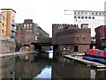
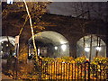
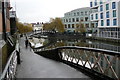
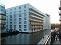
NW1 8RA is a compact residential postcode covering 3,828 square metres, nestled within a tightly defined urban cluster in Camden. This specific pocket holds a population of 1,932 people, creating an extremely high-density environment where space is at a premium. You are looking at a neighbourhood that functions as a small residential island, surrounded by the broader vibrancy of North London while maintaining its own distinct postcode identity. Daily life here involves navigating a close-knit community where the proximity of neighbours is unavoidable. The layout is typical of London's inner-city fabric, prioritising access over sprawl. Residents here live in a setting defined by its efficiency and its placement at the heart of the city's transport network. Living in NW1 8RA means accepting a high-traffic, urban pace of life in exchange for immediate access to everything the capital offers. This area is not a suburb; it is a microcosm of London living where every square metre counts towards your address.
- Area Type
- Postcode
- Area Size
- 3828 m²
- Population
- 1932
- Population Density
- 8871 people/km²
House Prices in NW1 8RA
Showing 37 properties
| Address | Type | Beds | Baths | Last Sale Price | Last Sale Date | |
|---|---|---|---|---|---|---|
| Flat 3, 22A Castlehaven Road, London, NW1 8RA | Flat | 1 | 1 | - | - | |
| 22 Castlehaven Road, London, NW1 8RA | Flat | 2 | 2 | - | - | |
| 22B Castlehaven Road, London, NW1 8RA | Flat | 2 | 2 | - | - | |
| Flat 2, 22A Castlehaven Road, London, NW1 8RA | Flat | - | - | - | - | |
| Flat 4, 22A Castlehaven Road, London, NW1 8RA | Flat | - | - | - | - | |
| Flat 1, 22A Castlehaven Road, London, NW1 8RA | Flat | 1 | 1 | - | - | |
| 22C Castlehaven Road, London, NW1 8RA | Flat | - | - | - | - | |
| 20A Castlehaven Road, London, NW1 8RA | Flat | - | - | - | - | |
| 16A Castlehaven Road, London, NW1 8RA | Office | - | - | - | - | |
| Commercial Unit, 14 Castlehaven Road, London, NW1 8RA | shop | - | - | - | - |
Energy Efficiency in NW1 8RA
Amenities
Schools
| Rank | School | Type | Entry gender | Ages |
|---|
Explore more schools in this area
Go to Schools tabDemographics
The community in NW1 8RA has settled into a mature profile, with the average age of residents sitting at 47 years. The majority of the population falls into the adult bracket between 30 and 64 years, suggesting a neighbourhood filled with established households rather than families with young children or retiring couples. This age demographic often correlates with career-focused individuals or those seeking stability in a prime London location. Despite the title "Flats" indicating the predominant accommodation type, the area does record a low home ownership rate of just 12 per cent. This figure strongly implies that the vast majority of residents are private tenants rather than owners living in this postcode. The ethnic composition is predominantly White, reflecting the traditional demographic patterns of much of central London. With a population density reaching 504,756 people per square kilometre, the area feels perpetually full. You should expect a community where social interactions are frequent and where the transient nature of tenancy might be more common than in owner-occupied zones.
Household Size
Accommodation Type
Tenure
Ethnic Group
Religion
Household Composition
Age
Household Deprivation
NS-SEC
Explore more demographic insights in this area
Go to Demographics tabPlanning
Planning Constraints
- Flood RiskPremium
- Ramsar Wetland SitesPremium
- Area of Outstanding Natural BeautyPremium
- Protected Nature ReservePremium
- Protected WoodlandPremium