Area Overview for NW1 8DG
Photos of NW1 8DG


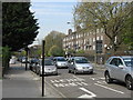
Area Information
NW1 8DG is a small residential cluster defined by its limited footprint of just 3499 square metres. Despite its compact size, it supports a population of 2066 residents. You will find that living in this specific postcode means navigating a densely packed environment where space is at a premium. The area feels distinct due to its high population density, which concentrates a diverse group of people into a very small geographical location. Daily life here is characterised by immediate proximity to major transport hubs and local shops. While the area is small, it functions as a self-contained pocket within a larger city network. You are surrounded by the immediate infrastructure of a major metropolis without the sprawling nature of suburban districts. The sheer number of people relative to the land area creates a dynamic urban atmosphere. Knowing exactly who lives here and how they move through the space gives you a clear picture of the local rhythm. This postcode is not a vast neighbourhood but a specific address choice within a wider zone. Your view from a window here is likely limited to buildings or streets because of the tight layout. The defining feature is how efficiently it packs 2066 souls into a space smaller than most districts.
- Area Type
- Postcode
- Area Size
- 3499 m²
- Population
- 2066
- Population Density
- 17717 people/km²
The property market in NW1 8DG is defined by a significant dominance of rental properties. Only 22% of homes in this postcode are owner-occupied, meaning the vast majority of the housing stock is let rather than bought. This statistic clearly indicates that if you are looking to purchase a home here, you are entering a competitive and heavily rented environment. The accommodation type data confirms that flats are the primary housing form. Homes in NW1 8DG are almost exclusively flats, limiting choices for buyers seeking detached or semi-detached properties. You will likely encounter a market driven by tenants seeking flexibility or affordable living options rather than long-term investors looking for stability. The low ownership percentage suggests that buyers may find fewer long-standing residents in the immediate vicinity. For those considering buying flats in this area, the market dynamics are influenced by the high volume of rental activity. The density of flats within the 3499 square metre area means you will face a narrow selection of property styles. It is essential to understand that this is not a typical owner-occupier market. Your search for a home here will focus heavily on available flats. The prevalence of rental housing means that vendor motivation and turnover rates may differ from areas with higher ownership.
House Prices in NW1 8DG
Showing 21 properties
| Address | Type | Beds | Baths | Last Sale Price | Last Sale Date | |
|---|---|---|---|---|---|---|
| 68 Clarence Way, London, NW1 8DG | Terraced | 2 | 1 | £1,200,000 | Nov 2022 | |
| 60 Clarence Way, London, NW1 8DG | Detached | 2 | 1 | £1,135,000 | Feb 2021 | |
| 81 Clarence Way, London, NW1 8DG | Terraced | 2 | 1 | £1,125,000 | Sep 2020 | |
| 67 Clarence Way, London, NW1 8DG | Terraced | 2 | 1 | £834,000 | Nov 2019 | |
| 58 Clarence Way, London, NW1 8DG | Terraced | 3 | 1 | £989,000 | Oct 2018 | |
| 85 Clarence Way, London, NW1 8DG | house | 3 | 1 | £991,000 | Jun 2017 | |
| 73 Clarence Way, London, NW1 8DG | Terraced | 2 | 1 | £1,050,000 | May 2017 | |
| 83 Clarence Way, London, NW1 8DG | house | - | - | £797,000 | Nov 2011 | |
| 72 Clarence Way, London, NW1 8DG | house | 2 | - | £875,000 | Jun 2011 | |
| 75 Clarence Way, London, NW1 8DG | Flat | 3 | 2 | £695,000 | Mar 2011 |
Energy Efficiency in NW1 8DG
Daily life in NW1 8DG is supported by a strong array of amenities within easy reach. You have access to five retail options including Morrisons Camden, Sainsburys Chalk, and Amazon Fresh. Shopping conveniences are plentiful for your daily needs. Transport diversity supports an active lifestyle with five rail connections and five metro stations nearby. Chalk Farm Station and Camden Town Station are key hubs for your daily commute or leisure trips. Water-based leisure is available through five ferry services including the Camden Lock Waterbus and Little Venice Waterbus Stop. You do not need a road vehicle to enjoy local attractions or cross the city. Five bus routes connect you to London Victoria Coach Station Arrivals and the Green Line Coach Station. The presence of multiple supermarkets ensures you do not need to travel far for groceries. Retail, rail, and water transport options create a seamless lifestyle where convenience is high. You can walk or use river transport to reach major shopping centres and tourist sites. The variety of five retail outlets and five rail stations ensures that essential services and long-distance travel are both accessible.
Amenities
Schools
Families living in NW1 8DG have access to specific educational facilities nearby. Harmood School is located close to the postcode and operates as a special school. CCfL Key Stage 3 PRU is another institution in the vicinity, classified as another type of school. There are no mainstream primary or secondary schools listed for this specific cluster. The presence of a special school indicates that the area serves specific educational needs within the local network. If you are moving to NW1 8DG with children, you will need to consider the distance to these specialised institutions. The mix includes a Key Stage 3 PRU, which typically serves pupils with persistent exclusion or those needing additional support. You must research transport links to reach these schools, as they are not situated within the immediate envelope of the postcode. The absence of standard primary or secondary schools in the list suggests that local families often rely on transport to reach schools further away. The proximity of Harmood School and the PRU offers specific support options for the community. Homebuyers should prioritise research on how they will access these facilities. The school landscape here is specialised rather than comprehensive.
| Rank | School | Type | Entry gender | Ages |
|---|
Explore more schools in this area
Go to Schools tabDemographics
The community within NW1 8DG reflects an established residential profile with a median age of 47 years. Most residents fall into the age range of 30 to 64 years, indicating a population that is largely middle-aged and moving past younger adulthood. Only 22% of households in this area own their homes, which suggests a predominantly rented sector. The overwhelming majority of accommodation consists of flats. You are looking at an area where rental tenants make up the bulk of the population. The demographic data shows that White residents form the predominant ethnic group in this specific cluster. With 2066 people living in such a small space, the local community is tightly knit yet transient due to the low home ownership rate. Adults aged 30 to 64 years drive the daily life of the area, likely working in nearby professions or commuting. The housing stock is uniform in its type, focusing almost exclusively on flat living arrangements. This concentration of rental flats shapes the social fabric, creating a neighbourhood where people may stay for shorter periods compared to owner-occupiers. The age distribution means you will find many families and established professionals rather than young singles or retirees.
Household Size
Accommodation Type
Tenure
Ethnic Group
Religion
Household Composition
Age
Household Deprivation
NS-SEC
Explore more demographic insights in this area
Go to Demographics tabPlanning
Planning Constraints
- Flood RiskPremium
- Ramsar Wetland SitesPremium
- Area of Outstanding Natural BeautyPremium
- Protected Nature ReservePremium
- Protected WoodlandPremium