Area Overview for NW1 7BA
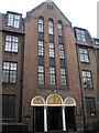
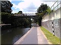
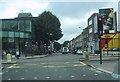
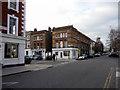
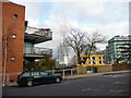
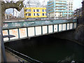
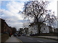
Photos of NW1 7BA


Area Information
Living in NW1 7BA means residing in a compact residential cluster with a total area size of 6458 square metres. The postcode serves a specific population of 1685 people, creating a densely populated environment with a density of 260918 people per square kilometre. This high concentration of residents shapes daily life, ensuring you are never far from neighbours or local services despite the small physical footprint. The area is situated in England and functions as a tight-knit pocket within the wider London landscape. Your experience here will be defined by proximity to key transport hubs and amenities rather than vast green spaces or sprawling streets. The location sits close to Camden Town, Chalk Farm, and Euston, meaning you have excellent access to Central London. You will find your immediate surroundings filter tenure heavily towards flats, reflecting the density constraints of the land. While the area is small, the infrastructure supports a significant number of households through high-rise living and block construction typical of this postcode sector. Daily life in NW1 7BA involves navigating a busy environment where convenience takes priority over quiet isolation. You will be surrounded by retail outlets, bus routes, and railway stations within walking distance. The character of the neighbourhood is utilitarian yet well-connected, designed for people who value accessibility above all else. If you are looking for a home in this specific postcode, you should expect a living situation that prioritises location over layout. The area offers a distinct experience in London, defined by its intense urban concentration and immediate access to the city's core transport network.
- Area Type
- Postcode
- Area Size
- 6458 m²
- Population
- 1685
- Population Density
- 9912 people/km²
The property market in NW1 7BA is dominated by a specific housing stock defined by its density and tenure split. With a home ownership rate of 54 per cent, this postcode operates as a mixed market where both owner-occupiers and private tenants coexist. However, the overwhelming accommodation type listed for the area is flats. This single dominant form implies that you will find very few, if any, terraced houses or detached bungalows available for purchase or rent within the immediate boundaries of NW1 7BA. Prospective buyers must approach the search for homes in this area with a clear understanding that flats are the norm. The high population density of 260918 people per square kilometre confirms that space is at a premium, necessitating vertical living solutions. You can expect the surrounding neighbourhoods to mirror this pattern, as the entire NW1 7BA cluster functions as a block of up-and-down living. The 54 per cent ownership statistic indicates that a robust secondary market exists, but you should also anticipate significant demand from landlords and investors looking for rental yields in a high-yield, high-traffic location. If you are looking for a specific tenure type outside of flats, you may need to expand your search slightly beyond the exact NW1 7BA boundaries, although the immediate vicinity almost certainly shares the same tenure characteristics. The market here is driven by convenience and location rather than garden space or room count. Understanding that flats constitute the primary housing type is essential when evaluating your options in this postcode.
House Prices in NW1 7BA
Showing 39 properties
| Address | Type | Beds | Baths | Last Sale Price | Last Sale Date | |
|---|---|---|---|---|---|---|
| 53 Gloucester Avenue, London, NW1 7BA | Terraced | 4 | 3 | £5,300,000 | May 2023 | |
| Basement Flat, 47 Gloucester Avenue, London, NW1 7BA | Flat | 3 | 2 | £7,900,000 | Nov 2020 | |
| House Excluding Lower Ground Floor, 55 Gloucester Avenue, London, NW1 7BA | Flat | 4 | 3 | £3,625,000 | Sep 2014 | |
| Basement Flat, 57 Gloucester Avenue, London, NW1 7BA | Flat | 2 | 1 | - | - | |
| 51 Gloucester Avenue, London, NW1 7BA | Flat | 2 | 1 | - | - | |
| Flat 3 1ST Floor, 43 Gloucester Avenue, London, NW1 7BA | Flat | 2 | 2 | - | - | |
| 47 Gloucester Avenue, London, NW1 7BA | house | 6 | - | - | - | |
| Flat F, 41 Gloucester Avenue, London, NW1 7BA | Flat | - | - | - | - | |
| Flat A, 41 Gloucester Avenue, London, NW1 7BA | Flat | - | - | - | - | |
| Flat E, 41 Gloucester Avenue, London, NW1 7BA | Flat | - | - | - | - |
Energy Efficiency in NW1 7BA
Your daily lifestyle in NW1 7BA is dictated by proximity to a dense network of amenities. Retail options are plentiful, with Co-op Camden, Whole Foods Market Whole, and Morrisons Camden situated within practical reach. These specific retailers ensure you have immediate access to groceries, essentials, and specialty foods without needing long commutes. The presence of Whole Foods indicates that demand for higher-quality produce is well-supported in this neighbourhood. Transport connectivity forms the heart of your daily routine. You are moments away from major stations including Camden Town Station, Chalk Farm Station, and Mornington Crescent. For rail travel, London Euston Railway Station, Camden Road Station, and Kentish Town West Station provide rapid access to the rest of the city and beyond. If you prefer water travel, five ferry stops serve the area, including the Camden Lock Waterbus, London Zoo Waterbus Stop, and Little Venice Waterbus Stop. Bus networks are also well-developed, with connections to London Victoria Coach Station Arrivals and the Green Line Coach Station. This multi-modal network means you can travel by tube, train, bus, or water bus depending on your destination. The concentration of these specific transport hubs illustrates the area's role as a transit gateway. Retail and transport work in tandem to create a lifestyle where convenience is king. You will find that every necessary facility is within a short walk or a few minutes' travel time.
Amenities
Schools
Families considering homes in NW1 7BA have access to several educational institutions located very near their homes. Primrose Hill School operates as a primary school within the immediate vicinity and holds a good Ofsted rating, confirming strong performance standards. You can also find Primrose Hill Infant School nearby, which serves younger children in the area. For parents seeking independent education or those who prefer a non-state sector option, North Bridge House Preparatory is available close to the postcode. This independent school holds an outstanding Ofsted rating, representing the highest level of academic achievement in the UK grading system. The presence of an institution with this rating suggests that the local education environment is of a very high standard. The mix of state primary provisions and an independent preparatory school offers flexibility depending on your educational philosophy. Primrose Hill School provides a state-educated route with positive governance feedback, while North Bridge House opens doors for families seeking a different curriculum or pastoral approach. Both educational facilities are situated within practical reach of residents in NW1 7BA. The concentration of schools including these specific names indicates that education infrastructure is well-developed in this area. You do not need to look far to find schooling options, and the Ofsted ratings for these specific institutions provide clear evidence of their quality.
| Rank | School | Type | Entry gender | Ages |
|---|
Explore more schools in this area
Go to Schools tabDemographics
The community profile of NW1 7BA reveals a mature and established population. The median age in the area stands at 47 years, indicating that older residents form the core of the neighbourhood. Adults aged between 30 and 64 years represent the most common age range, confirming that the area attracts a working-age demographic alongside retirees. You will find a significant proportion of the population falls into the prime earning years, which influences local spending habits and demand for services. Housing tenure in NW1 7BA shows a balanced split with 54 per cent of residents owning their homes. This figure suggests that more than half of the people living here have achieved ownership stability, though the remaining 46 per cent likely reside in rental properties. This ownership rate places the area slightly above the national average for similar high-density zones, suggesting a degree of financial stability among long-term residents. The predominant ethnic group in the postcode area is White, which forms the majority of the demographic composition. While the data does not provide a detailed breakdown of minority groups, the White population remains the primary cultural force shaping the local identity of NW1 7BA. The accommodation type is almost exclusively flats, reflecting the limited land availability in this congested zone. This factual reality dictates the lifestyle, as you cannot expect large detached properties or extensive gardens in this location. The community feels cohesive due to the shared living constraints and the concentration of households in a small 6458 square metre footprint.
Household Size
Accommodation Type
Tenure
Ethnic Group
Religion
Household Composition
Age
Household Deprivation
NS-SEC
Explore more demographic insights in this area
Go to Demographics tabPlanning
Planning Constraints
- Flood RiskPremium
- Ramsar Wetland SitesPremium
- Area of Outstanding Natural BeautyPremium
- Protected Nature ReservePremium
- Protected WoodlandPremium