Area Overview for NW1 6LN
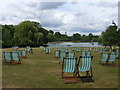
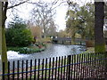
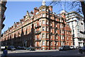
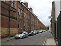
Photos of NW1 6LN


Area Information
Living in NW1 6LN means residing in a specific postcode cluster within the London Borough of Westminster. The area covers a population of 1981 residents, creating a tightly knit environment rather than a sprawling suburb. Daily life here is marked by proximity to major transport hubs, making it a practical choice for commuters who avoid the congestion of central London streets. The location sits near significant thoroughfares and stations, offering immediate access to wider city networks without the noise of those main arteries coming directly through the residential streets. You will find this area blends as a residential cluster defined by its postal address rather than a formal neighbourhood boundary with unique historical quirks. The character is urban and functional, centring on the convenience of immediate rail, tube, and bus connections. Residents benefit from a compact layout where essentials like supermarkets and tube stations are within walking distance. This density supports a lifestyle focused on efficiency and connectivity over extensive local green spaces or village-style amenities. Potential homebuyers should expect a focused living experience where the postcode itself acts as the primary identifier for the location. The area does not hide behind generic descriptions but stands as a distinct pocket of London accessible to those who prioritise transport links over quiet, suburban isolation.
- Area Type
- Postcode
- Area Size
- Not available
- Population
- 1981
- Population Density
- 36415 people/km²
Homes in NW1 6LN belong to a market characterised by a heavy reliance on rented accommodation. With home ownership levels standing at only 16 per cent, the leasehold market significantly outweighs freehold ownership in this specific postcode. You will find that the housing stock is almost entirely composed of flats, aligning with the development patterns of the NW1 area in Westminster. The low percentage of owner-occupiers indicates that buying into NW1 6LN might target a smaller segment of the local population compared to buying and renting out a property across the broader borough. Most buyers in London areas like this focus on units that can be let out due to the high demand for rental housing. If you are looking to purchase, you are entering a competitive market where units move quickly because they serve a high-volume tenant market. The accommodation type data confirms that traditional houses are rare here. Instead, you focus on apartment blocks where internal space might be at a premium. The 16 per cent ownership rate remains a constant statistic for residents understanding the tenure mix of their home.
House Prices in NW1 6LN
No properties found in this postcode.
Energy Efficiency in NW1 6LN
Living in NW1 6LN places you at the heart of immense commercial proximity without needing to travel. Within practical reach you access notable retail outlets such as Tesco Lisson, Tesco Paddington, and M&S Marylebone Rail SF. These shops sit alongside five major metro stations that serve as conduits to the wider city. You can hop on five railway services to reach Paddington Station, Bond Street Station, and South Hampstead Station with ease. If prefer to go by water, five ferry options like the Little Venice Waterbus Stop and London Zoo Waterbus Stop allow you to travel via the Regent's Canal. Ground transport includes five bus routes that connect you directly to London Victoria Coach Station Arrivals and the Green Line Coach Station. This access to large department stores and wholesale markets creates a lifestyle where your daily errands are consolidated. You do not need a car to navigate your own immediate area as the sheer density of stations and supermarkets covers your most basic needs.
Amenities
Schools
The educational landscape for living in NW1 6LN is heavily skewed towards early years provision. The neighbour guards your residence by listing Portman Early Childhood Centre as the nearest school. This facility functions as a nursery, catering to infants and toddlers rather than children in compulsory secondary education. You cannot find a primary, secondary, or college on the immediate list of schools for this postcode. The presence of a nursery suggests that residents with very young children live nearby, but families with school-age students will need to look further afield for education. This gap implies that the local school catchment serves no official primary or secondary schools directly within this immediate cluster. If you are a homebuyer with children, Portman Early Childhood Centre is your only option within the immediate vicinity. You must be prepared to commute your older children to schools in neighbouring postcodes such as Paddington, Marylebone, or Greater Hampstead, as no data exists for secondary institutions in this specific data set. The mix is essentially pre-primary, meaning the local provision stops short of the ages most parents seek for local authority schools.
| Rank | School | Type | Entry gender | Ages |
|---|
Explore more schools in this area
Go to Schools tabDemographics
The community in NW1 6LN is defined by a mature demographic profile with a median age of 47 years. Most residents fall within the adult age range of 30 to 64 years, indicating a population that is firmly established in their working or retirement years. You are looking at a neighbourhood where children are less common, with families likely comprising younger parents or adults with grown children rather than young couples starting out. Home ownership stands at just 16 per cent, meaning the vast majority of residents are renters. This figure suggests a predominantly tenanted environment where people move for lifestyle reasons rather than generation building. Almost all dwellings are flats, reflecting the construction history of this part of London and the prevalence of apartment living over detached or semi-detached homes. The predominant ethnic group is Asian, which shapes the cultural landscape and the types of shops and services you will find nearby. There is little evidence of deprivation in the specific figures for this postcode. The area is stable and non-marginalised, defined more by its rental nature and the specific age of its residents.
Household Size
Accommodation Type
Tenure
Ethnic Group
Religion
Household Composition
Age
Household Deprivation
NS-SEC
Explore more demographic insights in this area
Go to Demographics tabPlanning
Planning Constraints
- Flood RiskPremium
- Ramsar Wetland SitesPremium
- Area of Outstanding Natural BeautyPremium
- Protected Nature ReservePremium
- Protected WoodlandPremium