Area Overview for NW1 4QP
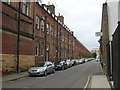
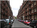
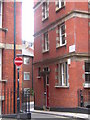
Photos of NW1 4QP

Area Information
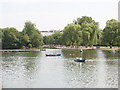
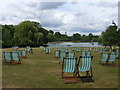
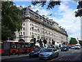
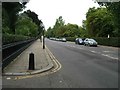
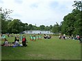
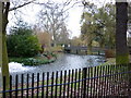
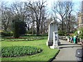
NW1 4QP represents a small residential cluster of just 8,592 square metres, yet it serves a community of 1,545 people. The population density stands at 1,366 inhabitants per square kilometre, indicating a compact urban environment typical of central London postcodes. Situated within the broader vicinity of Regent's Park, this postcode benefits from proximity to a 410-acre Royal Park originally commissioned by John Nash in the 1810s. The land's history traces back to Marylebone Park, a hunting ground appropriated by King Henry VIII in the 1530s. Despite the historic grandeur of the surrounding named entity, the immediate character of NW1 4QP focuses on residential living. You will find homes nestled near notable features such as Queen Mary's Gardens and the London Zoo, which occupies the site of the original South Villa within the park boundaries. Daily life here is defined by convenience and proximity to major educational institutions like the London Business School. The area acts as a functional residential zone where the scale of the postcode does not diminish access to the city's wider infrastructure. Living in NW1 4QP means accessing a dense slice of a historically significant area without the spaciousness often associated with such landmarks.
- Area Type
- Postcode
- Area Size
- 8592 m²
- Population
- 1545
- Population Density
- 1366 people/km²
The housing stock in NW1 4QP is dominated by flats, reflecting the limited land area of 8,592 square metres. Only 40% of homes are owned outright or have a mortgage, while the majority of residents are tenants. This 60% rental proportion signals a competitive lease market typical of prime London postcodes. You will find few detached or semi-detached houses within the immediate boundaries of this postcode. The small size of the residential cluster necessitates vertical living arrangements. Buyers looking for freehold homes must cast their net wider than NW1 4QP itself, targeting neighbouring areas. For tenants, the availability of flats aligns with the needs of a population of 1,545 people. The market dynamics favour investors and long-term renters. Property values likely correlate with the high density of 1,366 people per square kilometre. Understanding the 40% ownership rate helps you gauge the competition for sales versus the volume available for rent.
House Prices in NW1 4QP
Showing 14 properties
| Address | Type | Beds | Baths | Last Sale Price | Last Sale Date | |
|---|---|---|---|---|---|---|
| Lethbridge House, 20 Cornwall Terrace, London, NW1 4QP | Terraced | 6 | 7 | £39,160,000 | Dec 2016 | |
| Carruthers House, 4 Cornwall Terrace, London, NW1 4QP | Flat | 2 | 2 | £3,627,000 | May 2011 | |
| Silk House, 11 Cornwall Terrace, London, NW1 4QP | Terraced | 6 | 8 | £660,000 | Feb 1996 | |
| Pagent House, 10 Cornwall Terrace, London, NW1 4QP | house | 7 | - | £140,000 | Feb 1996 | |
| 9 Cornwall Terrace, London, NW1 4QP | Terraced | 6 | - | - | - | |
| Stanley House, 8 Cornwall Terrace, London, NW1 4QP | house | 5 | 6 | - | - | |
| Boswall House, 2 Cornwall Terrace, London, NW1 4QP | Terraced | 6 | - | - | - | |
| 18-19 Cornwall Terrace, London, NW1 4QP | Terraced | - | - | - | - | |
| 22 Cornwall Terrace, London, NW1 4QP | house | - | - | - | - | |
| 1 Cornwall Terrace, London, NW1 4QP | house | - | - | - | - |
Energy Efficiency in NW1 4QP
Residents of NW1 4QP enjoy immediate access to five retail outlets including Co-op London, Tesco Marylebone, and Co-op Park. These venues form the core of your weekly shopping routine. Five metro stations sit nearby, providing easy routes to the rest of London. Great Portland Street and Regent's Park Station are particularly convenient for walking commuters. You are also close to five major rail hubs, including Bond Street and London Euston Railway Station. Five ferry stops, such as Little Venice Waterbus and Camden Lock Waterbus, offer leisurely travel options. Three major bus and coach locations, including London Victoria Coach Station Arrivals, serve long-distance needs. Your daily errands are just moments away in centres like Green Line Coach Station. The abundance of amenities creates a self-contained environment for daily life. You will find practical facilities within a short walk of your home.
Amenities
Schools
Parents residing in NW1 4QP have access to the London Business School located near their homes. This institution falls under the 'other' category rather than a standard primary or secondary education classification. It serves as a prominent educational landmark within the vicinity. The area does not list traditional state primary or secondary schools in the immediate database. You must look beyond NW1 4QP for children's primary education, as the small residential cluster lacks these specific facilities. The presence of the London Business School indicates a gathering place for professional education and adult learning. Families with school-age children may need to travel to other parts of Regent's Park Ward for primary schooling. The local educational landscape is defined by this single notable institution. Prospective homebuyers should consider the commute time to external state schools. The mix of education types is limited in this specific postcode area.
| Rank | School | Type | Entry gender | Ages |
|---|
Explore more schools in this area
Go to Schools tabDemographics
The community within NW1 4QP reflects a mature demographic profile, with a median age of 47 years. Adults aged between 30 and 64 years constitute the most common age range for residents. This concentration of middle-aged adults suggests a population stability often found in London's inner zones. Home ownership accounts for 40% of households, meaning the remaining 60% reside in rented properties. This split indicates a mixed market where long-term security coexists with tenancy. The predominant accommodation type in this postcode is flats, consistent with the high density required for a population of 1,545 within 8,592 square metres. Ethnically, the White population remains the most common group. A dense living environment supports a lifestyle oriented towards urban amenities rather than suburban sprawl. The high residential density supports a fast-paced environment. Families and professionals navigate the postcode daily. The demographic data paints a picture of an established community rather than a rapidly changing one. Statistical clarity shows the makeup of the area without ambiguity.
Household Size
Accommodation Type
Tenure
Ethnic Group
Religion
Household Composition
Age
Household Deprivation
NS-SEC
Explore more demographic insights in this area
Go to Demographics tabPlanning
Planning Constraints
- Flood RiskPremium
- Ramsar Wetland SitesPremium
- Area of Outstanding Natural BeautyPremium
- Protected Nature ReservePremium
- Protected WoodlandPremium