Area Overview for NW1 4HJ
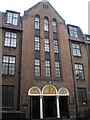
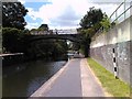
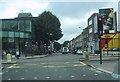
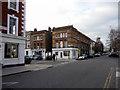
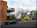
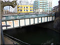
Photos of NW1 4HJ


Area Information
Living in NW1 4HJ means residing within a compact residential cluster defined by postcode NW1 4HJ. This small area covers just 7,340 square metres, accommodating a population of 1,531 residents. The density is extremely high at 208,574 people per square kilometre, which is characteristic of central Inner London locations. You are situated near the periphery of Regent's Park, a Grade I listed historic landscape designed by John Nash. Originally part of the Manor of Tyburn and later a royal hunting ground, this 410-acre park forms the immediate backdrop to your daily life. The location offers proximity to major transport hubs while maintaining a defined residential footprint. You enjoy access to London Zoo and the Inner Circle via the park's surrounding streets. This postcode represents a specific slice of north-west London where historical grandeur meets modern urban density. The area functions as a quiet sanctuary between the busy thoroughfares of Camden Town and Great Portland Street. Your day-to-day experience involves navigating a tight-knit environment where space is at a premium but connectivity to the wider city is immediate.
- Area Type
- Postcode
- Area Size
- 7340 m²
- Population
- 1531
- Population Density
- 7778 people/km²
Understanding the property market in NW1 4HJ requires looking at the specific housing stock and ownership patterns. The hallmark of this area is that the predominant accommodation type is flats. This classification holds true for the specific postcode covering the 7,340 square metre site. Only 32% of residents are homeowners, which paints a picture of a market often dominated by private renting or shared ownership schemes. This low ownership rate suggests that entering the property ladder here might involve purchasing a flat within a managed block. Buyers looking at this small area should expect a focus on vertical living rather than detached houses or bungalows. The high population density reinforces the prevalence of multi-unit dwellings. New buyers should weigh the convenience of flat living against the communal nature of such buildings. The market here serves professionals and those seeking convenience over traditional single-family homes. Prospective purchasers must consider the implications of this 32% ownership rate on price and availability trends.
House Prices in NW1 4HJ
Showing 12 properties
| Address | Type | Beds | Baths | Last Sale Price | Last Sale Date | |
|---|---|---|---|---|---|---|
| 60 Cumberland Terrace, London, NW1 4HJ | Terraced | - | - | £9,340,000 | Apr 2025 | |
| 56 Cumberland Terrace, London, NW1 4HJ | Terraced | 6 | 7 | £17,930,000 | Sep 2024 | |
| 52 Cumberland Terrace, London, NW1 4HJ | Terraced | 4 | 6 | £12,000,000 | Nov 2022 | |
| Former 55, Cumberland Terrace, London, NW1 4HJ | Terraced | 6 | 7 | £10,400,000 | Mar 2020 | |
| 50 Cumberland Terrace, London, NW1 4HJ | Terraced | 5 | 5 | £3,750,000 | Oct 2006 | |
| 54 Cumberland Terrace, London, NW1 4HJ | house | - | - | £3,330,000 | Mar 2002 | |
| 59 Cumberland Terrace, London, NW1 4HJ | Terraced | 7 | 7 | £499,000 | Jun 2000 | |
| 53 Cumberland Terrace, London, NW1 4HJ | Terraced | 7 | 7 | £475,000 | May 1998 | |
| 58 Cumberland Terrace, London, NW1 4HJ | house | - | - | - | - | |
| 57 Cumberland Terrace, London, NW1 4HJ | Terraced | - | - | - | - |
Energy Efficiency in NW1 4HJ
Your lifestyle in NW1 4HJ is defined by the convenience of nearby amenities within practical reach. You have access to five main shopping destinations, including Co-op Camden, Whole Foods Market, and Sainsburys Mornington. Daily necessities and quality groceries are readily available without leaving the immediate vicinity. Transport links are equally diverse, with five metro stations, five rail stations, and three bus stops located nearby. Key transport points include Mornington Crescent and London Euston Railway Station. Leisure options are anchored by the presence of Regent's Park, which you access via the specified postcode area. The park features London Zoo, established in 1826, and Queen Mary's Gardens. You can also board the Camden Lock Waterbus or London Zoo Waterbus Stop directly from the local area. This mix of retail variety and cultural landmarks ensures a convenient daily routine. Your weekends may involve a stroll through the historic landscapes of the Inner Circle or the Broad Walk.
Amenities
Schools
| Rank | School | Type | Entry gender | Ages |
|---|
Explore more schools in this area
Go to Schools tabDemographics
The community within homes in NW1 4HJ reflects a mature living profile. The median age is 47, with adults between 30 and 64 years old representing the most common age range. This demographic skew suggests a neighbourhood settled by those further along in their living journey rather than young families or students. Ownership statistics indicate that 32% of residents own their homes outright or via mortgage. This figure leaves a significant majority within the rental sector, though exact rental percentages are not provided in this dataset. The predominant ethnic group in the area is White, indicating the cultural composition of the immediate population. The accommodation type for this postcode is flats, which aligns with the high population density of the site. You will find a shared living environment typical of central London inner-city blocks. There is no specific data available to confirm deprivation levels, so one should rely on standard security precautions. The age profile and ownership figures create a distinct community character focused on stability rather than transient living.
Household Size
Accommodation Type
Tenure
Ethnic Group
Religion
Household Composition
Age
Household Deprivation
NS-SEC
Explore more demographic insights in this area
Go to Demographics tabPlanning
Planning Constraints
- Flood RiskPremium
- Ramsar Wetland SitesPremium
- Area of Outstanding Natural BeautyPremium
- Protected Nature ReservePremium
- Protected WoodlandPremium