Area Overview for NW1 3LH
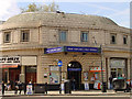
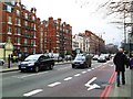
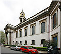
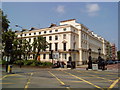
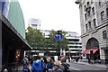
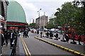
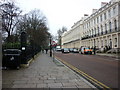
Photos of NW1 3LH

Area Information
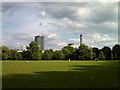
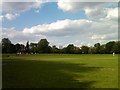
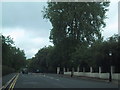
This specific postcode cluster sits within the historic Royal Park of Regent's Park, occupying a compact 4,228 square metres in north-west Inner London. While the area is small in physical footprint, it supports a population of 1,464 residents, creating a dense residential environment where daily life revolves around the unique landmarks of the park's periphery. Living in NW1 3LH means being entrenched in a Grade I listed landscape designed by John Nash in the early 19th century, originally intended as a pleasure garden for the wealthy before opening to the public. The proximity to this enforced green space defines the local atmosphere, offering immediate access to the 410-acre park which borders the City of Westminster and Camden. The location is defined by a specific residential cluster rather than a wide, sprawling neighbourhood. For anyone considering homes in this postcode, the reality is a high-density urban setting directly adjacent to one of London's most significant veteran landscapes. Daily routines here are shaped by the shade of the park and the convenience of a location that served as a royal hunting ground until the Dissolution of the Monasteries and later became a public asset. The sheer density of 346,278 people per square kilometre reflects the intense urban development surrounding this managed stretch of land.
- Area Type
- Postcode
- Area Size
- 4228 m²
- Population
- 1464
- Population Density
- 25112 people/km²
The housing stock in this specific postcode is defined by a high concentration of rental units rather than owner-occupied homes. With only 15% of residents owning their property, the market dynamics strongly favour tenants and landlords. Flats constitute the primary accommodation type found in NW1 3LH, aligning with the needs of the local age profile where most residents are between 30 and 64 years old. Potential buyers should note that securing a freehold or leasehold property here presents a specific challenge given the low ownership rate. The area functions as a significant cluster of privately rented homes, which often implies a market driven by corporate leases or investor portfolios. This structure means that long-term stability for an individual homebuyer may differ from that of traditional owner-occupied suburbs. Anyone viewing homes in NW1 3LH must understand that they are entering a market where inventory is predominantly available through the rental sector or buy-to-let investments rather than typical family owner-occupation. The layout supports multi-dwelling units, reflecting the high population density and the urban nature of this Regent's Park fringe location.
House Prices in NW1 3LH
Showing 49 properties
| Address | Type | Beds | Baths | Last Sale Price | Last Sale Date | |
|---|---|---|---|---|---|---|
| 16 Clarence Gardens, London, NW1 3LH | Maisonette | 3 | 1 | £650,000 | Jul 2025 | |
| 43 Clarence Gardens, London, NW1 3LH | Flat | 3 | 1 | £600,000 | Sep 2023 | |
| 30 Clarence Gardens, London, NW1 3LH | Flat | - | - | £307,500 | Dec 2022 | |
| 20 Clarence Gardens, London, NW1 3LH | Flat | - | - | £504,400 | Mar 2022 | |
| 3 Clarence Gardens, London, NW1 3LH | Flat | - | - | £320,000 | Oct 2021 | |
| 49 Clarence Gardens, London, NW1 3LH | Maisonette | - | - | £475,000 | Mar 2021 | |
| 10 Clarence Gardens, London, NW1 3LH | Flat | - | - | £365,000 | Mar 2021 | |
| 14 Clarence Gardens, London, NW1 3LH | Maisonette | 3 | 1 | £665,000 | Dec 2017 | |
| 27 Clarence Gardens, London, NW1 3LH | Flat | - | 1 | £330,000 | Dec 2017 | |
| 7 Clarence Gardens, London, NW1 3LH | Flat | - | - | £405,000 | Mar 2017 |
Energy Efficiency in NW1 3LH
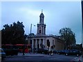
Daily living in NW1 3LH offers immediate access to a wide array of amenities within a short walk. Residents are just steps away from major retail outlets including Sainsburys London Euston, Amazon Fresh, and Tesco Euston. This density of shopping options ensures errands can be completed quickly without a long journey. Transport infrastructure is similarly extensive, with five nearby metro stations including Great Portland Street and Warren Street Station. Rail access is equally convenient, with London Euston Railway Station and St Pancras International LL Railway Station serving the locality. For those preferring water access, the Camden Lock Waterbus and Savoy Pier are available as nearby ferry options. The area is dominated by the presence of Regent's Park, a 410-acre Grade I listed landscape that serves as a green sanctuary. Notable features within this vast park include London Zoo, established in 1826, Queen Mary's Gardens in the Inner Circle, and the Broad Walk. The ability to access these historic landmarks and modern retail and transport facilities creates a lifestyle that blends urban convenience with significant open space.
Amenities
Schools
| Rank | School | Type | Entry gender | Ages |
|---|
Explore more schools in this area
Go to Schools tabDemographics
The community within NW1 3LH reflects a mature demographic profile, with a median age of 47 years. The majority of the population falls into the adult bracket between 30 and 64 years, indicating a neighbourhood populated by working professionals and established residents rather than young families or students. Home ownership stands at 15%, which confirms that this location is dominated by private renters rather than owner-occupiers. Consequently, the vast majority of people reside in flats, as designated by the area's predominant accommodation type. This high proportion of rental properties suggests a transient or investment-heavy housing market compared to areas with higher ownership figures. The area is also ethnically diverse yet predominantly white in terms of the most common ethnic group. With such a high population density, life in this postcode feels tightly packed and urban. The demographic data paints a clear picture of a residential zone that relies heavily on the rental sector, catering to the needs of adults in their prime working years who require flat-style living arrangements.
Household Size
Accommodation Type
Tenure
Ethnic Group
Religion
Household Composition
Age
Household Deprivation
NS-SEC
Explore more demographic insights in this area
Go to Demographics tabPlanning
Planning Constraints
- Flood RiskPremium
- Ramsar Wetland SitesPremium
- Area of Outstanding Natural BeautyPremium
- Protected Nature ReservePremium
- Protected WoodlandPremium