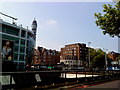
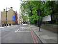
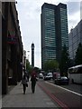
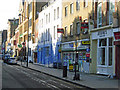
Area Overview for NW1 3AU
Photos of NW1 3AU


Area Information
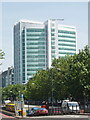
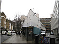
This postcode covers a specific residential cluster occupying just 1.2 hectares in central London. It houses 1,479 people, creating a high population density of 123,024 people per square kilometre. The social makeup is distinct, with young adults aged 15 to 29 years forming the dominant age group. Consequently, the median age is just 22, defining the character of neighbourhoods within NW1 3AU. Residents expect a fast-paced urban environment rather than a quiet suburban escape. You will find this postcode is tightly packed, meaning every travel time feels shorter compared to outer boroughs. The cluster is surrounded by major thoroughfares, ensuring daily life revolves around the city centre. While the area lacks green space due to its dense footprint, the proximity to transport hubs means local convenience is immediate. Living in NW1 3AU involves sharing a vibrant postcode with thousands of fellow residents in a very small footprint. This concentration ensures you are never far from employment, leisure, or travel opportunities. The area functions as a microcosm of wider London, offering instant access to the needs of a modern metropolis despite its limited physical size.
- Area Type
- Postcode
- Area Size
- 1.2 hectares
- Population
- 1479
- Population Density
- 11079 people/km²
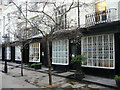
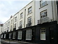
The housing stock in NW1 3AU is defined by a specific focus on flats. Only 25% of residents own their homes, revealing a market that serves primarily renters and investors rather than established families seeking mortgages. The dominance of flats suits the young adult demographic, where smaller, more manageable living spaces are the standard. You will find very few detached houses or semi-detached properties within this 1.2-hectare cluster. Instead, the skyline likely features high-rise blocks and converted Georgian terraces designed for density. Buying a home here requires navigating a landscape where leasehold flats are the norm rather than freehold properties. The low ownership percentage indicates that most transactions involve buy-to-let schemes or private landlords. If you are considering homes in NW1 3AU, be prepared for a competitive bidding war against other investors attracted by the location. This area is not designed for long-term family growth but rather for dynamic, short-to-medium-term living. The lack of ownership opportunities means equity building is difficult for the average buyer. Consequently, the focus for buyers shifts to rental yield and capital appreciation rather than immediate family expansion.
House Prices in NW1 3AU
Showing 6 properties
| Address | Type | Beds | Baths | Last Sale Price | Last Sale Date | |
|---|---|---|---|---|---|---|
| Third Floor, 385-387 Euston Road, London, NW1 3AU | Office | - | - | - | - | |
| Basement Floor, Ground Floor And Mezzanine Floor, 385-387 Euston Road, London, NW1 3AU | office_workshop | - | - | - | - | |
| Grofton House, 377-381 Euston Road, London, NW1 3AU | Office | - | - | - | - | |
| 383A Euston Road, London, NW1 3AU | commercial | - | - | - | - | |
| First Floor, 385-387 Euston Road, London, NW1 3AU | Office | - | - | - | - | |
| Fourth Floor, 385-387 Euston Road, London, NW1 3AU | Office | - | - | - | - |
Energy Efficiency in NW1 3AU
Your daily life in NW1 3AU centres on immediate access to major retail and leisure hubs. You live just steps from five retail destinations, including Amazon Fresh, Tesco Euston, and Sainsburys London Euston. These supermarkets offer everything from weekly groceries to quick meal solutions without needing a car. Five metro stations dot the neighbourhood, including Euston Square and Warren Street Station, allowing you to step onto the Underground within minutes. For rail enthusiasts, you are moments away from London Euston Railway Station and Bond Street Station. If walking on the Thames appeals to you, the area offers five ferry options like the Camden Lock Waterbus and London Zoo Waterbus Stop. Travel by road is also seamless; nearby bus connections include routes to London Victoria Coach Station and Green Line Coach Station. You can walk to Bond Street Station for shopping or grab coffee near Great Portland Street. The concentration of amenities means you can dine, shop, or travel without leaving the immediate vicinity. Living in NW1 3AU grants you a lifestyle defined by convenience, where a grocery run or train ticket is a matter of minutes. This density of options suits those who value time efficiency over tranquil surroundings.
Amenities
Schools
| Rank | School | Type | Entry gender | Ages |
|---|
Explore more schools in this area
Go to Schools tabDemographics
The community in NW1 3AU is heavily skewed towards younger households. You can expect 25% of residents to own their homes, indicating a market where rentals remain far more prevalent than ownership. Flats dominate the accommodation type within this postcode, catering to those seeking urban living without the space of a detached house. The countdown to adulthood defines the demographic, as the most common age range spans from 15 to 29 years old. With a median age of just 22, the area attracts students, young professionals, and early-career workers. While the predominant ethnic group is White, the high density suggests a diverse mix of nationalities typical of central London. Only a quarter of people in this cluster own their property, meaning you will compete with a steady stream of tenants looking for flexible leases. This profile means local shops favour quick-consumption goods and 24-hour services over traditional family-oriented retail. Living in NW1 3AU means sharing streets with peers who are professionally ambitious and socially active. The low ownership rate reflects the high cost of living and the prevalence of student accommodation and purpose-built rental blocks.
Household Size
Accommodation Type
Tenure
Ethnic Group
Religion
Household Composition
Age
Household Deprivation
NS-SEC
Explore more demographic insights in this area
Go to Demographics tabPlanning
Planning Constraints
- Flood RiskPremium
- Ramsar Wetland SitesPremium
- Area of Outstanding Natural BeautyPremium
- Protected Nature ReservePremium
- Protected WoodlandPremium