Area Overview for NW1 1PN
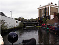
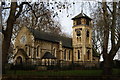
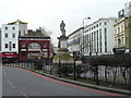
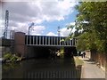
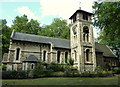
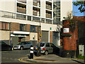
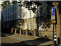
Photos of NW1 1PN


Area Information
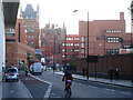
Living in NW1 1PN means residing in one of London's most historically significant transport hubs, situated within a tiny residential cluster of just 945 square metres. This postcode covers a small section of St Pancras and Somers Town, a ward in the London Borough of Camden that sits between three of London's major railway termini: Euston, Euston Road, St Pancras, and Kings Cross. The area is characterised by dense housing and a population of 1,751 residents who navigate a neighbourhood shaped by 19th-century railway expansion. Originally a working-class community, the ward today occupies ground defined by Euston Road, Pancras Road, and Crowndale Road. You will find yourself in a location where history meets high-speed connectivity, centred around Chalton Street and the railway approaches. The area retains a unique identity separate from the broader London landscape, yet it functions as an integral part of the capital's commuter grid. For those seeking a home in NW1 1PN, you are choosing a location that balances historic Georgian origins with modern urban intensity, all within a compact footprint that places major international stations at your doorstep.
- Area Type
- Postcode
- Area Size
- 945 m²
- Population
- 1751
- Population Density
- 31550 people/km²
The property market in NW1 1PN is overwhelmingly dominated by flats, as the area description explicitly states "Flats" as the primary accommodation type. With just 4% of residents owning their homes, this postcode operates strictly as a rental market rather than an owner-occupied one. You are unlikely to find traditional houses here; instead, you will encounter the dense, multi-storey blocks that define the ward, such as the historic Sidney Street estate. These properties, including St George's block, were originally designed as social housing and retain their character as Council-owned residential blocks. For a buyer looking at homes in NW1 1PN, the landscape is almost exclusively tenanted flats rather than freehold houses. The small area size of 945 square metres limits the scope for large detached properties, focusing the market on anything that fits within this dense urban grid. While the immediate surrounds may feature surviving Georgian houses towards Bloomsbury and Holborn, the NW1 1PN specific cluster remains a high-density flat estate. If you are purchasing, you will be entering a market defined by large housing stock with low private ownership, meaning new entrants will almost certainly be buying into leasehold flats or investor portfolios.
House Prices in NW1 1PN
Showing 18 properties
Energy Efficiency in NW1 1PN
Your daily life in NW1 1PN is defined by convenience and proximity to some of London's busiest landmarks. You are surrounded by five metro stations, including stations named Mornington Crescent, Euston Square, and Warren Street, which allow easy access to the wider city. Retail options are plentiful, with five notable shops nearby, including Sainsburys Mornington, M&S Euston Rail SF, and Sainsburys London, ensuring you can shop for groceries and essentials without venturing far. Five railway stations serve the area, providing direct rail links to London Euston and St Pancras International, which gives you access to Eurostar services and long-distance trains. For those who prefer water travel, you are close to Camden Lock Waterbus, the London Zoo Waterbus Stop, and Savoy Pier. Transport links extend further to bus services, including routes past the Green Line Coach Station and London Victoria Coach Station. This dense network of amenities and transport hubs means you can manage work, shopping, and leisure from a single postcode, making daily life highly efficient.
Amenities
Schools
Families considering schools near NW1 1PN have access to two key educational institutions within practical reach. St Mary and St Pancras Church of England Primary School meets the requirements for primary education and holds a "good" Ofsted rating, indicating solid academic standards according to government inspectors. For younger children, St Christopher's Nursery School provides early years care and education close to the residential cluster. The presence of both a primary school and a nursery suggests that the immediate area supports family life for those requiring early childhood care, although the very young median age of 22 years overall points to a transient population. You have direct access to a primary education option with a confirmed rating, ensuring that school choices in the vicinity are not left to guesswork. The mix of nursery and primary provisions means that residents can arrange schooling logistics efficiently without needing to commute into neighbouring boroughs for basics.
| Rank | School | Type | Entry gender | Ages |
|---|
Explore more schools in this area
Go to Schools tabDemographics
The community in NW1 1PN is young and heavily reliant on rental living, with a median age of just 22 years. Despite this youthful median figure, the adults aged 30 to 64 years remain the most common age range within the broader demographic spread, suggesting a hub for students as well as early-career professionals. Home ownership is extremely rare in this specific cluster, with only 4% of residents owning their properties outright. The vast majority of accommodation consists of flats, reflecting the density of the residential blocks that dominate the postcode area. White residents form the predominant ethnic group in NW1 1PN, consistent with wider trends in North London. The area holds a status among the 10% most deprived in the country, which influences the mix of residents and local services available. This deprivation score does not define the character of every individual home but indicates a concentration of council-owned housing and a lack of private investment in certain sectors. You will live amongst a population that includes many students, refugees, and less affluent residents who draw on the area's transport links for their daily lives.
Household Size
Accommodation Type
Tenure
Ethnic Group
Religion
Household Composition
Age
Household Deprivation
NS-SEC
Explore more demographic insights in this area
Go to Demographics tabPlanning
Planning Constraints
- Flood RiskPremium
- Ramsar Wetland SitesPremium
- Area of Outstanding Natural BeautyPremium
- Protected Nature ReservePremium
- Protected WoodlandPremium