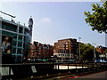
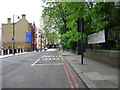
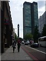
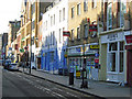
Area Overview for NW1 1DT
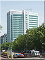
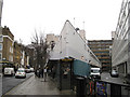
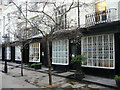
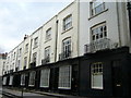
Photos of NW1 1DT


Area Information
Living in NW1 1DT places you at the heart of the St Pancras and Somers Town ward in the London Borough of Camden. This small residential cluster defines a distinctive part of north London, bounded by significant landmarks and major roads. The area is historically significant, centred around Chalton Street with immediate access to three major railway termini. Euston Station opened in 1838, followed by Kings Cross in 1852 and St Pancras Station in 1868. These transport hubs shape the daily rhythm of the neighbourhood, making it one of the most connected zones in England. You will find yourself amidst dense residential blocks that have largely resisted large-scale gentrification. Surviving Georgian houses towards Bloomsbury and Holborn offer a contrast to the prevalent housing stock. The ward had a population of 13,818 at the 2011 Census, indicating a densely populated urban environment. Despite its small postcode footprint, NW1 1DT serves as a vital junction where the A406, known as the Milton Keynes Orbital, intersects with other major road networks. The area's character is defined by its historical layers, from the original Georgian developments of the 1780s to the Victorian railway construction that transformed the landscape in the 19th century. Today, the streets are a blend of social history and modern utility, offering a unique urban experience distinct from other parts of the capital.
- Area Type
- Postcode
- Area Size
- Not available
- Population
- 1505
- Population Density
- 9477 people/km²
The property market in NW1 1DT is characterised almost exclusively by rental tenancies given the 13% home ownership rate. The vast majority of housing stock consists of flats, a direct result of the area's historical development and the dominance of social housing blocks. You will find few traditional houses within the immediate cluster of NW1 1DT, as the terrain has been built over with dense, Council-owned residential blocks. This structure largely prevented the usual patterns of gentrification seen elsewhere in London. Instead of owner-occupiers buying family homes, the area attracts students, refugees, and individuals seeking affordable accommodation. Surviving Georgian houses, particularly those located towards Bloomsbury and Holborn, have become increasingly sought after in recent years, but they represent a small fraction of the total stock compared to the flats. The Sidney Street estate, completed in 1938, comprises 250 flats in blocks named after saints, setting a precedent for the local housing architecture. St George's block within this estate holds historical significance as the first block of all-electric flats in the United Kingdom. For buyers looking at this specific area and its immediate surroundings, the focus remains on the rental market rather than freehold purchases. The concentration of these flats means that private purchases are rare, and the market operates heavily through letting agents and social housing management.
House Prices in NW1 1DT
Showing 11 properties
| Address | Type | Beds | Baths | Last Sale Price | Last Sale Date | |
|---|---|---|---|---|---|---|
| 2 Grafton Place, London, NW1 1DT | Flat | - | - | - | - | |
| Flat 1ST Floor Rear, 2 Grafton Place, London, NW1 1DT | Flat | - | - | - | - | |
| Flat 1ST Floor Front, 2 Grafton Place, London, NW1 1DT | Flat | - | - | - | - | |
| Flat 4TH Floor Rear, 2 Grafton Place, London, NW1 1DT | Flat | - | - | - | - | |
| Flat 3RD Floor Front, 2 Grafton Place, London, NW1 1DT | Flat | - | - | - | - | |
| Room At Travelodge, 1-11 Grafton Place, London, NW1 1DT | Flat | - | - | - | - | |
| Flat 2ND Floor Front, 2 Grafton Place, London, NW1 1DT | Flat | - | - | - | - | |
| Flat 5TH Floor, 2 Grafton Place, London, NW1 1DT | Flat | - | - | - | - | |
| Flat 4TH Floor Front, 2 Grafton Place, London, NW1 1DT | Flat | - | - | - | - | |
| Flat 3RD Floor Rear, 2 Grafton Place, London, NW1 1DT | Flat | - | - | - | - |
Energy Efficiency in NW1 1DT
Your lifestyle in NW1 1DT revolves around the convenience of major transport hubs and the proximity of key retail outlets. You will find yourself surrounded by five notable retail locations within practical reach, including M&S Euston Rail SF, Sainsburys London, and M&S St Pancras Rail Arcade SF. These shops provide essential daily necessities alongside larger department stores. Cultural and leisure options are equally accessible, with five railway stations and five metro stops situated alongside you. Camden Lock Waterbus, London Zoo Waterbus Stop, and Savoy Pier offer unique water-based transport and leisure activities nearby. Bus services connect you directly to the Green Line Coach Station and London Victoria Coach Station, allowing easy access to regional destinations. The area is dominated by three major railway termini, providing unparalleled connectivity for both business and tourism. St Pancras Old Church stands on Pancras Road, offering a historical anchor within the modern streetscape. The Sidney Street estate adds architectural interest with its blocks named after saints. For those seeking outdoor activities, the presence of waterbus stops suggests access to the Regent's Canal network. While specific parks are not detailed in the immediate amenity list, the proximity to the Grand Oasis and other facilities in St Pancras Town Centre enhances your options. Dining and shopping experiences are integrated into the transport arcades, allowing you to combine errands with leisure. Living in NW1 1DT offers a blend of historical character and modern urban convenience, with everything you need within a short walk of your doorstep.
Amenities
Schools
| Rank | School | Type | Entry gender | Ages |
|---|
Explore more schools in this area
Go to Schools tabDemographics
The community in NW1 1DT reflects a specific social profile distinct from many other London postcodes. The median age for residents is 22, which indicates a young population dominated by students and young professionals. The most common age range consists of adults between 30 and 64 years old, suggesting a working-age population despite the low median figure. Home ownership stands at just 13%, meaning the vast majority of households operate as tenants. This low rate of ownership is typical for areas with high concentrations of Council-owned residential blocks. The predominant ethnic group in the area identifies as Asian, contributing to a culturally diverse demographic landscape. You will likely meet a mix of affluent residents alongside less affluent families, students, and refugees. This diversity creates a dynamic social fabric, though it also contributes to the area ranking among the 10% most deprived in the country according to official assessments. The housing stock is entirely dominated by flats, reflecting the development history shaped by the Sidney Street estate completed in 1938. These blocks, named after saints, were designed as modern social housing with features like the first all-electric flats in the United Kingdom. Living in NW1 1DT means participating in a community where multi-ethnic interactions are common, and household composition varies widely due to the high tenant population and affordable housing options.
Household Size
Accommodation Type
Tenure
Ethnic Group
Religion
Household Composition
Age
Household Deprivation
NS-SEC
Explore more demographic insights in this area
Go to Demographics tabPlanning
Planning Constraints
- Flood RiskPremium
- Ramsar Wetland SitesPremium
- Area of Outstanding Natural BeautyPremium
- Protected Nature ReservePremium
- Protected WoodlandPremium