Area Overview for NW1 0SB
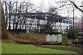
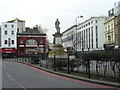
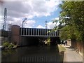
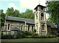
Photos of NW1 0SB
Area Information
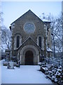
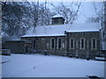
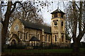
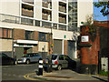
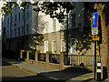
Living in the NW1 0SB postcode area means residing within a compact residential cluster in North London, covering just 2,023 square metres. This small geographical footprint houses a population of 1,691 people, creating a dense environment where neighbours are rarely far away. The location sits within the St Pancras and Somers Town ward, a distinct part of the London Borough of Camden. This specific cluster is situated amidst three major railway termini: Euston, Kings Cross, and St Pancras. The area has a rich history, having evolved from Georgian developments in the late 18th century to become a significant transport hub by the late 19th century. Lord Somers accepted the proposal to build Euston Station in 1834, transforming the local landscape. Today, the character of the ward remains defined by its proximity to these rail lines and the historic landmarks that surround them. Residents benefit from living near St Pancras Old Church and the iconic St Pancras Railway Station, opened in 1868. Though the physical area is small, its connections are extensive. The borough of Camden encompasses this zone, which is bounded by significant roads including Euston Road and Pancras Road. Daily life here is shaped by the constant energy of nearby rail networks that serve the Midlands, the North, and continental Europe via Eurostar. You are living in a location where history and modern connectivity intersect tightly.
- Area Type
- Postcode
- Area Size
- 2023 m²
- Population
- 1691
- Population Density
- 23101 people/km²
The property market in NW1 0SB is heavily skewed towards renting due to the specific housing stock available. Flats constitute the primary accommodation type, reflecting the 14% home-ownership level recorded for this postcode area. This low ownership rate indicates a rental-dominant environment where buyers should anticipate chasing secure, long-term tenancies or looking at the small slice of privately owned properties. You are looking at a very specific type of home in a very small area. With the postcode covering only 2,023 square metres, physical space for large detached homes is non-existent. Instead, the market is defined by dense blocks of flats, many of which are part of the council-owned estates that characterise the wider St Pancras and Somers Town ward. These estates historically prevented gentrification, preserving affordable housing for students and those with lower incomes. For a prospective buyer or investor, the 14% ownership figure suggests competition among tenants and landlords. While specific property prices are not listed in the current data, the historical context of the area reveals a mix of surviving Georgian houses and modern social housing blocks like the Sidney Street estate. The Sidney Street, completed in 1938, introduced the first all-electric flats in the UK, a legacy still visible in the concentration of block flats. If you are seeking homes in NW1 0SB, you must navigate a market where rental demand is high. The area’s location near three major railway termini drives this demand. However, the density of the housing stock, combined with the ward's classification as one of the 10% most deprived, means supply is tight. The dominance of flats means traditional family homes are rare features within this specific cluster.
House Prices in NW1 0SB
Showing 24 properties
| Address | Type | Beds | Baths | Last Sale Price | Last Sale Date | |
|---|---|---|---|---|---|---|
| Flat 18, Dulverton, Royal College Street, London, NW1 0SB | Flat | 2 | 1 | £525,000 | Jan 2020 | |
| Flat 20, Dulverton, Royal College Street, London, NW1 0SB | Flat | 1 | 1 | £185,000 | Jun 2006 | |
| Flat 22, Dulverton, Royal College Street, London, NW1 0SB | Flat | - | - | - | - | |
| Flat 12, Dulverton, Royal College Street, London, NW1 0SB | Flat | - | - | - | - | |
| Flat 5, Dulverton, Royal College Street, London, NW1 0SB | Flat | - | - | - | - | |
| Flat 9, Dulverton, Royal College Street, London, NW1 0SB | Flat | - | - | - | - | |
| Flat 16, Dulverton, Royal College Street, London, NW1 0SB | Flat | - | - | - | - | |
| Flat 24, Dulverton, Royal College Street, London, NW1 0SB | Flat | - | - | - | - | |
| Flat 4, Dulverton, Royal College Street, London, NW1 0SB | Flat | - | - | - | - | |
| Flat 1, Dulverton, Royal College Street, London, NW1 0SB | Flat | - | - | - | - |
Energy Efficiency in NW1 0SB
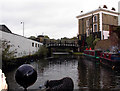
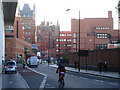
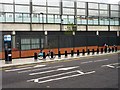
Your daily life in NW1 0SB is defined by immediate access to major retail chains and transport hubs. Within a short walking distance, you find Co-op Camden, Sainsburys Mornington, and Aldi Camden. These supermarkets ensure you have fresh groceries and household essentials without needing to travel far. The convenience of having five retail options nearby simplifies daily shopping routines significantly. Transport options are numerous, with five metro stops and five railway stations located practically within reach. Notable nearby stations include Mornington Crescent, Camden Town Station, and Euston Square for metro services. For rail travel, Camden Road Station and London St Pancras International provide connections across the country. You can also access the Camden Lock Waterbus and London Zoo Waterbus Stop if choosing a scenic route along the water. For those preferring road travel, bus services operate throughout the area, with routes linked to Green Line Coach Station and London Victoria Coach Station. This network allows for easy travel to other parts of London and the south-east. The area is also close to St Pancras Old Church, which stands on Pancras Road and offers a historic landmark for walks or visits. Living in this postcode area blends modern convenience with historic charm. You have access to the dining and leisure facilities of Camden Town and Somers Town without the need for a car. The proximity to Camden Road Station and the major roads like Eversholt Street means you can reach work or leisure destinations quickly. Whether you are grabbing lunch at a local cafe or commuting via the Eurostar from nearby St Pancras, your lifestyle is geared towards urban efficiency and historical richness.
Amenities
Schools
| Rank | School | Type | Entry gender | Ages |
|---|
Explore more schools in this area
Go to Schools tabDemographics
The community in NW1 0SB is predominantly composed of adults aged between 30 and 64 years old. The median age for residents is 47 years, indicating a mature population compared to national averages. Home ownership stands at a low 14%, suggesting that the vast majority of residents rent their homes rather than own them outright. This low figure reinforces the area's nature as a prime rental market for busy professionals and transient households. Flats are the predominant accommodation type in this cluster. This aligns with the higher population density figure of 835,917 people per square kilometre recorded for this specific postcode area. Such density reflects the urban apartment living style found throughout Camden. While specific ethnic data points suggest White residents are in the majority, the ward is known for housing students, refugees, and less affluent residents alongside those seeking convenient city access. The area ranks among the 10% most deprived in the country according to official character assessments of the St Pancras and Somers Town ward. This deprivation level often correlates with a lack of private home-ownership and a reliance on council-owned residential blocks. For you, living in NW1 0SB means joining a diverse mix of households living in close quarters. The high population density and low home-ownership rate create a unique social dynamic where temporary residents and long-term tenants coexist in a small, vibrant urban patch.
Household Size
Accommodation Type
Tenure
Ethnic Group
Religion
Household Composition
Age
Household Deprivation
NS-SEC
Explore more demographic insights in this area
Go to Demographics tabPlanning
Planning Constraints
- Flood RiskPremium
- Ramsar Wetland SitesPremium
- Area of Outstanding Natural BeautyPremium
- Protected Nature ReservePremium
- Protected WoodlandPremium