Area Overview for NW1 0PE
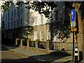
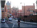
Photos of NW1 0PE

Area Information
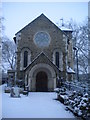
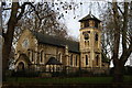
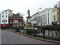
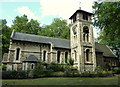
Living in NW1 0PE means residing in a specific postcode cluster within the London Borough of Camden, a ward defined by its proximity to three major railway termini. The area encompasses a small residential catchment of 5226 square metres, housing a population of 2940 people within this tightly packed footprint. You are situated in Somers Town, a district historically developed as a residential neighbourhood south and east of St Pancras Old Church. The ward lies at the convergence of Euston, Kings Cross, and St Pancras, centres established between 1838 and 1868. This location places you amidst significant transport infrastructure, including the St Pancras Railway Station which opened in 1868 and remains a dominant landmark. Your daily life is shaped by Chalton Street, which sits near the railway approaches, and is influenced by the area's transition from working-class communities and refugee housing schemes to a mix of current residents. The geography is bounded by major roads like Euston Road and Eversholt Street, creating a neighbourhood that functions as a vital connector of north London. While the area was once described by Victorian writers as the foulest slum in London, it has evolved significantly since the demolition of Agar Town in 1866 to build the current Station. You live in a space where history meets modern connectivity, anchored by the legacy of the Somers family and the subsequent industrial development that shaped the current street patterns and boundaries.
- Area Type
- Postcode
- Area Size
- 5226 m²
- Population
- 2940
- Population Density
- 12147 people/km²
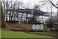
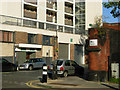
The property market in NW1 0PE is defined by a heavy reliance on rental accommodations rather than owner-occupied homes. With only 20% of the population owning their homes, the area functions primarily as a market for tenants looking for flats. The data confirms that flats are the predominant accommodation type, which is consistent with the area history of construction projects like the Sidney Street estate completed in 1938. These developments, including blocks named after saints such as St George's, were built to house less affluent residents and have largely prevented gentrification from altering the housing stock completely. Consequently, if you are looking to buy homes in NW1 0PE, you will find the market skewed towards purchase-to-rent scenarios or first-time buyers entering a very competitive sector. The small geographical size of 5226 square metres limits the variety of property types available compared to larger suburbs. Residents largely live in blocks designed to accommodate high-density living, a trait established when Father Basil Jellicoe secured support from Queen Mary to improve housing conditions in the 1920s. While surviving Georgian houses exist towards Bloomsbury and Holborn, the immediate vicinity of the postcode consists of these historic social housing blocks. This means buyers targeting this specific cluster should expect a range of vintage flats within a single, cohesive urban block rather than detached family homes or recent luxury developments.
House Prices in NW1 0PE
Showing 1 properties
| Address | Type | Beds | Baths | Last Sale Price | Last Sale Date | |
|---|---|---|---|---|---|---|
| Care Home, St Pancras Hospital, 4 St Pancras Way, London, NW1 0PE | Flat | 1 | 1 | - | - |
Energy Efficiency in NW1 0PE
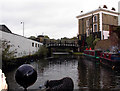
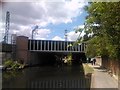
Your lifestyle in NW1 0PE revolves around convenient access to shops, transport hubs, and leisure facilities. Within practical reach, you have five retail outlets including Co-op Camden, Sainsburys Mornington, and Waitrose Kings. These supermarkets provide comprehensive daily shopping needs without requiring a long journey into central London. You are close to five metro and rail stations, including Mornington Crescent, Camden Town Station, Euston Square, London St Pancras International, and Camden Road Station. This abundance of stops means you can reach the rest of London quickly via underground or overground services. Water transport is also available through the Camden Lock Waterbus, London Zoo Waterbus Stop, and Savoy Pier, adding a unique river-based leisure element to your routine. Bus connectivity is further supported by three key stops, including those serving the Victoria Coach Station and the Green Line. The area offers a mix of functional shopping and leisure options that integrate seamlessly into daily life. St Pancras Old Church stands on Pancras Road, offering a historic focal point for walks. You live near notable social housing blocks like the Sidney Street estate, which adds character to the streetscape. The presence of multiple transport modes ensures that you can choose the method of travel that suits your mood or schedule. Whether walking to Waitrose Kings or taking the Eurostar from St Pancras, the amenities are immediately accessible from your doorstep.
Amenities
Schools
Families considering western schools or education access near NW1 0PE have specific options within the immediate vicinity. Abacus Belsize Primary School is located nearby and holds an Ofsted rating of outstanding, providing a high-standard educational setting for younger children. This primary institution is a key resource for the local community, offering quality instruction in the catchment area. For students requiring further vocational training or alternative secondary education, The Royal Veterinary College serves as a significant educational landmark. Although classified under a broader type as 'other', it represents a major centre for higher education and learning directly adjacent to the ward. The Royal Veterinary College contributes to the youthful demographic profile of the area, with many students residing in nearby flats. While the data only lists these two specific institutions, their presence supports the needs of both families with young children and older students returning to study. The concentration of high-quality primary education alongside major tertiary institutions creates a diverse educational landscape. Parents relying on schools near NW1 0PE will find that Abacus Belsize Primary School stands out for its academic performance. The availability of these institutions ensures that the area can cater to different age groups, from primary school entrants to university-level learners, reinforcing the role of the neighbourhood as an educational hub within Camden.
| Rank | School | Type | Entry gender | Ages |
|---|
Explore more schools in this area
Go to Schools tabDemographics
The community in NW1 0PE is dominated by young residents, with a median age of just 22 years. Most of the population falls into the 15 to 29 age range, creating a distinctly youthful atmosphere compared to the wider borough. Home ownership rates stand at 20%, indicating that the majority of residents rent their accommodation rather than own their homes. This statistic reflects a tenant-heavy environment typical of prime London locations. The predominant accommodation type in this postcode is flats, which aligns with the high density requirements of a small 5226 square metre area housing 2940 people. The racial makeup is primarily White, though the area's history includes significant numbers of French Revolution refugees and migrants over the centuries. You are part of an area characterised by a concentration of dense, often Council-owned residential blocks, a legacy of social housing strategies implemented since the early 20th century. The ward falls among the 10% most deprived areas in the country, a fact supported by the low percentage of owner-occupiers and the high population density. This level of deprivation influences local services and property values, distinguishing this postcode from the surrounding, more affluent zones of Camden. The demographic profile suggests a living arrangement suited to students, young professionals, and those seeking affordable rental options near central employment hubs.
Household Size
Accommodation Type
Tenure
Ethnic Group
Religion
Household Composition
Age
Household Deprivation
NS-SEC
Explore more demographic insights in this area
Go to Demographics tabPlanning
Planning Constraints
- Flood RiskPremium
- Ramsar Wetland SitesPremium
- Area of Outstanding Natural BeautyPremium
- Protected Nature ReservePremium
- Protected WoodlandPremium