Area Overview for Northwood Hills Ward
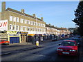
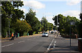
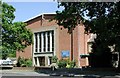
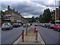
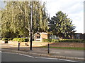
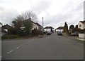
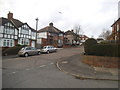
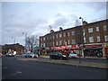
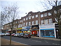
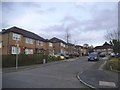
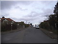
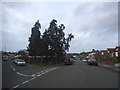
Photos of Northwood Hills Ward
Area Information
Living in Northwood Hills Ward offers a quiet retreat defined by its compact size and mature surroundings. This district represents a modest footprint of just 2.9 square kilometres, creating an intimate community where residents often know their neighbours. The area attracts those seeking a lifestyle away from the rapid pace of larger housing estates, favouring a slower rhythm of daily life. Homeowners find a predominantly settled environment where property values reflect stability rather than speculative growth. Daily routines involve local interactions and access to regional amenities rather than extensive international connectivity. The geography supports a walkable neighbourhood structure, reducing the need for long commutes within the immediate vicinity. Prospective buyers appreciate the density control that such a small ward provides, ensuring no overwhelming sprawl disrupts the local character. You will find a setting where privacy and community knowledge coexist without contradiction. The scale of the area means that local issues resolve quickly through direct communication between residents and local authorities. This ward serves as a distinct residential node within the wider borough, offering a focused living experience. Those relocating here should expect a neighbourhood built on tenure and familiarity, distinct from transient urban zones. The physical boundaries create a contained sense of place, reinforcing a strong sense of belonging among inhabitants.
- Area Type
- District Borough Unitary Ward
- Area Size
- 2.9 km²
- Population
- Not available
- Population Density
- Not available
Demographics
The community within Northwood Hills Ward reflects a distinctly established residential pattern with a median age of 70 years. This high average indicates a population comprised largely of retirees and long-term residents who have settled for decades. Age distribution shows a clear concentration in the elderly demographic, meaning the local economy and social services cater primarily to older adults. Home ownership stands at 62 per cent of households, confirming that the majority of residents purchased their properties rather than renting. This high tenure rate suggests a stable population with deep roots in the locality, rather than a transient workforce. Household composition remains consistent with national trends for similar age profiles, focusing on smaller family units or single occupants. The ward lacks diverse ethnic or religious percentages in the available records, reinforcing a homogenous, established community structure. You can expect a neighbourhood where long-standing traditions and customs prevail over recent cultural shifts. The population density supports an environment where quietude takes precedence over nightlife or commercial vibrancy. Residents benefit from a peer group with shared generational values and life experiences. The demographic profile confirms this is a retirement-friendly area where services are tailored to older needs.
Household Size
Accommodation Type
Tenure
Ethnic Group
Religion
Household Composition
Age
Household Deprivation
NS-SEC
Explore more demographic insights in this area
Go to Demographics tabPlanning
Planning Constraints
- Flood RiskPremium
- Ramsar Wetland SitesPremium
- Area of Outstanding Natural BeautyPremium
- Protected Nature ReservePremium
- Crime RiskPremium