Area Overview for North Harrow Ward
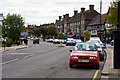
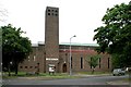
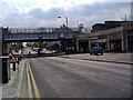
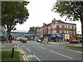
Photos of North Harrow Ward

Area Information
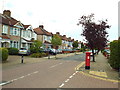
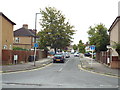
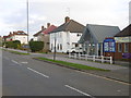
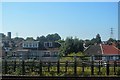
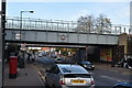
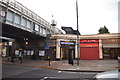
North Harrow Ward is a compact electoral ward situated within the London Borough of Harrow, covering just 1.4 square kilometres. The area is a settled residential district located approximately at coordinates 51.5818°N, 0.3630°W. Recent census figures confirm a population of 8,994, indicating a dense, established community rather than a sprawling suburb. Living in North Harrow Ward means engaging with a location that forms part of the borough's northern districts, offering a specific slice of Greater London life. The ward's boundaries are clearly defined on local maps and remain a distinct unit for local governance. Residents enjoy a neighbourhood that has maintained its character over recent years. The area serves as a specific homebase for nearly 9,000 people in southern England. The ward map highlights its position relative to surrounding Harrow estates, providing clear context for navigation. This small geographical footprint supports a high population density, ensuring essential services are within easy reach for everyone calling North Harrow Ward their home.
- Area Type
- District Borough Unitary Ward
- Area Size
- 1.4 km²
- Population
- Not available
- Population Density
- Not available
Demographics
The community profile of North Harrow Ward is defined by an exceptionally mature age profile. The median age within the ward is 70, reflecting a significant living community for older adults. This demography shapes the daily rhythm of the neighbourhood and influences local business offerings. Home ownership is the prevailing arrangement, with 71% of residents owning their dwelling outright or with a mortgage. This high rate of ownership contrasts sharply with typical high-density rental hubs found elsewhere in London. The household composition and accommodation types reflect this settled nature. Ethnic diversity and religious distribution follow the standard patterns for the total ward population, consistent with broader UK trends. The age structure suggests a population that values stability and quiet domestic life. Understanding that the average resident is in their seventies helps buyers anticipate noise levels and local activity patterns. The 71% ownership statistic signals a market where long-term residents have established deep roots.
Household Size
Accommodation Type
Tenure
Ethnic Group
Religion
Household Composition
Age
Household Deprivation
NS-SEC
Explore more demographic insights in this area
Go to Demographics tabPlanning
Planning Constraints
- Flood RiskPremium
- Ramsar Wetland SitesPremium
- Area of Outstanding Natural BeautyPremium
- Protected Nature ReservePremium
- Protected WoodlandPremium
- Crime RiskPremium