Area Overview for North Acton Ward
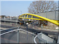
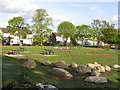
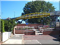
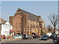
Photos of North Acton Ward
Area Information
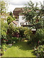
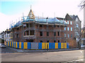
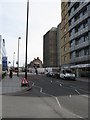
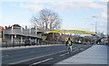
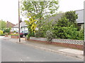
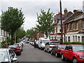
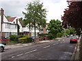
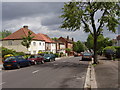
North Acton Ward sits within the London Borough of Ealing, covering an urban district of 4.3 km². The ward holds a population of 4,335, concentrated along the Uxbridge Road and north of the main Acton settlement. This electoral ward has deep historical roots, appearing in the Domesday Book of 1086 and developing its medieval core west of the parish centre. Industrial emergence defined the early 20th century, particularly north of the Mitre Bridge Loop, where factories like Bostwick Gate and Shutter Co. established operations from 1880. The area retains significant heritage, featuring Acton Cemetery which opened in 1895 on former farmland near North Acton Station. The station itself showcases Edwardian architecture as a notable example of Great Western Railway suburban design. Housing stock reflects this mixed heritage, situated between older residential pockets and historic industrial zones. Latin names for local features and the inclusion of the municipal borough history from 1921 to 1965 highlight the ward transition into the London Borough of Ealing in 1965. Daily life here centres around proximity to transport infrastructure and the legacy of manufacturing employment that once saturated the local economy.
- Area Type
- District Borough Unitary Ward
- Area Size
- 4.3 km²
- Population
- 4335
- Population Density
- 1018 people/km²
Demographics
The community profile in North Acton Ward varies, with a median age of 70 standing out as a key demographic statistic. The most common age range recorded in the data is simply listed as "Age: Total". Home ownership sits at 37%, meaning roughly one in three residents own their property outright. This relatively lower ownership rate suggests a population where renting plays a significant role in housing arrangements. The ward accommodates a distinct mix of household compositions and accommodation types, though specific breakdowns for single-person homes or multi-generational living are not detailed in current records. Ethnic diversity and religious affiliation are present within the 4,335 residents, but the provided data does not specify predominant groups or percentages. With a population density of 1,018 people per km² across just 4.3 square kilometres, the area remains distinctly urban. The lack of specific data on broader household composition means the resident picture relies heavily on the high median age and the significant share of renters alongside the 37% of owners.
Household Size
Accommodation Type
Tenure
Ethnic Group
Religion
Household Composition
Age
Household Deprivation
NS-SEC
Explore more demographic insights in this area
Go to Demographics tabPlanning
Planning Constraints
- Flood RiskPremium
- Ramsar Wetland SitesPremium
- Area of Outstanding Natural BeautyPremium
- Protected Nature ReservePremium
- Protected WoodlandPremium
- Crime RiskPremium