Area Overview for New Cross Gate Ward
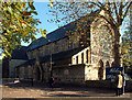
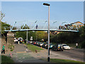
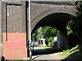
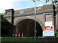
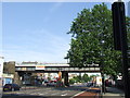
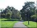
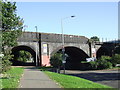
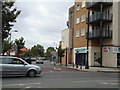
Photos of New Cross Gate Ward
Area Information
New Cross Gate Ward is a compact district within the borough, covering just 1.1 square kilometres. Despite its small footprint, it offers a distinct residential setting. This area represents a specific slice of the local landscape where daily life revolves around proximity. The ward is defined by its tight boundaries and concentrated nature. Residents here experience a neighbourhood character shaped by its size. There is no room for sprawl, which provides a controlled environment for living. The area serves as a defined boundary for those seeking a contained community. The profile of people here matters when assessing suitability for your needs. Understanding the composition of the ward helps you picture your future. The demographic data reveals the type of households that call this location home. This information grounds your understanding of the area's true nature. You will find that New Cross Gate Ward has specific traits that separate it from larger districts. The ward functions as a self-contained unit within the broader borough structure. Every street and block falls within these measurable boundaries. This clarity allows you to evaluate the area with precision. Living in New Cross Gate Ward requires an understanding of its physical constraints and social makeup. The small size influences noise levels and traffic density differently than in larger zones. The ward acts as a functional component of the local housing market. Your experience here will depend heavily on how the land is used within these limits. The defined area ensures that services are concentrated. This concentration can create a sense of place within the borough.
- Area Type
- District Borough Unitary Ward
- Area Size
- 1.1 km²
- Population
- Not available
- Population Density
- Not available
Demographics
The community in New Cross Gate Ward is dominated by older residents. The median age stands at 70 years old. This statistic highlights a significant shift away from young families towards retirement-age households. You are likely to encounter an environment designed for the elderly or owned by them. The most common age bracket reflects this demographic reality entirely. Age: Total indicates the overarching span of the population, yet the median confirms the skew towards senior citizens. Household dynamics in New Cross Gate Ward lean heavily towards renting rather than owning. Only 28% of residents own their homes outright. This low ownership rate suggests a rental market drives the local housing stock. The majority of people here either rent privately or live as tenants. Accommodation types mirror this trend, with a high percentage of occupiers not holding freehold titles. The lack of owner-occupation often correlates with older stock or social housing provisions. Diversity factors are not explicitly detailed with specific ethnic or religious breakdowns in the available records. Religion and predominant ethnic group data remain unlisted. This absence suggests a need for caution in making assumptions about cultural demographics. Household composition totals are recorded but specific split ratios are not provided. You cannot claim precision regarding minority groups or family structures without further investigation. The demographic picture is clear on age and ownership but vague elsewhere. For buyers prioritising specific cultural communities, this ward may lack the data to confirm suitability. The focus remains on the seniority of the population and the rental nature of the homes.
Household Size
Accommodation Type
Tenure
Ethnic Group
Religion
Household Composition
Age
Household Deprivation
NS-SEC
Explore more demographic insights in this area
Go to Demographics tabPlanning
Planning Constraints
- Flood RiskPremium
- Ramsar Wetland SitesPremium
- Area of Outstanding Natural BeautyPremium
- Protected Nature ReservePremium
- Protected WoodlandPremium
- Crime RiskPremium