Area Overview for New Addington North Ward
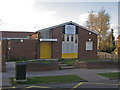
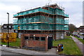
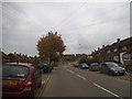
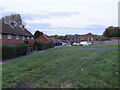
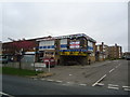
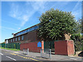
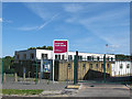
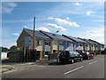
Photos of New Addington North Ward
Area Information
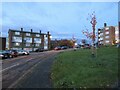
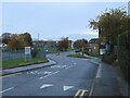
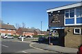
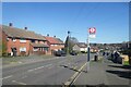
New Addington North Ward is a distinct suburban village located within the London Borough of Croydon. You will find this 1.4 km² district approximately 1,000 metres from the city centre, creating a defined sense of independence from the rest of the borough. The area currently houses 1,808 residents across a landscape that largely remains residential. This ward covers part of the historic New Addington estate, which was originally farmland and woodland before the First National Housing Trust began developing it in the 1930s. The landscape today features council housing estates, local shops, and community facilities that support daily life. Living in New Addington North Ward offers a environment shaped by its origins as a 'Garden Village' started in 1935. Until 1939, developers built 1,023 houses and 23 shops on the Fisher's Farm site before progress halted due to war. Post-war expansion by Croydon Corporation added prefabs, semi-detached homes, and flats, completing 1,412 houses by 1968. You will find a strong local identity supported by a library, leisure centre, and the Addington Community Association. Residents rely on the Fieldway Estate and Central Parade for local amenities. The area feels isolated from central Croydon, yet it retains a sense of community rooted in decades of local development and survival of pre-war and post-war architecture.
- Area Type
- District Borough Unitary Ward
- Area Size
- 1.4 km²
- Population
- 1808
- Population Density
- 1279 people/km²
Demographics
The community in New Addington North Ward displays a clearly defined age profile with a median age of 70. This demographic skew suggests the area attracts older residents who have sought refuge from other parts of London. You will find that home ownership stands at 32%, indicating that the majority of households are tenants rather than owners. This pattern aligns with the ward's history as a council estate developed for workers and later families. The population density reaches 1,279 people per square kilometre, reflecting a compact living arrangement typical of suburban estates. Most common household types and predominant ethnic groups are not detailed in the available records, so specific breakdowns are unavailable. However, the high median age distinguishes New Addington North Ward from more diverse or younger districts in Croydon. With two-thirds of residents living in rented accommodation, the social fabric likely involves a high turnover of tenants or shared renting practices. You should be aware that the older population influences local demand for healthcare and proximity to shops. The lack of young families in the current data suggests limited access to family-sized accommodations or schooling facilities within the immediate 1.4 km² area. Despite this, the strong community feel persists through local associations and reduced need for central integration.
Household Size
Accommodation Type
Tenure
Ethnic Group
Religion
Household Composition
Age
Household Deprivation
NS-SEC
Explore more demographic insights in this area
Go to Demographics tabPlanning
Planning Constraints
- Flood RiskPremium
- Ramsar Wetland SitesPremium
- Area of Outstanding Natural BeautyPremium
- Protected Nature ReservePremium
- Protected WoodlandPremium
- Crime RiskPremium