Area Overview for N9 9YT
Photos of N9 9YT
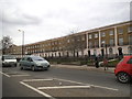
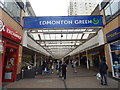

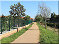
33 photos from this area
Area Information
Key information about the N9 9YT including its size, population, and administrative classification.
- Area Type
- Postcode
- Area Size
- 8604 m²
- Population
- 1227
- Population Density
- 17089 people/km²
House Prices in N9 9YT
42
Properties
£269,333
Average Sold Price
£199,000
Lowest Price
£394,000
Highest Price
Showing 42 properties
| Address | Type | Beds | Baths | Last Sale Price | Last Sale Date | |
|---|---|---|---|---|---|---|
| 40 Bedevere Road, Edmonton, N9 9YT | Terraced | 3 | 1 | £394,000 | Jul 2018 | |
| 36 Bedevere Road, Edmonton, N9 9YT | Terraced | - | - | £215,000 | Mar 2012 | |
| 46 Bedevere Road, Edmonton, N9 9YT | house | - | - | £199,000 | Oct 2006 | |
| 3 Bedevere Road, Edmonton, N9 9YT | Flat | 1 | 1 | - | - | |
| 52 Bedevere Road, Edmonton, N9 9YT | house | - | - | - | - | |
| 54 Bedevere Road, Edmonton, N9 9YT | house | - | - | - | - | |
| 48 Bedevere Road, Edmonton, N9 9YT | house | - | - | - | - | |
| 11 Bedevere Road, Edmonton, N9 9YT | house | - | - | - | - | |
| 5 Bedevere Road, Edmonton, N9 9YT | house | - | - | - | - | |
| 27 Bedevere Road, Edmonton, N9 9YT | house | - | - | - | - |
Page 1 of 5
Energy Efficiency in N9 9YT
Amenities
Schools
| Rank | School | Type | Entry gender | Ages |
|---|
Explore more schools in this area
Go to Schools tabDemographics
Household Size
Family (3-5 people)
most common
Accommodation Type
Flats
most common
Tenure
19
majority
Ethnic Group
black_total
most common
Religion
N/A
most common
Household Composition
N/A
most common
Age
47
median
Adults (30-64 years)
most common
Household Deprivation
N/A
with no deprivation
NS-SEC
21
in Lower managerial occupations
Explore more demographic insights in this area
Go to Demographics tabPlanning
Planning Constraints
- Flood RiskPremium
- Ramsar Wetland SitesPremium
- Area of Outstanding Natural BeautyPremium
- Protected Nature ReservePremium
- Protected WoodlandPremium