Area Overview for N9 0XT
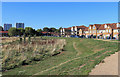
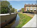
Photos of N9 0XT


Area Information
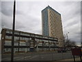
Living in N9 0XT means being part of a small, tightly knit residential cluster in north London. With a population of 1,538, the area is compact but well-served by transport links and local amenities. The community here is predominantly adults aged 30–64, reflecting a mature demographic with established lifestyles. Daily life is shaped by proximity to retail hubs like Iceland Edmonton and Asda Edmonton, as well as frequent rail and metro services. The area’s housing stock is largely composed of homes, though home ownership is relatively low at 27%, suggesting a mix of rental properties and private residences. N9 0XT is not defined by natural landscapes or protected sites, but its practical connectivity and modest size make it a functional base for commuters and families. The absence of flood risk or environmental constraints adds to its appeal, while the low crime score of 68/100 reinforces a sense of security. For those seeking a quiet yet accessible corner of London, this postcode offers a straightforward, no-frills living experience.
- Area Type
- Postcode
- Area Size
- Not available
- Population
- 1538
- Population Density
- 11113 people/km²
The property market in N9 0XT is characterised by a low home ownership rate of 27%, suggesting that the area is more rental-focused than owner-occupied. The accommodation type is predominantly houses, though the small population and limited data make it difficult to assess the balance between single-family homes and other formats. This small postcode cluster likely contains a limited number of properties, which could mean competition for buyers or renters in the immediate surrounding areas. The low home ownership rate may reflect broader trends in north London, where rental demand often outstrips supply. For buyers, this suggests that properties in N9 0XT may be more available to investors or those seeking long-term leases, though the exact market dynamics would require local insights beyond the provided data.
House Prices in N9 0XT
No properties found in this postcode.
Energy Efficiency in N9 0XT
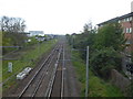
Residents of N9 0XT have access to a range of local amenities within walking or short transit distance. Retail options include Iceland Edmonton, Lidl Lower, and Asda Edmonton, providing everyday shopping needs. The area’s proximity to rail and metro stations—such as Edmonton Green, Wood Green, and Turnpike Lane—ensures easy access to broader urban amenities. While no specific parks or leisure facilities are listed in the data, the absence of protected natural sites suggests a focus on practical infrastructure over green spaces. The presence of multiple transport hubs and retail outlets indicates a functional, convenience-driven lifestyle, ideal for those prioritising accessibility over expansive recreational areas. The area’s character is defined by its straightforward, service-oriented approach to daily living.
Amenities
Schools
| Rank | School | Type | Entry gender | Ages |
|---|
Explore more schools in this area
Go to Schools tabDemographics
The population of N9 0XT is 1,538, with a median age of 47. The most common age range is adults between 30 and 64, indicating a community of working-age individuals and families. Home ownership here is low at 27%, suggesting that many residents rent their homes. The predominant accommodation type is houses, though the small population and limited data mean the exact distribution of household types remains unclear. The area’s predominant ethnic group is Black_total, reflecting a specific demographic profile. While no deprivation data is provided, the low crime score and lack of environmental constraints imply a stable living environment. However, the relatively high proportion of renters and the absence of detailed socioeconomic breakdowns mean that the area’s affordability and quality of life depend on broader regional factors.
Household Size
Accommodation Type
Tenure
Ethnic Group
Religion
Household Composition
Age
Household Deprivation
NS-SEC
Explore more demographic insights in this area
Go to Demographics tabPlanning
Planning Constraints
- Flood RiskPremium
- Ramsar Wetland SitesPremium
- Area of Outstanding Natural BeautyPremium
- Protected Nature ReservePremium
- Protected WoodlandPremium