Area Overview for N9 0HN
Photos of N9 0HN


Area Information
N9 0HN is a small, tightly knit residential postcode area in England, home to 2,148 people. It is a compact cluster of properties, likely centred around local amenities and transport links. The area’s demographic profile suggests a mature community, with a median age of 47 and the majority of residents falling within the 30-64 age range. This implies a stable population with established routines, potentially including families and professionals. Daily life here is likely shaped by proximity to retail, rail, and metro stations, which are all within practical reach. The area’s small size means it is not a sprawling suburb but a focused neighbourhood, possibly with a quiet, residential character. While it lacks large-scale infrastructure, its connectivity to nearby towns via rail and bus services makes it a viable option for commuters. The presence of multiple supermarkets and shops nearby suggests convenience for everyday needs, though the area’s distinctiveness lies in its balance of accessibility and compactness. For buyers, this could mean a manageable, low-maintenance living environment with a clear sense of community.
- Area Type
- Postcode
- Area Size
- Not available
- Population
- 2148
- Population Density
- 11900 people/km²
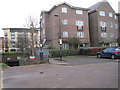
N9 0HN’s property market is characterised by a low home ownership rate of 28%, which suggests a higher reliance on rental properties compared to owner-occupied homes. The accommodation type is primarily houses, indicating a lack of high-rise or apartment blocks. This likely means the area is not densely populated but rather a collection of standalone homes, possibly in semi-detached or terraced arrangements. For buyers, this could imply a market where properties are fewer in number but potentially larger in size. The low home ownership percentage might also reflect affordability challenges, with fewer long-term residents committing to property purchase. However, the presence of multiple retail and transport hubs nearby could make the area appealing to commuters or those seeking a quieter residential base. The small size of the postcode means the immediate surroundings may hold more variety in property options, though buyers should consider the limited scale of the area itself.
House Prices in N9 0HN
No properties found in this postcode.
Energy Efficiency in N9 0HN
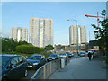
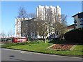
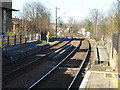
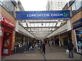
Living in N9 0HN offers access to a range of retail and transport amenities within close proximity. The area is served by five retail outlets, including Iceland Edmonton, Lidl Lower, and Asda Edmonton, providing everyday shopping options. Nearby rail stations such as Edmonton Green Station and Angel Road Railway Station, along with metro stops like Wood Green Station, ensure convenient travel for work or leisure. The presence of a bus interchange at Whipps Cross further enhances mobility. While the area lacks large parks or cultural landmarks, its practical amenities support a functional lifestyle. The retail options cater to daily needs, and the transport links connect residents to broader networks. The character of the area is defined by its accessibility and the ease of navigating between local services. For those prioritising convenience over sprawling green spaces, N9 0HN offers a compact, well-served environment.
Amenities
Schools
| Rank | School | Type | Entry gender | Ages |
|---|
Explore more schools in this area
Go to Schools tabDemographics
The population of N9 0HN is 2,148, with a median age of 47. This indicates a community skewed towards adults, particularly those aged 30-64, who make up the most common age range. Home ownership here is relatively low at 28%, suggesting a higher proportion of renters compared to owner-occupied properties. The predominant accommodation type is houses, which may reflect a mix of family homes and smaller dwellings. The area’s ethnic composition is predominantly White, though no further breakdown is provided. The absence of specific data on diversity or deprivation means the area’s social dynamics remain less defined. However, the age profile and home ownership rate imply a community that may include professionals, retirees, or those in semi-retirement. The relatively low home ownership percentage could indicate a transient population or a market influenced by rental demand. For residents, this balance of age groups and property types may foster a stable but not overly diverse social environment.
Household Size
Accommodation Type
Tenure
Ethnic Group
Religion
Household Composition
Age
Household Deprivation
NS-SEC
Explore more demographic insights in this area
Go to Demographics tabPlanning
Planning Constraints
- Flood RiskPremium
- Ramsar Wetland SitesPremium
- Area of Outstanding Natural BeautyPremium
- Protected Nature ReservePremium
- Protected WoodlandPremium