Area Overview for N8 7RH
Photos of N8 7RH

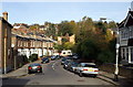
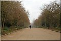
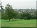
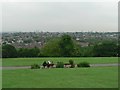
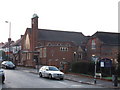
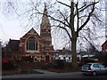
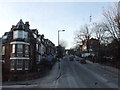
100 photos from this area
Area Information
Key information about the N8 7RH including its size, population, and administrative classification.
- Area Type
- Postcode
- Area Size
- 5738 m²
- Population
- 1361
- Population Density
- 11257 people/km²
House Prices in N8 7RH
25
Properties
£842,150
Average Sold Price
£125,750
Lowest Price
£1,390,000
Highest Price
Showing 25 properties
| Address | Type | Beds | Baths | Last Sale Price | Last Sale Date | |
|---|---|---|---|---|---|---|
| 30 Clovelly Road, Hornsey, London, N8 7RH | Terraced | 4 | 2 | £1,379,000 | Mar 2025 | |
| 4 Clovelly Road, Hornsey, London, N8 7RH | Terraced | 4 | 2 | £1,390,000 | Apr 2024 | |
| 8 Clovelly Road, Hornsey, London, N8 7RH | Terraced | 4 | 2 | £1,245,000 | Jan 2024 | |
| 26 Clovelly Road, Hornsey, London, N8 7RH | Terraced | 4 | 2 | £1,285,000 | Sep 2023 | |
| 42 Clovelly Road, Hornsey, London, N8 7RH | Terraced | 3 | - | £1,150,000 | Feb 2022 | |
| 24 Clovelly Road, Hornsey, London, N8 7RH | house | - | - | £1,350,000 | Oct 2021 | |
| 46 Clovelly Road, Hornsey, London, N8 7RH | house | - | - | £1,225,000 | Mar 2021 | |
| 38 Clovelly Road, Hornsey, London, N8 7RH | Terraced | 4 | 2 | £1,020,000 | Mar 2020 | |
| 14 Clovelly Road, Hornsey, London, N8 7RH | Terraced | 3 | 2 | £928,000 | Oct 2015 | |
| 18 Clovelly Road, Hornsey, London, N8 7RH | house | 4 | - | £1,025,000 | Jan 2015 |
Page 1 of 3
Energy Efficiency in N8 7RH
Amenities
Schools
| Rank | School | Type | Entry gender | Ages |
|---|
Explore more schools in this area
Go to Schools tabDemographics
Household Size
Family (3-5 people)
most common
Accommodation Type
Flats
most common
Tenure
66
majority
Ethnic Group
White
most common
Religion
N/A
most common
Household Composition
N/A
most common
Age
47
median
Adults (30-64 years)
most common
Household Deprivation
N/A
with no deprivation
NS-SEC
62
in Lower managerial occupations
Explore more demographic insights in this area
Go to Demographics tabPlanning
Planning Constraints
- Flood RiskPremium
- Ramsar Wetland SitesPremium
- Area of Outstanding Natural BeautyPremium
- Protected Nature ReservePremium
- Protected WoodlandPremium