Area Overview for N8 7JA
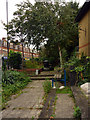
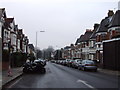
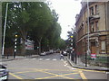
Photos of N8 7JA


Area Information
N8 7JA is a small, densely populated residential cluster in north London, covering just 667 square metres and home to 1,425 residents. Despite its compact size, the area is well-connected to transport networks and retail hubs, making it a practical choice for those prioritising convenience. The community here skews towards adults aged 30–64, with a median age of 47, suggesting a mix of established professionals and families. Daily life is shaped by proximity to major retail outlets like Asda Crouch, Tesco Hornsey, and Sainsburys Hornsey, as well as frequent rail, metro, and ferry services. While the area lacks natural beauty designations, its high population density means it is a hub of activity, though not without its challenges. The moderate crime risk and strong digital connectivity underscore a balance between urban practicality and modern living demands. For buyers, N8 7JA offers a compact, accessible environment with a clear focus on connectivity and local amenities.
- Area Type
- Postcode
- Area Size
- 667 m²
- Population
- 1425
- Population Density
- 11787 people/km²
The property market in N8 7JA is defined by a low home ownership rate of 37%, suggesting that rental properties dominate the housing stock. The area is primarily composed of houses, which may appeal to those seeking more space in a compact setting. However, the high population density means that these properties are likely to be smaller or multi-occupancy units. For buyers, this presents a challenge: with limited owner-occupied homes, competition for available properties may be fierce. The proximity to major transport routes like Hornsey Station and Turnpike Lane Metro Station could make the area attractive to commuters, though the small size of the postcode means that buyers must consider nearby areas for more options. The predominance of houses over flats or apartments may also influence local property values, with a focus on practicality rather than luxury.
House Prices in N8 7JA
Showing 1 properties
| Address | Type | Beds | Baths | Last Sale Price | Last Sale Date | |
|---|---|---|---|---|---|---|
| 1 Lightfoot Road, Hornsey, London, N8 7JA | Terraced | - | - | - | - |
Energy Efficiency in N8 7JA
Living in N8 7JA grants access to a range of retail and transport hubs within walking distance. Major supermarkets like Asda Crouch, Tesco Hornsey, and Sainsburys Hornsey provide everyday shopping convenience, while rail stations such as Hornsey and Harringay offer direct links to London’s transport network. The nearby metro stations at Turnpike Lane and Wood Green further expand connectivity, making it easy to reach nearby suburbs. For leisure, ferry stops like Camden Lock Waterbus and Little Venice Waterbus Stop provide scenic travel options. The area’s compact size means that amenities are closely clustered, reducing the need for long commutes. This proximity to shops, transport, and water-based routes creates a dynamic lifestyle, blending practicality with urban accessibility.
Amenities
Schools
| Rank | School | Type | Entry gender | Ages |
|---|
Explore more schools in this area
Go to Schools tabDemographics
The population of N8 7JA is predominantly adults aged 30–64, with a median age of 47. This suggests a community of working-age individuals, likely balancing careers with family life. Home ownership is relatively low at 37%, indicating that a majority of residents are renters, which may influence the local housing market dynamics. The area is characterised by houses as the primary accommodation type, though the high population density of 2.1 million people per square kilometre implies that properties are closely packed. The predominant ethnic group is White, with no data provided on other demographics. This demographic profile shapes a community that is stable but not diverse in terms of ethnicity. The absence of specific data on deprivation means that quality of life factors such as access to services and infrastructure must be inferred from the available amenities and connectivity scores.
Household Size
Accommodation Type
Tenure
Ethnic Group
Religion
Household Composition
Age
Household Deprivation
NS-SEC
Explore more demographic insights in this area
Go to Demographics tabPlanning
Planning Constraints
- Flood RiskPremium
- Ramsar Wetland SitesPremium
- Area of Outstanding Natural BeautyPremium
- Protected Nature ReservePremium
- Protected WoodlandPremium