Area Overview for N8 7FY
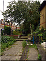
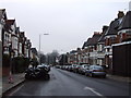
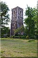
Photos of N8 7FY


Area Information
Living in N8 7FY means inhabiting a densely populated, small residential cluster in north London. The area covers just 2640 square metres, yet it accommodates 1369 residents, resulting in a population density of over 518,000 people per square kilometre. This compact postcode is defined by its proximity to transport hubs and retail amenities, making it a practical choice for those prioritising connectivity. The community here is largely composed of adults aged 30–64, reflecting a mature demographic. Daily life is shaped by the availability of nearby shops, including Sainsburys Hornsey and Tesco Hornsey, and multiple rail and metro stations. While the area’s size is limited, its strategic location offers access to broader London networks. For buyers, N8 7FY presents a niche opportunity in a high-density urban setting, though its small footprint means properties are closely spaced. The area’s character is defined by its balance of residential living and commuter convenience, with a focus on accessibility over expansive green spaces.
- Area Type
- Postcode
- Area Size
- 2640 m²
- Population
- 1369
- Population Density
- 18013 people/km²
The property market in N8 7FY is characterised by a low home ownership rate of 35%, indicating that the area functions more as a rental market than an owner-occupied one. The predominant accommodation type is flats, which aligns with the high population density and compact nature of the postcode. This suggests that properties are designed for efficiency rather than spaciousness, catering to those who prioritise location over living space. For buyers, the small area size and limited housing stock mean that opportunities are constrained to a narrow geographic footprint. The focus on flats may appeal to investors or first-time buyers seeking affordable urban housing, though the low ownership rate implies competition for available properties. The immediate surroundings, while not extensively detailed, likely offer similar housing typologies, reinforcing the area’s role as a secondary residential zone within London’s transport network.
House Prices in N8 7FY
Showing 6 properties
Energy Efficiency in N8 7FY
Residents of N8 7FY enjoy a range of amenities within close proximity, enhancing daily life. Retail options include Sainsburys Hornsey, Tesco Hornsey, and Iceland Wood, providing essential shopping needs. The area’s transport network is extensive, with rail services at Hornsey and Alexandra Palace stations, and metro stops at Turnpike Lane and Wood Green. Ferry access points like Camden Lock Waterbus and London Zoo Waterbus Stop add to the connectivity, though their practicality depends on specific travel needs. While the data does not mention parks or leisure facilities, the presence of stations like Harringay and Bounds Green suggests nearby recreational opportunities. The combination of retail, transport, and commuter links creates a convenient lifestyle, ideal for those seeking a compact, service-rich environment. The area’s density ensures that amenities are never far, though it may lack expansive open spaces.
Amenities
Schools
| Rank | School | Type | Entry gender | Ages |
|---|
Explore more schools in this area
Go to Schools tabDemographics
The community in N8 7FY is predominantly middle-aged, with a median age of 47 and the majority of residents falling within the 30–64 age range. Home ownership here is relatively low, at 35%, suggesting that a significant portion of the population rents. The accommodation type is almost exclusively flats, reflecting a housing stock suited to urban living rather than detached homes. The predominant ethnic group is White, though specific data on diversity is not provided. The area’s population density, at 518,585 people per square kilometre, indicates a tightly packed urban environment, which may influence the pace of daily life and the availability of private space. This demographic profile suggests a community focused on convenience and proximity to services, with a mature population likely prioritising stability and accessibility over expansion.
Household Size
Accommodation Type
Tenure
Ethnic Group
Religion
Household Composition
Age
Household Deprivation
NS-SEC
Explore more demographic insights in this area
Go to Demographics tabPlanning
Planning Constraints
- Flood RiskPremium
- Ramsar Wetland SitesPremium
- Area of Outstanding Natural BeautyPremium
- Protected Nature ReservePremium
- Protected WoodlandPremium