Area Overview for N8 7EL
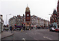
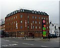
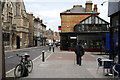
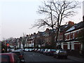
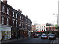
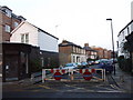
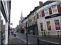
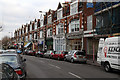
Photos of N8 7EL


Area Information
Living in N8 7EL means inhabiting a tightly packed residential cluster in north London, where 1,913 people reside across 6,973 square metres. This small postcode area is characterised by a high population density of 274,344 people per square kilometre, reflecting a compact, urbanised environment. The area’s proximity to Hornsey School for Girls and multiple transport hubs positions it as a practical choice for families and commuters. Daily life here is shaped by its density, with residents navigating a mix of retail, rail, and metro services within walking distance. The predominantly flat-based housing stock, combined with a median age of 47, suggests a community of established adults, many of whom are likely to be renters. N8 7EL’s blend of convenience and accessibility makes it a viable option for those prioritising connectivity over expansive living space.
- Area Type
- Postcode
- Area Size
- 6973 m²
- Population
- 1913
- Population Density
- 11320 people/km²
N8 7EL’s property market is largely rental-focused, with only 39% of homes owned by residents. The area’s housing stock is dominated by flats, reflecting its urban character and limited space. This makes it a niche market for buyers, as the small area size and flat-centric supply may limit options for those seeking larger properties or detached homes. The high population density and proximity to transport links suggest a demand from commuters or those prioritising convenience over space. Buyers should consider the competitive rental market and the likelihood of limited new developments in such a tightly packed postcode.
House Prices in N8 7EL
Showing 36 properties
| Address | Type | Beds | Baths | Last Sale Price | Last Sale Date | |
|---|---|---|---|---|---|---|
| 126A Tottenham Lane, Hornsey, London, N8 7EL | Flat | 3 | 2 | £124,000 | Jul 1999 | |
| Flat 1, 124 Tottenham Lane, Hornsey, London, N8 7EL | Flat | - | - | - | - | |
| Flat 5, 104 Tottenham Lane, Hornsey, London, N8 7EL | Flat | - | 1 | - | - | |
| Flat A, 120 Tottenham Lane, Hornsey, London, N8 7EL | Flat | - | - | - | - | |
| Flat 1, 102 Tottenham Lane, Hornsey, London, N8 7EL | Flat | - | - | - | - | |
| Flat 4, 102 Tottenham Lane, Hornsey, London, N8 7EL | Flat | - | - | - | - | |
| Flat 2, 104 Tottenham Lane, Hornsey, London, N8 7EL | Flat | - | - | - | - | |
| Flat 2, 102 Tottenham Lane, Hornsey, London, N8 7EL | Flat | - | - | - | - | |
| Flat 3, 104 Tottenham Lane, Hornsey, London, N8 7EL | Flat | - | - | - | - | |
| Flat 6, 102 Tottenham Lane, Hornsey, London, N8 7EL | Flat | - | - | - | - |
Energy Efficiency in N8 7EL
Residents of N8 7EL have access to a range of amenities within practical reach. Retail options include Asda Crouch, Tesco Hornsey, and Sainsburys Hornsey, providing daily shopping convenience. The area’s transport links connect to multiple rail, metro, and ferry services, facilitating easy travel to nearby hubs. While the data does not specify parks or leisure facilities, the proximity to London Zoo Waterbus Stop hints at recreational opportunities. The compact layout ensures that essential services are close, though the lack of detailed information on green spaces or dining options leaves some aspects of lifestyle unexplored.
Amenities
Schools
The nearest school to N8 7EL is Hornsey School for Girls, a primary school with an Ofsted rating of ‘good’. This institution serves the local community, offering education for younger children. The absence of secondary schools in the immediate area means families may need to look further afield for secondary education options. However, the presence of a well-rated primary school is a positive factor for parents prioritising early education quality. The single school listed underscores the need for careful planning for older children, though the area’s transport links may ease access to broader educational facilities.
| Rank | School | Type | Entry gender | Ages |
|---|
Explore more schools in this area
Go to Schools tabDemographics
The community in N8 7EL is predominantly composed of adults aged 30–64, with a median age of 47. Only 39% of residents own their homes, indicating a rental-heavy market, while flats are the primary accommodation type. The majority of the population identifies as White, though specific data on other ethnic groups is not provided. With a population density of 274,344 people per square kilometre, the area is highly compact, which may influence local dynamics and resource availability. The relatively high proportion of working-age adults suggests a mature, stable community, though the absence of detailed diversity statistics limits a fuller picture of social composition.
Household Size
Accommodation Type
Tenure
Ethnic Group
Religion
Household Composition
Age
Household Deprivation
NS-SEC
Explore more demographic insights in this area
Go to Demographics tabPlanning
Planning Constraints
- Flood RiskPremium
- Ramsar Wetland SitesPremium
- Area of Outstanding Natural BeautyPremium
- Protected Nature ReservePremium
- Protected WoodlandPremium