Area Overview for N8 7EA
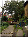
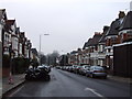
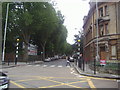
Photos of N8 7EA


Area Information
Living in N8 7EA means inhabiting a compact, densely populated residential cluster in north London. The area covers just 1325 m² yet accommodates 1734 residents, resulting in a population density of 1,308,498 people per km². This high density suggests a tightly knit community with limited open space, typical of urban postcode areas. The area’s small size means residents are likely to live close to local amenities, schools, and transport links. Daily life here is shaped by proximity to multiple rail and metro stations, including Hornsey, Harringay, and Turnpike Lane, which connect to central London and beyond. The mix of retail outlets, such as Sainsburys Hornsey and Asda Crouch, ensures basic shopping needs are met within walking distance. While the area lacks expansive parks or green spaces, its compact nature makes it convenient for those prioritising accessibility over sprawling landscapes. N8 7EA’s character is defined by its density, its blend of residential and transport infrastructure, and its position as a node in north London’s suburban network.
- Area Type
- Postcode
- Area Size
- 1325 m²
- Population
- 1734
- Population Density
- 10212 people/km²
The property market in N8 7EA is characterised by a high proportion of rental properties, with only 37% of homes owned by residents. This suggests the area functions more as a rental market than an owner-occupied one, which may appeal to those seeking short-term or flexible housing solutions. The accommodation type is predominantly flats, reflecting the area’s compact size and the typical housing stock in densely populated urban zones. For buyers, this means the available housing stock is limited to apartments rather than detached or semi-detached homes. The small area size also means the immediate surroundings offer few alternative properties, making competition for available homes likely. Prospective buyers should consider whether the flat-based market aligns with their long-term housing needs, particularly if they prefer larger or more private properties. The high population density further underscores the importance of proximity to transport and amenities in this area.
House Prices in N8 7EA
Showing 3 properties
| Address | Type | Beds | Baths | Last Sale Price | Last Sale Date | |
|---|---|---|---|---|---|---|
| 42 Tottenham Lane, Hornsey, London, N8 7EA | retail_financial | - | - | - | - | |
| 40 Tottenham Lane, Hornsey, London, N8 7EA | office_workshop | - | - | - | - | |
| Flat At Rear, 40 Tottenham Lane, Hornsey, London, N8 7EA | Flat | - | - | - | - |
Energy Efficiency in N8 7EA
Residents of N8 7EA benefit from a variety of nearby amenities that cater to daily needs. Retail options include Sainsburys Hornsey, Tesco Hornsey, and Asda Crouch, ensuring access to groceries and household essentials. The area’s proximity to multiple rail and metro stations, such as Turnpike Lane and Wood Green, enhances mobility, while ferry services like Camden Lock Waterbus and London Zoo Waterbus Stop provide alternative routes for those near the Thames. Although the data does not specify parks or leisure facilities, the presence of multiple transport hubs and retail outlets suggests a focus on convenience over expansive recreational spaces. The compact nature of the area means amenities are closely clustered, reducing travel time for errands and social activities. This density supports a lifestyle prioritising accessibility, though residents may need to travel further for larger green spaces or cultural attractions.
Amenities
Schools
Residents of N8 7EA have access to a range of schools, including St Mary’s CofE Primary School, which holds a ‘good’ Ofsted rating, and St David and St Katharine CofE Secondary School, which serves the local secondary education needs. The North London Rudolf Steiner School offers an independent alternative, while Greig City Academy, an academy with a ‘good’ Ofsted rating, provides another option. This mix of state and independent schools allows families to choose between traditional public education and alternative curricula. The presence of both primary and secondary schools within the area ensures continuity for children’s education, reducing the need for long commutes. The ‘good’ ratings for St Mary’s and Greig City Academy indicate that at least some local schools meet or exceed national standards, which is a key consideration for families prioritising quality education.
| Rank | School | Type | Entry gender | Ages |
|---|
Explore more schools in this area
Go to Schools tabDemographics
The community in N8 7EA is predominantly composed of adults aged 30–64, with a median age of 47. This suggests a mature population, likely with established careers and families. Home ownership is relatively low at 37%, indicating a rental market that dominates the area. The accommodation type is primarily flats, reflecting the high population density and the typical housing stock in urban postcode areas. The predominant ethnic group is White, though specific data on diversity beyond this is not provided. The population density of 1,308,498 people per km² implies a highly compact living environment, which can influence social dynamics and access to shared resources. While no deprivation data is available, the high density and focus on rental properties may suggest a mix of socioeconomic backgrounds, with some residents potentially facing higher living costs or limited housing choice.
Household Size
Accommodation Type
Tenure
Ethnic Group
Religion
Household Composition
Age
Household Deprivation
NS-SEC
Explore more demographic insights in this area
Go to Demographics tabPlanning
Planning Constraints
- Flood RiskPremium
- Ramsar Wetland SitesPremium
- Area of Outstanding Natural BeautyPremium
- Protected Nature ReservePremium
- Protected WoodlandPremium