Area Overview for N8 7BY
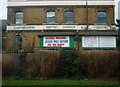
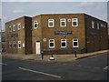
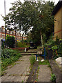
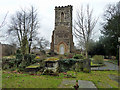
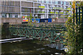
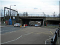
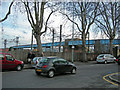
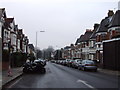
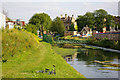
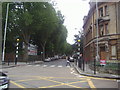
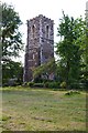
Photos of N8 7BY

Area Information
Living in N8 7BY means inhabiting a compact, densely populated residential cluster in north London. The area covers just 3,315 square metres, yet it accommodates 1,734 residents, resulting in a population density of 523,075 people per square kilometre. This reflects a tightly knit community where proximity to amenities and transport is a defining feature. The postcode lies within a strategic location, offering access to major rail, metro, and bus networks, as well as a range of schools and retail hubs. Daily life here is shaped by the balance between urban convenience and the relative quiet of a small residential area. While the population is predominantly adults aged 30–64, the area’s mix of flats and rental properties suggests a dynamic mix of long-term residents and those seeking affordable housing. For buyers, N8 7BY represents a microcosm of London’s housing diversity, where limited space is offset by strong connectivity and a well-established infrastructure.
- Area Type
- Postcode
- Area Size
- 3315 m²
- Population
- 1734
- Population Density
- 10212 people/km²
The property market in N8 7BY is characterised by a high proportion of rental properties, with only 37% of homes owned by residents. This suggests a strong tenant-driven market, likely influenced by the area’s compact size and limited housing stock. The predominant accommodation type is flats, which aligns with the need for space-efficient living in a densely populated area. For buyers, this means a limited pool of owner-occupied properties, potentially making the market competitive. The small area size also means that property values may be influenced by proximity to transport links and amenities rather than standalone features. Prospective buyers should consider the area’s rental dynamics and the likelihood of long-term availability of flats, as well as the need for proximity to services given the lack of expansive housing options.
House Prices in N8 7BY
Showing 16 properties
| Address | Type | Beds | Baths | Last Sale Price | Last Sale Date | |
|---|---|---|---|---|---|---|
| 4 Temple Road, Hornsey, London, N8 7BY | Terraced | 5 | 2 | £590,000 | Feb 2011 | |
| Flat 2, 2 Temple Road, Hornsey, London, N8 7BY | Flat | 2 | 1 | - | - | |
| Flat A, 5 Temple Road, Hornsey, London, N8 7BY | Flat | - | - | - | - | |
| Flat A, 6 Temple Road, Hornsey, London, N8 7BY | Flat | - | - | - | - | |
| Flat 1, 2 Temple Road, Hornsey, London, N8 7BY | Flat | - | - | - | - | |
| Flat 3, 1 Temple Road, Hornsey, London, N8 7BY | Flat | - | - | - | - | |
| Flat C, 6 Temple Road, Hornsey, London, N8 7BY | Flat | - | - | - | - | |
| Flat 4, 1 Temple Road, Hornsey, London, N8 7BY | Flat | - | - | - | - | |
| Flat 1, 3 Temple Road, Hornsey, London, N8 7BY | Flat | 2 | 1 | - | - | |
| Flat B, 5 Temple Road, Hornsey, London, N8 7BY | Flat | - | - | - | - |
Energy Efficiency in N8 7BY
Residents of N8 7BY enjoy a range of nearby amenities that cater to daily needs and leisure. Retail options include major supermarkets such as Sainsburys Hornsey, Tesco Hornsey, and Asda Crouch, ensuring easy access to groceries and household essentials. The area’s transport hubs, including Hornsey Station and Turnpike Lane Metro, provide seamless links to London’s broader network, facilitating both work and social activities. For leisure, ferry services like the London Zoo Waterbus Stop offer scenic travel options, while the proximity to Alexandra Palace Station suggests access to cultural and recreational spaces. The combination of retail, transport, and leisure facilities creates a convenient lifestyle, where residents can balance practicality with urban amenities. The density of services reflects a community designed for efficiency, though the small area size means amenities are tightly clustered.
Amenities
Schools
Residents of N8 7BY have access to a mix of state and independent schools. St Mary’s CofE Primary School and Greig City Academy, both rated ‘good’ by Ofsted, offer state education options, while St David and St Katharine CofE Secondary School provides secondary-level state schooling. The North London Rudolf Steiner School is an independent institution, offering an alternative educational approach. This diversity of school types allows families to choose between traditional state education, academies, and independent institutions. The presence of multiple schools within practical reach ensures that children have options for both primary and secondary education. For parents, the combination of ‘good’ rated state schools and independent alternatives provides flexibility, though the proximity of these institutions may influence property desirability in the area.
| Rank | School | Type | Entry gender | Ages |
|---|
Explore more schools in this area
Go to Schools tabDemographics
The community in N8 7BY is largely composed of adults aged 30–64, with a median age of 47. This suggests a mature population, likely with established careers and families. Home ownership is relatively low at 37%, indicating that a majority of residents rent their properties. The accommodation type is predominantly flats, reflecting a housing stock tailored to urban living. The predominant ethnic group is White, though no data is provided on other groups. The age profile and home ownership rate imply a stable but not rapidly growing population. For quality of life, the density of services and transport options may compensate for lower home ownership, offering convenience for daily needs. However, the lack of diversity data means the community’s full demographic picture remains incomplete.
Household Size
Accommodation Type
Tenure
Ethnic Group
Religion
Household Composition
Age
Household Deprivation
NS-SEC
Explore more demographic insights in this area
Go to Demographics tabPlanning
Planning Constraints
- Flood RiskPremium
- Ramsar Wetland SitesPremium
- Area of Outstanding Natural BeautyPremium
- Protected Nature ReservePremium
- Protected WoodlandPremium