Area Overview for N8 7AJ
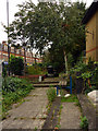
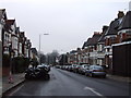
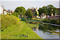
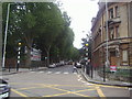
Photos of N8 7AJ


Area Information
N8 7AJ is a compact residential postcode in north London, covering just 2,291 square metres and home to 1,375 residents. Its high population density of 600,303 people per square kilometre reflects a tightly knit community, with homes clustered closely together. The area is strategically positioned near transport hubs and amenities, making it accessible for commuters and families alike. Daily life here is shaped by its proximity to Hornsey’s retail and transport networks, while the surrounding green spaces and local schools cater to residents’ needs. With a median age of 47 and a majority of adults aged 30–64, the community is mature and stable. The area’s small size means it is best suited for those prioritising convenience over expansive living spaces, with homes primarily in traditional house formats. N8 7AJ balances urban connectivity with a sense of local identity, offering a snapshot of London’s residential diversity within a manageable footprint.
- Area Type
- Postcode
- Area Size
- 2291 m²
- Population
- 1375
- Population Density
- 11317 people/km²
The property market in N8 7AJ is characterised by a 52% home ownership rate, with houses forming the predominant accommodation type. This indicates a balance between owner-occupied homes and rental properties, though the exact proportion of rentals is not specified. Given the area’s small size, the housing stock is limited, and buyers should consider the scarcity of available properties. The focus on houses rather than flats or apartments suggests a preference for traditional, family-friendly living spaces. However, the compact nature of N8 7AJ means that properties are likely to be smaller compared to larger suburban areas. For buyers, this small postcode area offers a niche market, potentially with higher demand from those seeking proximity to Hornsey’s amenities. The limited availability may also drive competition, requiring swift decision-making for those interested in purchasing.
House Prices in N8 7AJ
Showing 35 properties
Energy Efficiency in N8 7AJ
Living in N8 7AJ offers access to a range of amenities within practical reach. Retail options include Sainsburys Hornsey, Tesco Hornsey, and Iceland Wood, providing everyday shopping convenience. The area’s transport links connect residents to leisure spots like London Zoo via waterbus stops at Camden Lock and Little Venice. Rail and metro stations such as Hornsey, Bowes Park, and Bounds Green facilitate quick travel to cultural and commercial centres. The presence of multiple ferry stops adds to the area’s accessibility, particularly for those near waterways. These amenities contribute to a dynamic lifestyle, blending urban convenience with recreational opportunities. The compact nature of N8 7AJ ensures that essential services are never far, supporting a lifestyle that prioritises ease of access over expansive spaces.
Amenities
Schools
N8 7AJ is served by two primary schools: Campsbourne Junior School and Campsbourne Infant School. Both are rated 'good' by Ofsted, offering a reliable educational foundation for young children. The presence of two primary schools in close proximity ensures that families have options for early education without long commutes. While no secondary schools are listed in the data, the primary schools’ quality ratings suggest a focus on foundational learning. This makes the area appealing to parents seeking a stable start for their children’s education. The schools’ 'good' ratings indicate that they meet or exceed national standards in teaching and facilities, though specific details about curriculum or extracurriculars are not provided. For families, the availability of two primary schools within the area reduces the need for additional travel, enhancing convenience.
| Rank | School | Type | Entry gender | Ages |
|---|
Explore more schools in this area
Go to Schools tabDemographics
The population of N8 7AJ is predominantly adults aged 30–64, with a median age of 47. This suggests a community of established professionals and families, rather than younger or elderly demographics. Home ownership sits at 52%, indicating a mix of owner-occupied properties and rentals. The area’s accommodation is primarily houses, which aligns with its compact size and traditional housing stock. The predominant ethnic group is White, though no specific diversity metrics are provided. The high population density of 600,303 people per square kilometre implies a closely packed living environment, which may influence social dynamics and local services. For residents, this density ensures proximity to amenities but may also mean limited private outdoor space. The age profile and home ownership rate suggest a stable, long-term community with a focus on family-oriented living.
Household Size
Accommodation Type
Tenure
Ethnic Group
Religion
Household Composition
Age
Household Deprivation
NS-SEC
Explore more demographic insights in this area
Go to Demographics tabPlanning
Planning Constraints
- Flood RiskPremium
- Ramsar Wetland SitesPremium
- Area of Outstanding Natural BeautyPremium
- Protected Nature ReservePremium
- Protected WoodlandPremium