Area Overview for N8 7AF
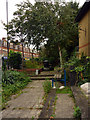
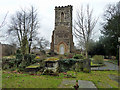
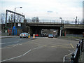
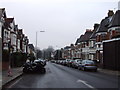
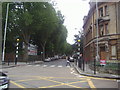
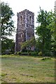
Photos of N8 7AF


Area Information
Living in N8 7AF means inhabiting a tightly packed residential cluster in north London, where 1,375 people reside across 6,386 square metres. The area’s high population density — 215,305 people per square kilometre — reflects its compact nature, typical of inner-city postcode zones. This is a mature community, with a median age of 47 and most residents falling within the 30–64 age range. Daily life here is shaped by proximity to transport hubs, including Hornsey and Alexandra Palace rail stations, and a mix of retail and leisure amenities. The presence of two primary schools, both rated ‘good’ by Ofsted, suggests a focus on family living. While the area has no significant natural constraints, its small size means residents must navigate limited space. For buyers, N8 7AF offers a snapshot of urban living: close to public transport, with a balance of older properties and practical amenities. However, its density and compact footprint mean space is at a premium.
- Area Type
- Postcode
- Area Size
- 6386 m²
- Population
- 1375
- Population Density
- 11317 people/km²
The property market in N8 7AF is characterised by a 52% home ownership rate, meaning more than half of residents rent their homes. This suggests a rental market that may be competitive, given the area’s small size and limited housing stock. The accommodation type is predominantly houses, which is unusual for a high-density postcode area. This mix of larger properties may appeal to families or buyers seeking more space, but the compact footprint of N8 7AF means housing options are constrained. Buyers should consider the area’s small size and proximity to transport links, which may influence property values. The lack of high-rise or modern developments indicates a focus on older, established homes, which could be a draw for those seeking traditional living.
House Prices in N8 7AF
Showing 1 properties
| Address | Type | Beds | Baths | Last Sale Price | Last Sale Date | |
|---|---|---|---|---|---|---|
| Campsbourne Infant School, Nightingale Lane, Hornsey, London, N8 7AF | commercial | - | - | - | - |
Energy Efficiency in N8 7AF
Residents of N8 7AF have access to a range of amenities, including five retail outlets such as Tesco Hornsey, Sainsburys Hornsey, and Co-op Muswell. These shops provide essential services and grocery needs. The area’s transport links also grant access to leisure spots like London Zoo and Little Venice via waterbus stops. Nearby rail and metro stations connect to parks, cultural venues, and employment hubs. The presence of multiple transport options enhances convenience, allowing residents to navigate both urban and recreational spaces. While the area’s compact size limits large-scale amenities, the proximity to Hornsey’s retail and transport networks compensates, offering a blend of practicality and accessibility.
Amenities
Schools
Residents of N8 7AF have access to two primary schools: Campsbourne Junior School and Campsbourne Infant School, both rated ‘good’ by Ofsted. These institutions cater to younger children, providing a foundation for education within the community. The presence of two primary schools suggests a focus on family-oriented living, though no secondary schools are listed in the data. For families with children, the ‘good’ Ofsted ratings indicate a reliable standard of education, though parents may need to look beyond the immediate area for secondary schooling. The proximity of these schools to local homes reinforces the area’s appeal to households with young children.
| Rank | School | Type | Entry gender | Ages |
|---|
Explore more schools in this area
Go to Schools tabDemographics
N8 7AF’s population skews towards adults, with 47 as the median age and 30–64-year-olds making up the largest cohort. Home ownership here is modest, at 52%, indicating a majority of residents rent their homes. The accommodation type is predominantly houses, which is uncommon in high-density areas, suggesting a mix of older, larger properties. The predominant ethnic group is White, reflecting the broader demographic trends of the region. While no specific deprivation data is provided, the high population density and limited space may impact quality of life, particularly for larger households. The area’s compact size and mature demographic profile suggest a stable, long-term resident base, though the 52% ownership rate implies a degree of transient occupancy.
Household Size
Accommodation Type
Tenure
Ethnic Group
Religion
Household Composition
Age
Household Deprivation
NS-SEC
Explore more demographic insights in this area
Go to Demographics tabPlanning
Planning Constraints
- Flood RiskPremium
- Ramsar Wetland SitesPremium
- Area of Outstanding Natural BeautyPremium
- Protected Nature ReservePremium
- Protected WoodlandPremium