Area Overview for N8 0BQ
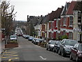
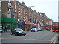
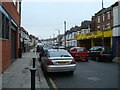
Photos of N8 0BQ


Area Information
Living in N8 0BQ offers a compact, residential experience shaped by its small cluster of homes and proximity to key transport routes. With a population of 1,761, this area is a quiet, low-density postcode where daily life is defined by convenience and accessibility. The community is predominantly composed of adults aged 30–64, reflecting a mature demographic with a median age of 47. This suggests a settled, perhaps family-oriented environment, though the 45% home ownership rate indicates a significant portion of residents rent. The area’s housing stock is almost entirely flats, a common feature in urban settings, which may appeal to those seeking modern, low-maintenance living. Safety is a key factor here: flood risk is negligible, and crime rates are below average, with a safety score of 80. Residents benefit from strong digital connectivity, with broadband rated excellent and mobile coverage good. Nearby, retail options like Tesco Harringay and Sainsburys Harringay, combined with multiple rail and metro stations, ensure practical access to shopping, transport, and leisure. For buyers, N8 0BQ is a niche area where proximity to infrastructure and safety are prioritised over expansive space.
- Area Type
- Postcode
- Area Size
- Not available
- Population
- 1761
- Population Density
- 10884 people/km²
The property market in N8 0BQ is characterised by a high proportion of rental properties, with only 45% of homes owner-occupied. This suggests that the area is more of a rental market than a buyers’ market, potentially limiting opportunities for those seeking to purchase a home. The accommodation type is almost exclusively flats, which are typically more compact and suited to urban living. This may appeal to buyers looking for low-maintenance properties or investors seeking rental income, though the small size of the area means the housing stock is limited. The low home ownership rate could indicate affordability challenges or a preference for renting in a location with strong transport links. For buyers, the area’s proximity to rail, metro, and bus services may offset the lack of larger properties, but the small postcode means competition for available homes could be fierce. Those considering N8 0BQ should weigh the benefits of its infrastructure against the constraints of its limited housing supply.
House Prices in N8 0BQ
No properties found in this postcode.
Energy Efficiency in N8 0BQ
Life in N8 0BQ is shaped by its proximity to retail, transport, and leisure options. Nearby, shops such as Tesco Harringay, Iceland Haringey, and Sainsburys Harringay provide essential grocery and household needs, while the area’s rail, metro, and bus networks ensure easy access to London’s cultural and commercial hubs. The presence of ferry stops like Camden Lock Waterbus and London Zoo Waterbus Stop adds a unique dimension to daily life, offering scenic travel routes and connections to green spaces. For residents, the combination of retail convenience and transport links means errands and commutes are efficient. The area’s small size means amenities are within practical reach, though the lack of dedicated parks or leisure facilities suggests a focus on urban living. Overall, N8 0BQ offers a functional lifestyle for those prioritising accessibility over expansive natural spaces.
Amenities
Schools
| Rank | School | Type | Entry gender | Ages |
|---|
Explore more schools in this area
Go to Schools tabDemographics
The community in N8 0BQ is predominantly composed of adults aged 30–64, with a median age of 47. This suggests a mature, stable population, likely with established careers and families. Home ownership is relatively low at 45%, meaning over half of residents rent, which may indicate a mix of long-term tenants and transient occupants. The accommodation type is almost exclusively flats, a common feature in urban or semi-urban areas. The predominant ethnic group is White, though no specific data on diversity or deprivation is provided. The age profile and home ownership figures suggest a community that is neither young nor overwhelmingly elderly, with a focus on rental housing. This may reflect a balance between affordability and the need for proximity to transport links, as the area’s rail and metro stations are within practical reach. The lack of data on deprivation means the quality of life cannot be fully assessed, but the low crime rate and safety score of 80 imply a generally secure environment.
Household Size
Accommodation Type
Tenure
Ethnic Group
Religion
Household Composition
Age
Household Deprivation
NS-SEC
Explore more demographic insights in this area
Go to Demographics tabPlanning
Planning Constraints
- Flood RiskPremium
- Ramsar Wetland SitesPremium
- Area of Outstanding Natural BeautyPremium
- Protected Nature ReservePremium
- Protected WoodlandPremium