Area Overview for N7 9HR
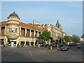
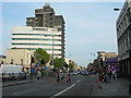
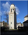
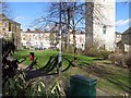
Photos of N7 9HR


Area Information
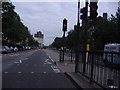
N7 9HR is a small residential postcode in north London, home to 2857 people. It sits in a compact cluster of properties, offering a mix of urban convenience and proximity to transport hubs. The area’s character is defined by its accessibility—rail, metro, and bus routes provide seamless connections to central London and beyond. Daily life here is shaped by a blend of retail, transport, and leisure options within walking distance. Residents benefit from nearby supermarkets like Co-op Camden and Sainsburys Caledonian, while rail stations such as Highbury & Islington and Caledonian Road & Barnsbury offer frequent services. The median age of 22 contrasts with the most common age group of 30-64 years, suggesting a dynamic mix of younger professionals and established families. With low flood risk and no protected natural sites, the area is free from environmental constraints, though crime rates are average. N7 9HR is ideal for those seeking a compact, well-connected home without sacrificing proximity to London’s amenities.
- Area Type
- Postcode
- Area Size
- Not available
- Population
- 2857
- Population Density
- 16717 people/km²
The property market in N7 9HR is characterised by a 19% home ownership rate, indicating that the majority of residents are renters. Flats dominate the accommodation type, reflecting a focus on smaller, urban living spaces. This suggests the area is more suited to tenants than buyers seeking owner-occupied homes. The limited number of properties, combined with the flat-dominated stock, may make the market competitive for those looking to purchase. Buyers should consider the small area’s constraints, as housing options are restricted to flats within a compact postcode. The rental market is likely to be active, particularly among professionals reliant on nearby transport hubs. For those seeking a home, the area’s proximity to London’s amenities may outweigh its limited housing diversity.
House Prices in N7 9HR
No properties found in this postcode.
Energy Efficiency in N7 9HR
Living in N7 9HR offers a blend of convenience and urban vibrancy. Retail options include nearby supermarkets such as Co-op Camden, Sainsburys Caledonian, and Tesco Caledonian, ensuring daily essentials are within reach. Transport links to major stations like Highbury & Islington and Caledonian Road & Barnsbury make commuting straightforward, while ferry services such as Camden Lock Waterbus and Blackfriars Pier provide scenic travel alternatives. The area’s proximity to London’s cultural and commercial hubs adds to its appeal. Parks and leisure facilities are not explicitly detailed, but the lack of planning constraints suggests open spaces may be accessible nearby. For residents, the balance of retail, transport, and connectivity creates a lifestyle that prioritises efficiency without sacrificing access to London’s broader offerings.
Amenities
Schools
| Rank | School | Type | Entry gender | Ages |
|---|
Explore more schools in this area
Go to Schools tabDemographics
The population of N7 9HR is 2857, with a median age of 22. However, the most common age range is 30-64 years, indicating a community skewed toward working-age adults. Only 19% of residents own their homes, with flats being the predominant accommodation type. This suggests a rental market dominated by tenants, likely including young professionals and commuters. The predominant ethnic group is White, though specific data on diversity is not provided. The low home ownership rate implies limited long-term investment in property, which may affect housing stability. The age profile suggests a mix of career-focused individuals and families, though the absence of data on household composition means this remains speculative. Residents may benefit from the area’s transport links, which cater to a mobile workforce.
Household Size
Accommodation Type
Tenure
Ethnic Group
Religion
Household Composition
Age
Household Deprivation
NS-SEC
Explore more demographic insights in this area
Go to Demographics tabPlanning
Planning Constraints
- Flood RiskPremium
- Ramsar Wetland SitesPremium
- Area of Outstanding Natural BeautyPremium
- Protected Nature ReservePremium
- Protected WoodlandPremium