Area Overview for N7 8ED
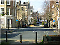
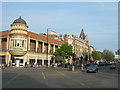
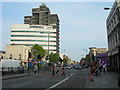
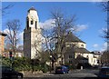
Photos of N7 8ED


Area Information
Living in N7 8ED means inhabiting a compact residential cluster in north London, where convenience and connectivity define daily life. With a population of just 1199, this area is small but well-served by transport and amenities. The community is characterised by a mature demographic, with a median age of 47 and most residents falling within the 30-64 age range. This suggests a stable, established population, likely drawn to the area for its accessibility to central London. The low flood risk and absence of environmental constraints like AONB or protected woodlands mean residents face minimal natural hazards. Nearby, the area’s proximity to Holloway Road Station and multiple rail links ensures easy access to jobs and services. For those who prefer retail, Tesco Hornsey, Aldi, and other shops are within walking distance. The combination of safety, practical amenities, and transport options makes N7 8ED a pragmatic choice for those prioritising efficiency over sprawling urban sprawl.
- Area Type
- Postcode
- Area Size
- Not available
- Population
- 1199
- Population Density
- 49139 people/km²
The property market in N7 8ED is defined by its compact size and limited housing stock. With 30% home ownership, the area leans heavily towards rental properties, suggesting a transient or younger population. The predominant accommodation type is flats, which aligns with the small, clustered nature of the postcode. This means buyers seeking owner-occupied homes may find limited options, but the proximity to transport hubs like Holloway Road Station and multiple rail links could offset this. The area’s small size means property values may be influenced by nearby amenities and transport access rather than standalone features. For those considering the area, the focus should be on proximity to services and the practicality of living in a well-connected, low-risk environment rather than expansive housing choices.
House Prices in N7 8ED
No properties found in this postcode.
Energy Efficiency in N7 8ED
Daily life in N7 8ED is shaped by its proximity to a range of amenities. Retail options include Tesco Hornsey, Aldi, and Tesco Caledonian, offering convenience for grocery shopping. Transport hubs like Holloway Road Station and Drayton Park Station provide easy access to London’s transport network, while ferry services like London Zoo Waterbus Stop add flexibility for leisure travel. Parks and open spaces are not explicitly listed, but the absence of environmental constraints suggests accessible green areas nearby. The area’s density means residents can walk to shops, cafes, and services, fostering a compact, efficient lifestyle. Whether commuting, shopping, or relaxing, the mix of retail, transport, and connectivity ensures N7 8ED supports both practical needs and a dynamic daily routine.
Amenities
Schools
| Rank | School | Type | Entry gender | Ages |
|---|
Explore more schools in this area
Go to Schools tabDemographics
The community in N7 8ED is predominantly composed of adults aged 30-64, with a median age of 47. This suggests a mature, settled population, likely with established careers and families. Home ownership is relatively low, at 30%, indicating that a significant proportion of residents rent their homes. The accommodation type is almost exclusively flats, reflecting the area’s density and likely development history. The predominant ethnic group is White, though specific data on diversity or deprivation is not provided. The low crime risk score of 71/100, combined with no environmental constraints, implies a stable, low-risk living environment. For buyers, this demographic profile suggests a community focused on practicality and proximity to services, with limited new development but a strong existing infrastructure.
Household Size
Accommodation Type
Tenure
Ethnic Group
Religion
Household Composition
Age
Household Deprivation
NS-SEC
Explore more demographic insights in this area
Go to Demographics tabPlanning
Planning Constraints
- Flood RiskPremium
- Ramsar Wetland SitesPremium
- Area of Outstanding Natural BeautyPremium
- Protected Nature ReservePremium
- Protected WoodlandPremium