Area Overview for N7 6HP
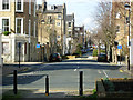
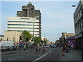
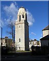
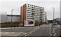
Photos of N7 6HP


Area Information
Living in N7 6HP means inhabiting a tightly packed residential cluster in north London, where 1,941 people reside across just 1,275 square metres. This makes it one of the most densely populated areas in England, with over 1.5 million people per square kilometre. The area’s compact nature means daily life is defined by proximity to amenities and transport hubs. Residents benefit from being within walking distance of Holloway Road Station, Arsenal, and Tufnell Park Station, ensuring easy access to central London. The postcode’s character is shaped by its mix of retail and transport infrastructure, with Lidl Holloway, Morrisons Holloway, and Waitrose Holloway providing nearby shopping options. While the area lacks green spaces or natural constraints, its high connectivity and urban convenience cater to commuters and those prioritising accessibility. The population, predominantly adults aged 30–64, suggests a community focused on stability and practicality, with a notable proportion of renters living in flats. N7 6HP is not for those seeking spacious living — it is a place where proximity to services and transport outweighs the need for open space.
- Area Type
- Postcode
- Area Size
- 1275 m²
- Population
- 1941
- Population Density
- 17822 people/km²
The property market in N7 6HP is characterised by a 20% home ownership rate, meaning the majority of residents are renters. This reflects a rental market rather than an owner-occupied one, with flats making up the predominant accommodation type. Given the area’s small size and high population density, the housing stock is limited to a cluster of flats, offering little variety in property types. Buyers seeking homes in N7 6HP would face a competitive market with limited availability, as the area’s compact nature restricts expansion. The high population density also means properties are likely to be smaller, prioritising space efficiency over comfort. For those considering the area, the focus should be on proximity to transport and amenities rather than property size or style. The lack of private housing stock suggests that any available homes are likely to be in the rental sector, with limited opportunities for long-term ownership.
House Prices in N7 6HP
No properties found in this postcode.
Energy Efficiency in N7 6HP
Residents of N7 6HP have access to a range of amenities within practical reach, blending retail, transport, and leisure options. The area is anchored by supermarkets like Lidl Holloway, Morrisons Holloway, and Waitrose Holloway, ensuring daily shopping needs are met. Transport links are extensive, with Holloway Road Station, Arsenal, and Tufnell Park Station providing metro access, while Upper Holloway Station and Finsbury Park Railway Station offer rail connections. Ferry services such as Camden Lock Waterbus and London Zoo Waterbus Stop add to the mobility options. Bus routes from Green Line Coach Station and Victoria Coach Station further enhance connectivity. The area’s compact size means these amenities are within walking or short transit distance, reducing the need for cars. While there is no mention of parks or leisure facilities in the data, the proximity to central London suggests easy access to cultural and recreational spaces. The lifestyle here is defined by convenience, with services and transport prioritised over expansive green spaces.
Amenities
Schools
| Rank | School | Type | Entry gender | Ages |
|---|
Explore more schools in this area
Go to Schools tabDemographics
N7 6HP’s population of 1,941 is composed largely of adults aged 30–64, with a median age of 47. This reflects a mature, established community with limited presence of younger or older demographics. Home ownership is low at 20%, indicating that most residents are renters, likely drawn to the area’s transport links and affordability. The predominant accommodation type is flats, a common feature in high-density urban zones. The majority of residents identify as White, though no specific data on diversity beyond this is provided. The high population density — over 1.5 million people per square kilometre — suggests a mix of transient and long-term residents, with limited private housing stock. This density can impact quality of life, though the area’s amenities and connectivity mitigate some of the challenges. The absence of detailed deprivation data means the extent of socioeconomic variation remains unclear, but the low home ownership rate and flat-dominated housing suggest a rental-driven market with limited scope for property investment.
Household Size
Accommodation Type
Tenure
Ethnic Group
Religion
Household Composition
Age
Household Deprivation
NS-SEC
Explore more demographic insights in this area
Go to Demographics tabPlanning
Planning Constraints
- Flood RiskPremium
- Ramsar Wetland SitesPremium
- Area of Outstanding Natural BeautyPremium
- Protected Nature ReservePremium
- Protected WoodlandPremium