Area Overview for N7 6AU
Photos of N7 6AU
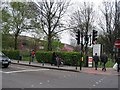
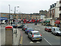
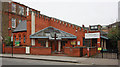
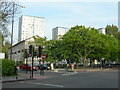
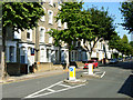
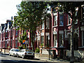
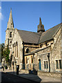
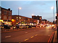
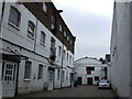
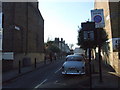
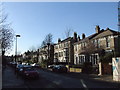
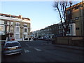
100 photos from this area
Area Information
Key information about the N7 6AU including its size, population, and administrative classification.
- Area Type
- Postcode
- Area Size
- 6101 m²
- Population
- 1282
- Population Density
- 13638 people/km²
House Prices in N7 6AU
45
Properties
£628,677
Average Sold Price
£295,000
Lowest Price
£1,150,000
Highest Price
Showing 45 properties
| Address | Type | Beds | Baths | Last Sale Price | Last Sale Date | |
|---|---|---|---|---|---|---|
| 40 Eburne Road, London, N7 6AU | Terraced | 5 | 2 | £1,150,000 | Sep 2023 | |
| 35 Eburne Road, London, N7 6AU | Terraced | 4 | 3 | £845,000 | Jun 2014 | |
| 34 Eburne Road, London, N7 6AU | Terraced | 5 | 2 | £630,000 | Aug 2013 | |
| 46 Eburne Road, London, N7 6AU | Terraced | 2 | 2 | £642,500 | Jul 2011 | |
| 42 Eburne Road, London, N7 6AU | Detached | 3 | 1 | £650,000 | Mar 2011 | |
| 41 Eburne Road, London, N7 6AU | Semi-detached | 5 | 2 | £610,000 | Sep 2010 | |
| 36 Eburne Road, London, N7 6AU | house | - | - | £600,000 | Jun 2010 | |
| 31 Eburne Road, London, N7 6AU | Terraced | 3 | 2 | £648,000 | Feb 2008 | |
| 38 Eburne Road, London, N7 6AU | Terraced | - | - | £465,000 | Nov 2006 | |
| 39 Eburne Road, London, N7 6AU | house | 4 | - | £379,950 | Oct 2002 |
Page 1 of 5
Energy Efficiency in N7 6AU
Amenities
Schools
| Rank | School | Type | Entry gender | Ages |
|---|
Explore more schools in this area
Go to Schools tabDemographics
Household Size
Two person
most common
Accommodation Type
Flats
most common
Tenure
30
majority
Ethnic Group
White
most common
Religion
N/A
most common
Household Composition
N/A
most common
Age
47
median
Adults (30-64 years)
most common
Household Deprivation
N/A
with no deprivation
NS-SEC
52
in Lower managerial occupations
Explore more demographic insights in this area
Go to Demographics tabPlanning
Planning Constraints
- Flood RiskPremium
- Ramsar Wetland SitesPremium
- Area of Outstanding Natural BeautyPremium
- Protected Nature ReservePremium
- Protected WoodlandPremium