Area Overview for N7 0EW
Photos of N7 0EW

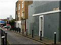
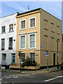
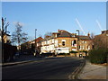
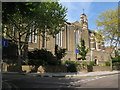


100 photos from this area
Area Information
Key information about the N7 0EW including its size, population, and administrative classification.
- Area Type
- Postcode
- Area Size
- 5681 m²
- Population
- 1755
- Population Density
- 13563 people/km²
House Prices in N7 0EW
32
Properties
£431,250
Average Sold Price
£215,000
Lowest Price
£650,000
Highest Price
Showing 32 properties
| Address | Type | Beds | Baths | Last Sale Price | Last Sale Date | |
|---|---|---|---|---|---|---|
| 54 Penderyn Way, London, N7 0EW | house | 4 | 1 | £650,000 | Mar 2022 | |
| 38 Penderyn Way, London, N7 0EW | house | 3 | - | £610,000 | Mar 2020 | |
| 4 Penderyn Way, London, N7 0EW | Terraced | 3 | 1 | £600,000 | Nov 2018 | |
| 24 Penderyn Way, London, N7 0EW | house | 4 | - | £580,000 | Apr 2015 | |
| 50 Penderyn Way, London, N7 0EW | Terraced | 3 | - | £475,000 | Aug 2013 | |
| 12 Penderyn Way, London, N7 0EW | house | - | - | £400,000 | May 2012 | |
| 36 Penderyn Way, London, N7 0EW | house | 4 | 2 | £420,000 | Apr 2012 | |
| 18 Penderyn Way, London, N7 0EW | Terraced | 4 | 1 | £380,000 | Feb 2008 | |
| 26 Penderyn Way, London, N7 0EW | Terraced | 4 | 3 | £325,000 | Aug 2007 | |
| 56 Penderyn Way, London, N7 0EW | house | - | - | £295,000 | May 2006 |
Page 1 of 4
Energy Efficiency in N7 0EW
Amenities
Schools
| Rank | School | Type | Entry gender | Ages |
|---|
Explore more schools in this area
Go to Schools tabDemographics
Household Size
One person
most common
Accommodation Type
Flats
most common
Tenure
26
majority
Ethnic Group
White
most common
Religion
N/A
most common
Household Composition
N/A
most common
Age
47
median
Adults (30-64 years)
most common
Household Deprivation
N/A
with no deprivation
NS-SEC
37
in Lower managerial occupations
Explore more demographic insights in this area
Go to Demographics tabPlanning
Planning Constraints
- Flood RiskPremium
- Ramsar Wetland SitesPremium
- Area of Outstanding Natural BeautyPremium
- Protected Nature ReservePremium
- Protected WoodlandPremium