Area Overview for N7 0BY
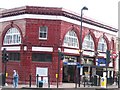
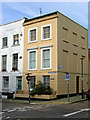
Photos of N7 0BY


Area Information
Living in N7 0BY means inhabiting a compact residential cluster in north London, where the population of 1,472 residents creates a tight-knit community. This postcode area is defined by its proximity to key transport hubs and educational institutions, making it a practical choice for commuters and families. The area’s small size ensures a focused local identity, with residents likely to know their neighbours and engage with nearby amenities. Daily life here is shaped by the availability of nearby schools, retail outlets, and public transport, which together support a functional, urban lifestyle. While the area lacks expansive green spaces, its connectivity to London’s transport network and proximity to amenities like Co-op Camden and Sainsburys Kentish ensure convenience. The demographic profile—primarily adults aged 30–64—suggests a community of established professionals and families, with a low home ownership rate indicating a rental-dominated market. For those seeking a manageable, well-serviced area with easy access to the city, N7 0BY offers a blend of practicality and accessibility.
- Area Type
- Postcode
- Area Size
- Not available
- Population
- 1472
- Population Density
- 15896 people/km²
The property market in N7 0BY is characterised by a low home ownership rate of 26%, indicating that the majority of residents are renters rather than homeowners. This suggests a rental-dominated market, likely influenced by the area’s compact size and focus on flats as the primary accommodation type. Flats are the norm here, which aligns with the urban setting and limited space for larger homes. For buyers, this means the housing stock is unlikely to include detached properties or spacious family homes. The small area’s immediate surroundings may offer more variety, but within N7 0BY itself, the options are constrained to flats. This dynamic may appeal to those prioritising affordability and proximity to transport, but it also means competition for available properties could be fierce. Buyers should consider the long-term viability of investing in a rental-heavy market with limited scope for property expansion.
House Prices in N7 0BY
No properties found in this postcode.
Energy Efficiency in N7 0BY
Residents of N7 0BY have access to a range of amenities within walking or short transport distance. Retail options include Co-op Camden, Co-op Kentish, and Sainsburys Kentish, providing essential shopping and grocery needs. For travel, the area’s proximity to Tufnell Park Station and Camden Town Station offers easy access to the city. Water-based transport is also available via Camden Lock Waterbus and London Zoo Waterbus Stop, adding variety to commuting and leisure. The presence of multiple bus routes, including London Victoria Coach Station Arrivals, ensures connectivity to regional and national destinations. While the area lacks large parks or leisure facilities, its density and transport links make it convenient for those prioritising urban living. The mix of retail, transport, and mobility options creates a practical lifestyle, though residents may need to venture further for dedicated recreational spaces.
Amenities
Schools
Residents of N7 0BY have access to two primary schools: Torriano Primary School, which holds an outstanding Ofsted rating, and Torriano Infant School. These institutions cater to younger children, providing a foundation for education within the area. The presence of both primary schools suggests a focus on early education, which is crucial for families with young children. The outstanding rating at Torriano Primary School indicates high-quality teaching and facilities, which could be a significant draw for families prioritising academic standards. However, the absence of secondary schools in the data means parents may need to look beyond N7 0BY for comprehensive schooling. The mix of school types ensures coverage for early years but highlights a potential gap in secondary education options.
| Rank | School | Type | Entry gender | Ages |
|---|
Explore more schools in this area
Go to Schools tabDemographics
The community in N7 0BY is predominantly composed of adults aged 30–64, with a median age of 47. This suggests a mature population, likely consisting of professionals and families settled in the area. Home ownership is relatively low at 26%, indicating that most residents rent their homes. The accommodation type is primarily flats, reflecting the area’s urban character and limited space for larger properties. The predominant ethnic group is White, though specific data on diversity is not provided. The age profile and home ownership rate suggest a community focused on stability and practical living, with fewer young families or transient populations. The absence of detailed deprivation data means the area’s quality of life remains unquantified, but the low crime risk and proximity to amenities imply a generally secure and functional environment for residents.
Household Size
Accommodation Type
Tenure
Ethnic Group
Religion
Household Composition
Age
Household Deprivation
NS-SEC
Explore more demographic insights in this area
Go to Demographics tabPlanning
Planning Constraints
- Flood RiskPremium
- Ramsar Wetland SitesPremium
- Area of Outstanding Natural BeautyPremium
- Protected Nature ReservePremium
- Protected WoodlandPremium