Area Overview for N6 6HL
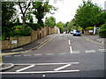
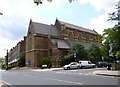
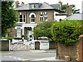
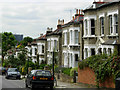
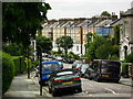
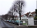
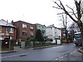
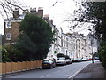
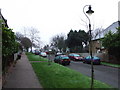
Photos of N6 6HL


Area Information
Living in N6 6HL offers a specific residential experience within a tightly defined cluster. This postcode covers an area of just 2,493 square metres, hosting a population of 1,523 residents. The density here is significant at 610,883 people per square kilometre. This location is situated in England and functions as a small, concentrated housing estate rather than a sprawling suburb. The physical environment is compact, meaning distances between homes are minimal. You will find that daily routines revolve close to your doorstep, yet the area maintains clear boundaries. The sheer concentration of people means that any local service you need is likely within walking distance. This is a place where community interactions happen frequently due to the high population per unit of space. It is an established part of the north London fabric, known for its flat living rather than detached houses. When you consider homes in N6 6HL, you are entering a specific urban microcosm where the layout dictates a high-contact lifestyle. The area does not offer large gardens or open spaces, but it provides immediate access to the wider transport network that surrounds the postcode. Your life here is defined by proximity to major thoroughfares and the efficient use of limited ground space.
- Area Type
- Postcode
- Area Size
- 2493 m²
- Population
- 1523
- Population Density
- 8703 people/km²
The property market for N6 6HL is dominated by flats, reflecting the area's high-density design. Accommodation surveys confirm that flats are the primary form of dwellings available in this 2,493 square metre zone. Only 31% of residents own their homes, which indicates that a large proportion of the housing stock is available for rent or temporary tenancy. This creates a dynamic market where buying involves navigating managed blocks or leasehold arrangements rather than freehold single-family properties. For buyers looking at homes in N6 6HL, the options are constrained by the footprint of the buildings themselves. The specific postcode does not offer bungalows or large detached estates; instead, it presents vertical living solutions. The high population of 1,523 people packed into such a small area reinforces the fact that space is at a premium. You must consider the implications of block living when evaluating property value and quality of life. The market likely reflects demand from those who cannot commute from further out but wish to live centrally. Leasehold costs and building maintenance fall squarely on the individual or shared ownership group. With over two-thirds of the population not owning their homes, resale values can fluctuate based on rental demand and management quality. This is a purchase for those who prioritise location over square footage.
House Prices in N6 6HL
Showing 26 properties
| Address | Type | Beds | Baths | Last Sale Price | Last Sale Date | |
|---|---|---|---|---|---|---|
| Flat 25, 30 Makepeace Avenue, London, N6 6HL | Flat | - | - | - | - | |
| Flat 9, 30 Makepeace Avenue, London, N6 6HL | Flat | - | - | - | - | |
| Flat 1, 30 Makepeace Avenue, London, N6 6HL | Flat | - | - | - | - | |
| Flat 23, 30 Makepeace Avenue, London, N6 6HL | Flat | - | - | - | - | |
| Flat 18, 30 Makepeace Avenue, London, N6 6HL | Flat | - | - | - | - | |
| Flat 21, 30 Makepeace Avenue, London, N6 6HL | Flat | - | - | - | - | |
| Flat 20, 30 Makepeace Avenue, London, N6 6HL | Flat | - | - | - | - | |
| Flat 15, 30 Makepeace Avenue, London, N6 6HL | Flat | - | - | - | - | |
| Flat 6, 30 Makepeace Avenue, London, N6 6HL | Flat | - | - | - | - | |
| Flat 17, 30 Makepeace Avenue, London, N6 6HL | Flat | - | - | - | - |
Energy Efficiency in N6 6HL
Daily life in N6 6HL is driven by immediate access to a wide variety of amenities that support a busy urban routine. Within practical reach, you can visit five retail sites, including Tesco Dartmouth, Tesco Highgate, and Iceland Archway. These shops provide you with daily groceries and household essentials without the need for a long journey. Your leisure and transport options are equally extensive, with five railway stations and five metro stations located nearby. You can reach Tufnell Park Station and Highgate Station for travel across the capital. The area offers five ferry stops, including Camden Lock Waterbus and the London Zoo Waterbus Stop, providing scenic travel routes. For those preferring land transport, there are three major bus hubs nearby, such as the London Victoria Coach Station and the Green Line Coach Station. This density of services means you can handle social engagements, work travel, and family errands from one small postcode. You have the convenience of major supermarkets and transport hubs all in close proximity. Living in N6 6HL means you can live without leaving the immediate vicinity to access the essentials your household requires.
Amenities
Schools
For families, the educational landscape for N6 6HL focuses on local primary education. Brookfield Primary School is the key institution listed near this postcode, operating as a primary school. It currently holds a 'good' Ofsted rating, which signals a standard of education considered reliable and effective by the state education system. As all listed schools are primary, you will find no secondary options immediately listed within this specific dataset. This means that once children reach secondary school age, they will typically be moved to schools further away in north London. The presence of a single named primary school suggests that the area serves as a feeder zone for early childhood and primary education. Families with young children can rest assured that a-rated primary schooling is within reach. However, the absence of secondary institutions in the immediate vicinity requires parents to plan for future commutes as their children grow. The 'good' rating is a concrete metric that supports families seeking consistent academic foundations. When researching schools near N6 6HL, you must look beyond this immediate area for high school options.
| Rank | School | Type | Entry gender | Ages |
|---|
Explore more schools in this area
Go to Schools tabDemographics
The community profile of N6 6HL is defined by a mature and working-age population. The median age stands at 47, with adults between 30 and 64 years being the most common age range. This indicates that the area attracts families and professionals in their prime earning years rather than students or retirees. Housing ownership is relatively low, with only 31% of residents owning their homes. The vast majority of the stock consists of flats, which aligns with the high-density nature of the postcode. While the predominant ethnic group is White, the high density suggests a diverse mix of households that navigate a shared urban environment. The age structure implies a stable neighbourhood where long-term residents often coexist with those looking to establish careers and raise children. You will find a demographic that values convenience and location over sprawl. The prevalence of flat living means that many households consist of singles, couples, or small families who cannot accommodate traditional houses. This sheltered housing type supports the active adult demographic that moves through the area daily. The 31% ownership rate suggests a significant rental sector alongside resident landlords. When you move to N6 6HL, you join a community characterised by its urban density and a mix of tenures.
Household Size
Accommodation Type
Tenure
Ethnic Group
Religion
Household Composition
Age
Household Deprivation
NS-SEC
Explore more demographic insights in this area
Go to Demographics tabPlanning
Planning Constraints
- Flood RiskPremium
- Ramsar Wetland SitesPremium
- Area of Outstanding Natural BeautyPremium
- Protected Nature ReservePremium
- Protected WoodlandPremium