Area Overview for N6 5UT
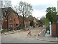
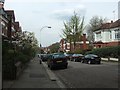
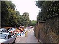
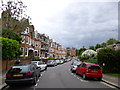
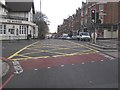
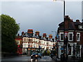
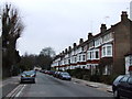
Photos of N6 5UT


Area Information
Living in N6 5UT offers a compact, residential experience in a small cluster of homes, serving a population of 1,748. The area is defined by its proximity to transport hubs and local amenities, making it practical for daily life. With a median age of 47 and a majority of residents aged 30–64, the community leans towards middle-aged adults, many of whom may be established professionals or families. The area’s housing stock is predominantly flats, reflecting a mix of owner-occupied and rental properties. While the population is small, the presence of multiple metro, rail, and bus stations ensures connectivity to nearby districts. Residents benefit from excellent broadband (96/100) and reliable mobile coverage (85/100), supporting both work and leisure. Nearby, Highfield School offers independent education, and retail options like Sainsburys Highgate and Tesco Highgate cater to daily needs. However, the area’s limited size means its character is shaped by its immediate surroundings, blending urban convenience with a quieter residential feel. For buyers, N6 5UT presents a focused opportunity to settle in a well-connected, compact postcode with clear advantages and manageable challenges.
- Area Type
- Postcode
- Area Size
- Not available
- Population
- 1748
- Population Density
- 2693 people/km²
The property market in N6 5UT is characterised by a 47% home ownership rate, indicating that nearly half of the housing stock is rented out. This suggests a rental market that may cater to professionals or families seeking flexibility, though the area’s small size means housing options are limited. The predominant accommodation type is flats, which aligns with the compact nature of the postcode and the presence of multi-unit developments. For buyers, this implies a focus on smaller, managed properties rather than detached homes. The limited population and housing stock mean the area is unlikely to see significant property turnover, making it a niche market for those prioritising proximity to transport and amenities. However, the flat-dominated landscape may appeal to buyers looking for maintenance-light living, though it also means fewer opportunities for larger family homes. The immediate surroundings, while not detailed, may offer similar characteristics, reinforcing the area’s practical, residential profile.
House Prices in N6 5UT
No properties found in this postcode.
Energy Efficiency in N6 5UT
Residents of N6 5UT have access to a range of amenities within practical reach. Retail options include Sainsburys Highgate, Co-op Food, and Tesco Highgate, providing essential shopping and grocery needs. The area’s transport links also grant proximity to leisure spots like London Zoo, accessible via waterbus services. Metro, rail, and bus stations ensure easy movement to nearby districts, while ferry stops add a layer of convenience for waterfront activities. The presence of multiple transport hubs suggests a lifestyle that balances local convenience with broader urban connectivity. However, the data does not mention parks or recreational spaces, so residents may need to travel further for green spaces. The character of the area is defined by its practicality, with amenities clustered around transport nodes. For those prioritising ease of access to retail, transport, and cultural attractions, N6 5UT offers a functional, if compact, lifestyle.
Amenities
Schools
The nearest school to N6 5UT is Highfield School, an independent institution. While no Ofsted rating is provided, the presence of an independent school suggests a focus on private education, which may cater to families prioritising specific curricula or facilities. The lack of state schools in the data means the educational options are limited to this single institution, which could be a consideration for families seeking diversity in schooling. Independent schools often come with higher fees and selective admissions, so prospective residents should factor in these practical aspects. For those valuing private education, Highfield School offers a clear option, but the absence of additional schools may limit alternatives. The area’s small size and proximity to transport links could also influence commuting to other districts for schooling, though this is not detailed in the data.
| Rank | School | Type | Entry gender | Ages |
|---|
Explore more schools in this area
Go to Schools tabDemographics
The community in N6 5UT is predominantly composed of adults aged 30–64, with a median age of 47. This suggests a population largely in their prime working years, potentially influencing local amenities and services. Home ownership here is at 47%, indicating a balance between owner-occupied properties and rental units. The accommodation type is primarily flats, which may reflect the area’s compact nature and the prevalence of multi-unit developments. The predominant ethnic group is White, though no specific data on diversity or deprivation is provided. The age profile and home ownership figures suggest a stable, mature demographic, likely with established careers and family structures. The absence of detailed diversity metrics means the community’s cultural composition remains less defined in the data. For residents, the age range and housing type imply a practical, low-maintenance lifestyle, though the limited population size may affect the vibrancy of local social networks.
Household Size
Accommodation Type
Tenure
Ethnic Group
Religion
Household Composition
Age
Household Deprivation
NS-SEC
Explore more demographic insights in this area
Go to Demographics tabPlanning
Planning Constraints
- Flood RiskPremium
- Ramsar Wetland SitesPremium
- Area of Outstanding Natural BeautyPremium
- Protected Nature ReservePremium
- Protected WoodlandPremium