Area Overview for N6 4SX
Photos of N6 4SX


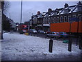
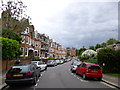
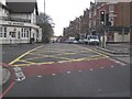
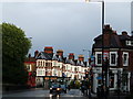
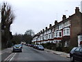
100 photos from this area
Area Information
Key information about the N6 4SX including its size, population, and administrative classification.
- Area Type
- Postcode
- Area Size
- 7.7 hectares
- Population
- 1748
- Population Density
- 2693 people/km²
House Prices in N6 4SX
27
Properties
£1,950,417
Average Sold Price
£370,000
Lowest Price
£3,750,000
Highest Price
Showing 27 properties
| Address | Type | Beds | Baths | Last Sale Price | Last Sale Date | |
|---|---|---|---|---|---|---|
| 31 Lanchester Road, Hornsey, London, N6 4SX | Semi-detached | 5 | 2 | £1,835,000 | Oct 2023 | |
| 37 Lanchester Road, Hornsey, London, N6 4SX | house | - | - | £1,750,000 | Oct 2020 | |
| Tudor House, 45 Lanchester Road, Hornsey, London, N6 4SX | Detached | 5 | 3 | £3,750,000 | Nov 2019 | |
| Wood Edge, 51 Lanchester Road, Hornsey, London, N6 4SX | Detached | 7 | 2 | £3,015,000 | May 2018 | |
| 67 Lanchester Road, Hornsey, London, N6 4SX | Detached | 6 | 3 | £2,950,000 | Jun 2017 | |
| 59 Lanchester Road, Hornsey, London, N6 4SX | Detached | 4 | 2 | £2,350,000 | Mar 2017 | |
| 35 Lanchester Road, Hornsey, London, N6 4SX | Semi-detached | 5 | 3 | £1,830,000 | Jan 2015 | |
| Pikaby, 49 Lanchester Road, Hornsey, London, N6 4SX | house | - | - | £3,400,000 | Mar 2013 | |
| 29 Lanchester Road, Hornsey, London, N6 4SX | Semi-detached | 4 | 2 | £810,000 | May 2012 | |
| 73 Lanchester Road, Hornsey, London, N6 4SX | Semi-detached | 6 | 2 | £850,000 | Mar 2012 |
Page 1 of 3
Energy Efficiency in N6 4SX
Amenities
Schools
| Rank | School | Type | Entry gender | Ages |
|---|
Explore more schools in this area
Go to Schools tabDemographics
Household Size
Two person
most common
Accommodation Type
Flats
most common
Tenure
47
majority
Ethnic Group
White
most common
Religion
N/A
most common
Household Composition
N/A
most common
Age
47
median
Adults (30-64 years)
most common
Household Deprivation
N/A
with no deprivation
NS-SEC
58
in Lower managerial occupations
Explore more demographic insights in this area
Go to Demographics tabPlanning
Planning Constraints
- Flood RiskPremium
- Ramsar Wetland SitesPremium
- Area of Outstanding Natural BeautyPremium
- Protected Nature ReservePremium
- Protected WoodlandPremium