Area Overview for N6 4RA
Photos of N6 4RA


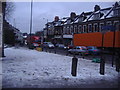
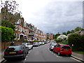
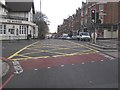
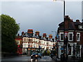
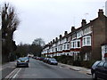
100 photos from this area
Area Information
Key information about the N6 4RA including its size, population, and administrative classification.
- Area Type
- Postcode
- Area Size
- 9208 m²
- Population
- 1748
- Population Density
- 2693 people/km²
House Prices in N6 4RA
36
Properties
£1,776,625
Average Sold Price
£471,000
Lowest Price
£3,120,000
Highest Price
Showing 36 properties
| Address | Type | Beds | Baths | Last Sale Price | Last Sale Date | |
|---|---|---|---|---|---|---|
| 64 Talbot Road, Hornsey, London, N6 4RA | house | 5 | 2 | £2,360,000 | Jun 2023 | |
| 78 Talbot Road, Hornsey, London, N6 4RA | Retail | 6 | 5 | £3,120,000 | Jul 2022 | |
| 94 Talbot Road, Hornsey, London, N6 4RA | house | 6 | 3 | £2,040,000 | Jan 2021 | |
| 74 Talbot Road, Hornsey, London, N6 4RA | Semi-detached | 6 | - | £2,225,000 | Apr 2016 | |
| 72 Talbot Road, Hornsey, London, N6 4RA | Semi-detached | 5 | 1 | £1,950,000 | Dec 2014 | |
| 86 Talbot Road, Hornsey, London, N6 4RA | Semi-detached | 6 | - | £1,900,000 | Feb 2014 | |
| 60 Talbot Road, Hornsey, London, N6 4RA | Semi-detached | 1 | 1 | £2,750,000 | Aug 2013 | |
| 96 Talbot Road, Hornsey, London, N6 4RA | Flat | 1 | 1 | £615,000 | Oct 2012 | |
| 88 Talbot Road, Hornsey, London, N6 4RA | Semi-detached | - | - | £1,500,000 | Aug 2010 | |
| 66 Talbot Road, Hornsey, London, N6 4RA | Semi-detached | 5 | 3 | £1,615,000 | Feb 2010 |
Page 1 of 4
Energy Efficiency in N6 4RA
Amenities
Schools
| Rank | School | Type | Entry gender | Ages |
|---|
Explore more schools in this area
Go to Schools tabDemographics
Household Size
Two person
most common
Accommodation Type
Flats
most common
Tenure
47
majority
Ethnic Group
White
most common
Religion
N/A
most common
Household Composition
N/A
most common
Age
47
median
Adults (30-64 years)
most common
Household Deprivation
N/A
with no deprivation
NS-SEC
58
in Lower managerial occupations
Explore more demographic insights in this area
Go to Demographics tabPlanning
Planning Constraints
- Flood RiskPremium
- Ramsar Wetland SitesPremium
- Area of Outstanding Natural BeautyPremium
- Protected Nature ReservePremium
- Protected WoodlandPremium