Area Overview for N6 4LH
Photos of N6 4LH
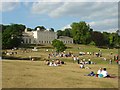

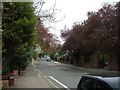


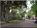
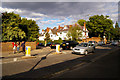
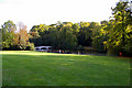

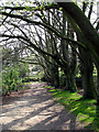
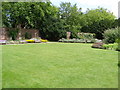
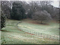
100 photos from this area
Area Information
Key information about the N6 4LH including its size, population, and administrative classification.
- Area Type
- Postcode
- Area Size
- 3.0 hectares
- Population
- 1341
- Population Density
- 2084 people/km²
House Prices in N6 4LH
9
Properties
£8,602,143
Average Sold Price
£4,400,000
Lowest Price
£11,750,000
Highest Price
Showing 9 properties
| Address | Type | Beds | Baths | Last Sale Price | Last Sale Date | |
|---|---|---|---|---|---|---|
| Esterel, Compton Avenue, Hornsey, London, N6 4LH | Detached | 4 | 4 | £5,750,000 | Nov 2020 | |
| Tree Tops, Compton Avenue, Hornsey, London, N6 4LH | Detached | 8 | 8 | £11,000,000 | Sep 2020 | |
| Beaulieu House, Compton Avenue, Hornsey, London, N6 4LH | Detached | 7 | 3 | £4,400,000 | Jul 2019 | |
| Woodley, Compton Avenue, Hornsey, London, N6 4LH | Detached | 8 | 7 | £10,800,000 | Aug 2015 | |
| Far End, Compton Avenue, Hornsey, London, N6 4LH | house | - | - | £11,750,000 | Jun 2015 | |
| Derwen, Compton Avenue, Hornsey, London, N6 4LH | house | 7 | 7 | £11,150,000 | Oct 2013 | |
| Chase End, Compton Avenue, Hornsey, London, N6 4LH | Detached | - | - | £5,365,000 | Oct 2000 | |
| Palladio, Compton Avenue, Hornsey, London, N6 4LH | Detached | 6 | 4 | - | - | |
| Nice Place, Compton Avenue, Hornsey, London, N6 4LH | Land | 6 | 7 | - | - |
Energy Efficiency in N6 4LH
Amenities
Schools
| Rank | School | Type | Entry gender | Ages |
|---|
Explore more schools in this area
Go to Schools tabDemographics
Household Size
Family (3-5 people)
most common
Accommodation Type
Houses
most common
Tenure
72
majority
Ethnic Group
White
most common
Religion
N/A
most common
Household Composition
N/A
most common
Age
47
median
Adults (30-64 years)
most common
Household Deprivation
N/A
with no deprivation
NS-SEC
60
in Lower managerial occupations
Explore more demographic insights in this area
Go to Demographics tabPlanning
Planning Constraints
- Flood RiskPremium
- Ramsar Wetland SitesPremium
- Area of Outstanding Natural BeautyPremium
- Protected Nature ReservePremium
- Protected WoodlandPremium