Area Overview for N6 4JN
Photos of N6 4JN


Area Information
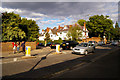
Living in N6 4JN means inhabiting a small, tightly knit residential cluster in north London, where the population of 1,341 reflects a quiet, stable community. This area is characterised by its proximity to Highgate and Tufnell Park, offering easy access to urban amenities while retaining a residential feel. Daily life here is shaped by a balance of local shops, transport hubs, and nearby green spaces. The area’s compact size means residents can walk to key destinations, from the Highgate branch of Tesco to the Upper Holloway rail station. With a median age of 47, the community skews toward adults in their 30s to 60s, suggesting a mix of long-term residents and families. The presence of both independent and state schools indicates a diverse range of educational options, while the broadband score of 91 ensures reliable internet for remote work or entertainment. N6 4JN is not a sprawling suburb but a focused postcode where convenience and connectivity are prioritised, making it appealing to those seeking a manageable, well-served living environment.
- Area Type
- Postcode
- Area Size
- Not available
- Population
- 1341
- Population Density
- 2084 people/km²
The property market in N6 4JN is dominated by owner-occupied homes, with 72% of residents in private ownership. This high rate of home ownership suggests a stable, long-term market with limited rental activity, which may appeal to buyers seeking a secure investment. The accommodation type is primarily houses, indicating a preference for larger properties over flats. This aligns with the area’s residential nature and proximity to green spaces, making it attractive to families or individuals prioritising space and privacy. The small postcode area means the housing stock is concentrated, and buyers should consider the limited availability of new builds or conversions. The focus on owner-occupied properties may also mean fewer short-term rental options, which could be a consideration for those seeking flexibility. Overall, the market is likely to cater to those seeking a settled, family-friendly environment with established infrastructure.
House Prices in N6 4JN
No properties found in this postcode.
Energy Efficiency in N6 4JN
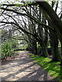
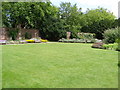
The lifestyle in N6 4JN is enriched by a range of amenities within practical reach. Local shops such as Tesco Highgate, Sainsburys Highgate, and Co-op Food provide everyday convenience, while nearby parks like Hampstead Heath offer green spaces for recreation. The area’s proximity to metro stations, including Highgate and Tufnell Park, ensures easy access to urban destinations, and ferry services like the London Zoo Waterbus Stop add a unique dimension to leisure activities. The presence of the Green Line Coach Station and Victoria Coach Station further enhances connectivity for longer journeys. This mix of retail, transport, and natural spaces creates a balanced lifestyle, blending urban accessibility with opportunities for relaxation. The area’s amenities cater to both daily needs and weekend pursuits, making it appealing to those who value convenience and variety.
Amenities
Schools
Residents of N6 4JN have access to a mix of educational institutions, including St Michael’s CofE Voluntary Aided Primary School, which holds an outstanding Ofsted rating. This school, serving younger children, is a strong draw for families prioritising high-quality primary education. Nearby, Highgate School offers independent education, catering to those seeking a private schooling option. The combination of a state school with an excellent rating and an independent institution provides a range of choices, from affordable state education to premium private schooling. This diversity ensures families can select a school that aligns with their values, budget, and educational goals. The proximity of both schools to the area reinforces N6 4JN’s appeal to households with children, offering convenience and access to reputable institutions.
| Rank | School | Type | Entry gender | Ages |
|---|---|---|---|---|
| 1 | St Michael's CofE Voluntary Aided Primary School | primary | N/A | N/A |
| 2 | Highgate School | independent | N/A | N/A |
Explore more schools in this area
Go to Schools tabDemographics
The community in N6 4JN is predominantly composed of adults aged 30–64, with a median age of 47. This suggests a mature, established population, likely with strong ties to the area. Home ownership is high, with 72% of residents owning their homes, indicating a stable housing market and long-term residency. The accommodation type is primarily houses, which aligns with the area’s residential character and suggests a focus on family homes rather than flats. The predominant ethnic group is White, though specific data on other groups is not provided. The age profile implies a community with a mix of professionals, retirees, and families, all of whom benefit from the area’s proximity to schools and transport. The absence of detailed diversity metrics means the demographic picture remains focused on the majority group, but the presence of both state and independent schools suggests a range of household needs are met.
Household Size
Accommodation Type
Tenure
Ethnic Group
Religion
Household Composition
Age
Household Deprivation
NS-SEC
Explore more demographic insights in this area
Go to Demographics tabPlanning
Planning Constraints
- Flood RiskPremium
- Ramsar Wetland SitesPremium
- Area of Outstanding Natural BeautyPremium
- Protected Nature ReservePremium
- Protected WoodlandPremium
- Crime RiskPremium