Area Overview for N5 2TT
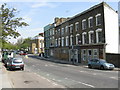
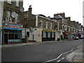
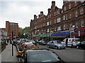
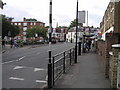
Photos of N5 2TT


Area Information
Living in N5 2TT means being part of a small, tightly knit residential cluster in north London. With a population of 2,000, the area is compact but offers a blend of convenience and accessibility. Its proximity to major transport hubs and retail centres makes it appealing for commuters and families alike. The community is predominantly made up of adults aged 30–64, reflecting a mature demographic. Daily life here is shaped by its location, with easy access to schools, shops, and public transport. While the area is small, it sits within a broader network of amenities, including nearby parks and cultural landmarks. The low crime risk and absence of environmental constraints such as protected woodlands or wetlands mean residents can enjoy a peaceful environment without planning restrictions. For those seeking a balance between urban and suburban living, N5 2TT provides a practical base with minimal disruption. Its housing stock, primarily flats, suits those prioritising space efficiency over large homes. The area’s character lies in its simplicity: a quiet, functional neighbourhood with straightforward needs met by nearby infrastructure.
- Area Type
- Postcode
- Area Size
- Not available
- Population
- 2000
- Population Density
- 18709 people/km²
The property market in N5 2TT is characterised by a high proportion of rented flats, with home ownership at 45%. This suggests a rental-dominated market, where private landlords and housing associations likely hold significant shares. The prevalence of flats indicates a focus on space-efficient living, which suits commuters or those prioritising convenience over larger homes. Given the area’s small size, property options are limited, and buyers may need to consider nearby zones for more choices. The lack of data on property prices or recent sales trends means it is unclear whether the area is undervalued or in demand. However, the low crime risk and proximity to transport links could make it an attractive option for first-time buyers or investors seeking affordability. For renters, the availability of flats may offer stability, though competition for desirable units could be fierce. The market’s dynamics are shaped by its role as a transit node, with housing likely catering to those working in adjacent business or commercial districts.
House Prices in N5 2TT
No properties found in this postcode.
Energy Efficiency in N5 2TT
Residents of N5 2TT have access to a range of amenities that support daily life. Retail options include major supermarkets like Tesco Stoke Newington and Sainsburys Hackney, ensuring grocery needs are met with ease. The area’s transport links also grant proximity to leisure spots such as London Zoo and Camden Lock, which are reachable via ferry or bus. Public transport hubs like Drayton Park Station and Whipps Cross Bus Interchange provide access to cultural venues, shopping centres, and employment zones. The presence of multiple rail and metro stations means residents can quickly reach destinations such as Islington, Camden, or the City of London. While the area itself is small, its integration with surrounding infrastructure creates a convenient lifestyle. The mix of retail, transport, and leisure options suggests a community that values practicality and accessibility over sprawling local amenities.
Amenities
Schools
Residents of N5 2TT have access to two notable schools within practical reach. St Joan of Arc RC Primary School is a state-funded institution with an Ofsted rating of ‘good’, indicating a reliable standard of education. For families seeking independent schooling, Primrose Independent School offers an alternative, though its specific performance metrics are not detailed. The presence of both state and independent options provides flexibility, allowing parents to choose between free public education and fee-paying institutions. The ‘good’ rating at the primary school suggests a focus on foundational learning and student welfare, which is critical for younger children. However, the absence of secondary school data means families may need to look further afield for high school options. The mix of school types reflects a community that values choice but may require additional planning for older children’s education.
| Rank | School | Type | Entry gender | Ages |
|---|
Explore more schools in this area
Go to Schools tabDemographics
The community in N5 2TT is predominantly composed of adults aged 30–64, with a median age of 47. Home ownership here stands at 45%, indicating that nearly half of residents rent their homes. The accommodation type is overwhelmingly flats, reflecting a preference for smaller, managed housing units. The predominant ethnic group is White, though specific data on diversity beyond this is not provided. The age profile suggests a stable, established population, with fewer young families or retirees compared to other areas. This demographic mix may influence local services and amenities, which cater more to working-age adults than to children or elderly residents. The lower home ownership rate implies a rental market that could offer flexibility for those seeking temporary or long-term housing. However, it also means limited scope for property investment or equity growth. The absence of detailed data on deprivation or income levels means the area’s economic profile remains opaque, though the low crime risk and access to transport suggest a generally stable quality of life.
Household Size
Accommodation Type
Tenure
Ethnic Group
Religion
Household Composition
Age
Household Deprivation
NS-SEC
Explore more demographic insights in this area
Go to Demographics tabPlanning
Planning Constraints
- Flood RiskPremium
- Ramsar Wetland SitesPremium
- Area of Outstanding Natural BeautyPremium
- Protected Nature ReservePremium
- Protected WoodlandPremium