Area Overview for N5 2JL
Photos of N5 2JL


Area Information
Living in N5 2JL means being part of a tightly knit residential cluster in England, home to 1,699 residents. The area’s compact size fosters a sense of community, with daily life shaped by proximity to essential services and transport links. Residents benefit from a balanced mix of retail, public transport, and leisure options within walking or short transit distance. The postcode’s small footprint ensures a quiet, manageable environment, though its location near major routes and amenities makes it convenient for commuters. With a population skewed toward adults aged 30–64, the area reflects a mature demographic, often drawn to its practicality and accessibility. While the housing stock is predominantly flats, the low home ownership rate suggests a rental market dominates, appealing to professionals and families seeking flexibility. The area’s character lies in its blend of residential calm and urban connectivity, offering a foothold in a dynamic part of London without the intensity of central hubs.
- Area Type
- Postcode
- Area Size
- Not available
- Population
- 1699
- Population Density
- 21506 people/km²
The property market in N5 2JL is characterised by a 30% home ownership rate, with flats making up the majority of accommodation. This suggests a rental-dominated market, likely attracting tenants rather than long-term homeowners. The prevalence of flats indicates a focus on space-efficient living, suitable for professionals or families seeking convenience over larger homes. Given the area’s small size, property options are limited to immediate surroundings, which may offer similar stock. Buyers should consider the rental market’s dynamics, as owner-occupied properties may be scarce. The compact nature of the postcode means proximity to transport and amenities is a key selling point, though it also limits scope for expansion or development.
House Prices in N5 2JL
No properties found in this postcode.
Energy Efficiency in N5 2JL
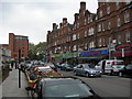
Life in N5 2JL is shaped by its proximity to a range of amenities. Retail options include major chains like Tesco Stoke Newington and Sainsburys Essex, ensuring everyday shopping needs are met. Public transport hubs such as Dalston Junction Station and Manor House Metro provide easy access to London’s broader network, while ferry services like Blackfriars Pier connect to river routes. The area’s bus stops, including London Victoria Coach Station, offer links to long-distance travel. Though the data does not specify dining or leisure venues, the presence of multiple retail and transport nodes suggests a lively, service-oriented environment. The combination of shops, transport, and connectivity makes daily life efficient, with minimal need to travel far for essentials or mobility.
Amenities
Schools
| Rank | School | Type | Entry gender | Ages |
|---|
Explore more schools in this area
Go to Schools tabDemographics
N5 2JL’s population of 1,699 is predominantly adults aged 30–64, with a median age of 47. This suggests a community of professionals, many of whom may be in their peak earning years or raising families. Home ownership is relatively low at 30%, indicating a rental market that caters to transient or flexible lifestyles. The accommodation type is largely flats, reflecting a preference for urban living or shared spaces. The predominant ethnic group is White, though no further breakdown is provided. The age profile implies a stable, established population with potential demand for services tailored to middle-aged residents. While the data does not specify deprivation levels, the combination of a mature demographic and rental focus may influence local amenities and housing priorities.
Household Size
Accommodation Type
Tenure
Ethnic Group
Religion
Household Composition
Age
Household Deprivation
NS-SEC
Explore more demographic insights in this area
Go to Demographics tabPlanning
Planning Constraints
- Flood RiskPremium
- Ramsar Wetland SitesPremium
- Area of Outstanding Natural BeautyPremium
- Protected Nature ReservePremium
- Protected WoodlandPremium