Area Overview for N5 2ED
Photos of N5 2ED


Area Information
N5 2ED is a small, tightly knit residential postcode area in England, home to around 1,313 people. It is characterised by a modest population and a compact footprint, typical of a residential cluster rather than a sprawling suburb. The area’s proximity to key transport hubs and retail centres makes it convenient for those seeking a balance between urban accessibility and a quieter residential environment. Daily life here is shaped by its proximity to multiple rail and metro stations, including Canonbury and Highbury & Islington, which provide seamless connections to central London. The community is predominantly composed of adults aged 30–64, with a median age of 47, suggesting a mature, established population. While the area lacks large-scale amenities, its immediate surroundings offer a range of shops, including multiple Tesco outlets, and a robust public transport network. This makes N5 2ED appealing to those prioritising convenience over expansive green spaces, though its small size means buyers should consider nearby areas for broader options.
- Area Type
- Postcode
- Area Size
- Not available
- Population
- 1313
- Population Density
- 13263 people/km²
The property market in N5 2ED is defined by its high proportion of rental properties, with only 40% of homes owner-occupied. The accommodation type is almost exclusively flats, which suggests a focus on smaller, more manageable units. This makes the area more suited to individuals or couples rather than larger families. The limited housing stock, combined with the small postcode area, means buyers may need to consider nearby regions for a broader range of properties. The dominance of flats also implies a lack of detached or semi-detached homes, which could be a drawback for those seeking more space. However, the area’s proximity to transport links and retail hubs may offset this, appealing to commuters or those prioritising location over property size. For investors, the rental market here is active, though the small scale of the area may limit long-term appreciation potential.
House Prices in N5 2ED
No properties found in this postcode.
Energy Efficiency in N5 2ED
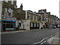
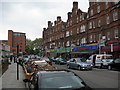
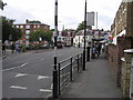
Living in N5 2ED offers access to a range of essential amenities within walking or short transit distance. Retail options include multiple Tesco stores, such as Tesco Stoke Newington and Tesco Drayton, providing convenience for daily shopping. The area’s transport links are extensive, with five rail stations, including Drayton Park and Highbury & Islington, and metro stops like Holloway Road and Manor House. Ferry services, such as Camden Lock Waterbus and Bankside Pier, offer scenic travel options along the Thames. For commuters, bus routes like the Green Line Coach Station and London Victoria Coach Station Arrivals provide flexibility. While the area lacks large parks or leisure facilities, its proximity to central London means residents can access cultural and recreational hubs easily. The combination of retail, transport, and connectivity makes daily life in N5 2ED efficient, though those seeking expansive green spaces may need to look further afield.
Amenities
Schools
| Rank | School | Type | Entry gender | Ages |
|---|
Explore more schools in this area
Go to Schools tabDemographics
The population of N5 2ED skews toward middle-aged adults, with 47 years as the median age and 30–64-year-olds forming the largest age group. Home ownership here is relatively low, at 40%, indicating a rental market that dominates the housing stock. The area’s accommodation is almost entirely flats, reflecting a lack of larger family homes or detached properties. The predominant ethnic group is White, though specific data on diversity or deprivation is not provided. The age profile suggests a stable, long-term resident base, though the low home ownership rate may indicate a transient element. For buyers, this dynamic implies a market where rental properties are common, and potential homeowners may need to look beyond N5 2ED itself for more varied housing options. The absence of detailed diversity metrics means further local research would be necessary to fully understand the community’s composition.
Household Size
Accommodation Type
Tenure
Ethnic Group
Religion
Household Composition
Age
Household Deprivation
NS-SEC
Explore more demographic insights in this area
Go to Demographics tabPlanning
Planning Constraints
- Flood RiskPremium
- Ramsar Wetland SitesPremium
- Area of Outstanding Natural BeautyPremium
- Protected Nature ReservePremium
- Protected WoodlandPremium
- Crime RiskPremium