Area Overview for N4 4NZ
Photos of N4 4NZ


Area Information
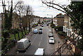
Living in N4 4NZ offers a compact, residential experience within a small postcode cluster in England. With a population of 1,544, the area is characterised by a mature demographic, where the median age of 47 suggests a community of established residents. Daily life here is shaped by proximity to essential services and transport links, making it practical for commuters and families alike. The area’s modest size means a tight-knit feel, though it remains integrated with broader London infrastructure. Residents benefit from a balance of residential tranquility and accessibility to urban amenities, with nearby schools, retail hubs, and public transport options. The low flood risk and absence of protected natural sites indicate minimal environmental constraints, while the crime risk score of 69/100 reinforces a generally safe living environment. For those seeking a settled, low-maintenance lifestyle with reliable connectivity and community stability, N4 4NZ provides a straightforward, functional base.
- Area Type
- Postcode
- Area Size
- Not available
- Population
- 1544
- Population Density
- 9207 people/km²
The property market in N4 4NZ is defined by a 53% home ownership rate, with flats making up the majority of accommodation types. This suggests a rental-heavy market, where landlords and tenants coexist in a compact residential cluster. The small postcode area limits the availability of larger properties, meaning flats are the primary housing stock. For buyers, this implies a niche market where opportunities may be limited to specific developments or conversions. The prevalence of flats also indicates a focus on affordability and space efficiency, appealing to those prioritising location over property size. Given the area’s low population and mature demographic, property values may reflect long-term stability rather than rapid growth. Buyers should consider the practicality of flat ownership, including potential restrictions on modifications and reliance on shared spaces.
House Prices in N4 4NZ
No properties found in this postcode.
Energy Efficiency in N4 4NZ
Daily life in N4 4NZ is enriched by a range of nearby amenities, from retail hubs to transport links. The area’s proximity to Tesco Stroud, Sainsburys London, and Aldi Arena ensures convenient access to grocery shopping, while bus and coach stations like Whipps Cross Interchange and London Victoria provide connections to broader destinations. Public transport options, including rail and metro services, make commuting straightforward, with stations such as Harringay Green Lanes and Manor House offering regular services. Leisure opportunities include ferry access to attractions like London Zoo and Blackfriars Pier. The mix of retail, transport, and leisure facilities contributes to a practical, accessible lifestyle, where residents can balance local convenience with urban connectivity.
Amenities
Schools
The nearest school to N4 4NZ is St Aidan’s Voluntary Controlled Primary School, an outstanding-rated primary school. This institution serves the local community, offering education for younger children in a setting with high Ofsted standards. The presence of a single primary school suggests that families in the area may need to travel slightly to access secondary education, though the school’s rating indicates a strong foundation for early learning. The absence of listed secondary schools in the data means further research is required for comprehensive schooling options. For parents prioritising quality primary education, St Aidan’s provides a clear advantage, though the limited school diversity may influence long-term educational planning for growing families.
| Rank | School | Type | Entry gender | Ages |
|---|
Explore more schools in this area
Go to Schools tabDemographics
The community in N4 4NZ is predominantly composed of adults aged 30–64, with a median age of 47. This suggests a population of working-age individuals and families, reflecting a mature, settled demographic. Home ownership stands at 53%, indicating a mix of owner-occupied properties and rentals, though flats are the primary accommodation type. The area’s predominant ethnic group is White, with no specific data on other demographics provided. The relatively small population of 1,544 means a close-knit community, though limited data prevents deeper analysis of diversity or deprivation levels. The age profile and home ownership figures suggest a stable, long-term resident base, likely with established careers and family ties. For buyers, this demographic profile implies a neighbourhood with minimal turnover and a focus on practical, long-term living rather than transient rental markets.
Household Size
Accommodation Type
Tenure
Ethnic Group
Religion
Household Composition
Age
Household Deprivation
NS-SEC
Explore more demographic insights in this area
Go to Demographics tabPlanning
Planning Constraints
- Flood RiskPremium
- Ramsar Wetland SitesPremium
- Area of Outstanding Natural BeautyPremium
- Protected Nature ReservePremium
- Protected WoodlandPremium