Area Overview for N4 4JE
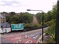
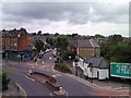
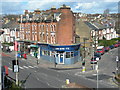
Photos of N4 4JE


Area Information
Living in N4 4JE offers a compact, residential experience within a small cluster of homes. With a population of 1,740, the area is intimate, fostering a sense of familiarity among residents. The postcode covers a tight-knit community where daily life is shaped by proximity to essential services and transport links. While the area is not expansive, its strategic location provides access to broader London networks. The demographic profile suggests a mature population, with a median age of 47 and a majority of residents aged 30–64. This reflects a stable, established community, likely with families and professionals seeking convenience over sprawling suburban living. The housing stock is predominantly flats, indicating a mix of rental and owner-occupied properties. For those considering N4 4JE, the blend of practicality and connectivity makes it a viable choice for those prioritising accessibility over large-scale amenities.
- Area Type
- Postcode
- Area Size
- Not available
- Population
- 1740
- Population Density
- 8770 people/km²
The property market in N4 4JE is characterised by a 48% home ownership rate, suggesting that nearly half of the area’s housing stock is rented out. The predominant accommodation type is flats, which aligns with the compact, urban nature of the postcode. This indicates a housing market that caters more to renters than owner-occupiers, likely due to the limited availability of larger properties. For buyers, this means competition for flats may be higher, with fewer opportunities for purchasing detached or semi-detached homes. The small size of the area also means the property selection is limited to immediate surroundings, requiring buyers to consider nearby neighbourhoods for more diverse options. The flat-dominated market may appeal to those seeking low-maintenance living, but it also underscores the importance of evaluating long-term rental viability if ownership is the goal.
House Prices in N4 4JE
No properties found in this postcode.
Energy Efficiency in N4 4JE
Life in N4 4JE is shaped by its proximity to a range of amenities. Retail options include Sainsburys London, Tesco Stroud, and Sainsburys Finsbury Park Stroud, ensuring everyday shopping needs are met. Transport hubs like Crouch Hill Station, Harringay Station, and Turnpike Lane Station provide easy access to London’s rail and metro networks, while bus routes connect to major points such as London Victoria Coach Station. For leisure, ferry services like the Camden Lock Waterbus and London Zoo Waterbus Stop offer scenic travel options. The area’s compact size means residents can access these services without long commutes. This blend of retail, transport, and leisure facilities creates a convenient, dynamic lifestyle, ideal for those valuing accessibility and urban connectivity.
Amenities
Schools
| Rank | School | Type | Entry gender | Ages |
|---|
Explore more schools in this area
Go to Schools tabDemographics
The community in N4 4JE is defined by its age profile, with a median age of 47 and the most common age range being 30–64 years. This suggests a population skewed towards middle-aged adults, many of whom may be in their peak working years or raising families. Home ownership stands at 48%, meaning nearly half of residents rent their homes, pointing to a market where rental properties are prevalent. The accommodation type is predominantly flats, reflecting a housing stock suited to urban living rather than detached homes. The predominant ethnic group is White, though specific diversity statistics are not provided. The lower home ownership rate may indicate a reliance on rental markets or shared living arrangements. This demographic structure implies a community with established routines, where stability and proximity to services are key priorities.
Household Size
Accommodation Type
Tenure
Ethnic Group
Religion
Household Composition
Age
Household Deprivation
NS-SEC
Explore more demographic insights in this area
Go to Demographics tabPlanning
Planning Constraints
- Flood RiskPremium
- Ramsar Wetland SitesPremium
- Area of Outstanding Natural BeautyPremium
- Protected Nature ReservePremium
- Protected WoodlandPremium