Area Overview for N4 3LY
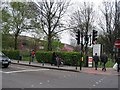
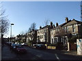
Photos of N4 3LY


Area Information
N4 3LY is a small residential postcode area in England, home to approximately 1913 residents. Its compact size means it is a tightly knit community, with a focus on local living and proximity to key services. The area is characterised by a mix of flats, reflecting its urban layout, and caters to a population predominantly aged 30–64, with a median age of 47. Daily life here is shaped by the availability of nearby amenities, from retail outlets to transport hubs. Residents benefit from excellent digital connectivity, with broadband scores near 100, ensuring reliable internet access for both work and leisure. The area’s proximity to multiple rail, metro, and bus stations makes it well-connected to London’s broader network. While the community is relatively small, it is served by a primary school with a good Ofsted rating, offering families a solid foundation for education. The area’s safety profile includes low flood risk and no significant environmental constraints, though crime rates sit at an average level, requiring standard security measures. N4 3LY is ideal for those seeking a balance between urban convenience and a manageable, community-focused lifestyle.
- Area Type
- Postcode
- Area Size
- Not available
- Population
- 1913
- Population Density
- 14581 people/km²
The property market in N4 3LY is defined by a low home ownership rate of 34%, suggesting that the area is not a primary destination for owner-occupiers but rather a rental-focused zone. The predominant accommodation type is flats, which is typical for urban postcode areas with limited space for larger homes. This housing stock is likely to be older, with a focus on practical, compact living. For buyers considering the area, the small size of N4 3LY means that property options are limited to a few flats, often in multi-unit buildings. The rental market may offer more availability, but buyers should be aware that the area is not ideal for those seeking long-term ownership. The immediate surroundings may share similar characteristics, with limited scope for property diversification. Investors or those seeking a secondary residence might find value here, but the area is not suited to those prioritising spacious or detached properties.
House Prices in N4 3LY
No properties found in this postcode.
Energy Efficiency in N4 3LY
Daily life in N4 3LY is enriched by a range of nearby amenities, from retail to transport hubs. The area is within walking distance of major supermarkets such as Tesco Hornsey, Tesco Stroud, and Sainsburys London, ensuring easy access to grocery shopping and daily essentials. For transport, residents have multiple rail stations, including Crouch Hill and Finsbury Park, as well as metro stops like Arsenal and Holloway Road, providing seamless connections to London’s transport network. Ferry services, such as Camden Lock Waterbus and Blackfriars Pier, add variety to travel options. The presence of bus interchanges like Green Line Coach Station and London Victoria Coach Station Arrivals further enhances mobility. These amenities contribute to a convenient lifestyle, where shopping, commuting, and leisure activities are all within reach. The mix of retail and transport options suggests a community that values accessibility and practicality, making N4 3LY a functional choice for those prioritising connectivity and ease of movement.
Amenities
Schools
The nearest school to N4 3LY is St Mark’s CofE Primary School, which provides education for younger children and holds a good Ofsted rating. This school is a key asset for families with primary-aged children, offering a reliable and well-regarded educational environment. The absence of secondary schools in the immediate vicinity means that students may need to commute to nearby areas for further education, though the area’s transport links could facilitate this. The presence of a primary school with a good rating is a positive indicator for families prioritising quality education, but prospective residents should consider the need for additional schooling options beyond primary level. The single school listed in the data underscores the importance of transport connectivity for students requiring access to secondary education elsewhere in London.
| Rank | School | Type | Entry gender | Ages |
|---|
Explore more schools in this area
Go to Schools tabDemographics
The population of N4 3LY is 1913, with a median age of 47, indicating a mature demographic. The majority of residents fall within the 30–64 age range, suggesting a stable adult population with established careers and families. Home ownership in the area is relatively low, at 34%, which implies that a significant portion of the community consists of renters, possibly including professionals working in nearby sectors. The predominant accommodation type is flats, aligning with the area’s urban character. The ethnic composition is largely White, reflecting broader regional trends. This demographic profile suggests a community that prioritises convenience and accessibility over large family homes. The age distribution and home ownership figures also indicate a population that may be more likely to commute to other parts of London for work, given the limited local employment opportunities. The absence of specific deprivation data means that quality of life is inferred from the availability of amenities and transport links, which appear to be robust.
Household Size
Accommodation Type
Tenure
Ethnic Group
Religion
Household Composition
Age
Household Deprivation
NS-SEC
Explore more demographic insights in this area
Go to Demographics tabPlanning
Planning Constraints
- Flood RiskPremium
- Ramsar Wetland SitesPremium
- Area of Outstanding Natural BeautyPremium
- Protected Nature ReservePremium
- Protected WoodlandPremium